Sottens elevation
Sottens (Vaud, Gros-de-Vaud District), Switzerland elevation is 754 meters and Sottens elevation in feet is 2474 ft above sea level [src 1]. Sottens is a seat of a third-order administrative division (feature code) with elevation that is 206 meters (676 ft) bigger than average city elevation in Switzerland.
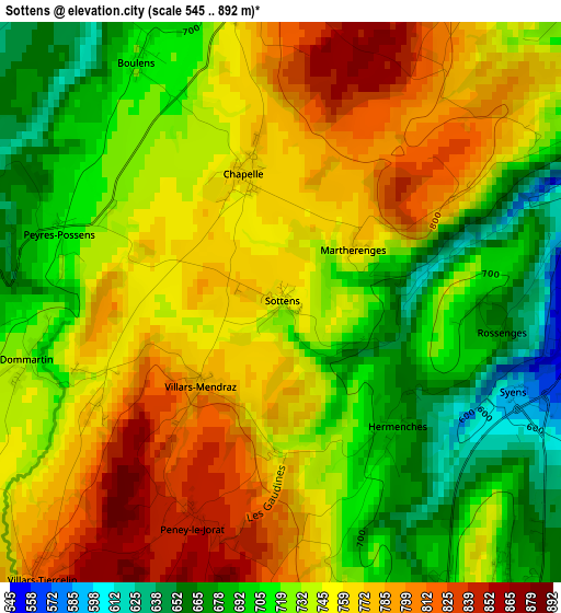
Below is the Elevation map of Sottens, which displays elevation range with different colors. Scale of the first map is from 545 to 892 m (1788 to 2927 ft) with average elevation of 740.2 meters (=2428 ft) [note 1]
These maps also provides idea of topography and contour of this city, they are displayed at different zoom levels. More info about maps, scale and edge coordinates you can find below images.
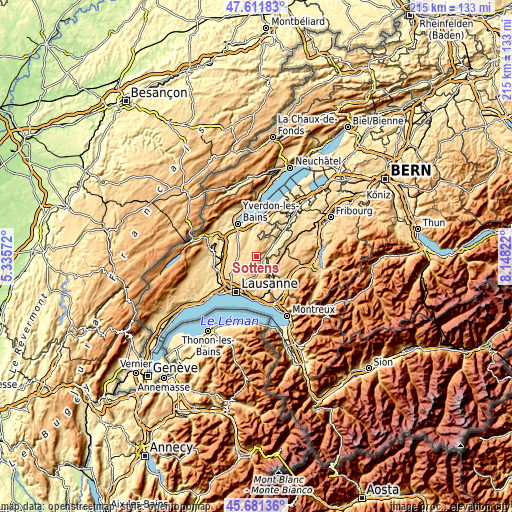
| \ | Map #1 | Topo.Map |
| Scale [m] | 545..892 m | × |
| Scale [ft] | 1788..2927 ft | × |
| Average | 740.2 m = 2428 ft | × |
| Width | 6.71 km = 4.2 mi | 214.6 km = 133.3 mi |
| Height | 6.71 km = 4.2 mi | 214.6 km = 133.3 mi |
| ↑Max Latitude | 46.685365° | 47.61183° |
| Latitude at center | 46.65521° | 46.65521° |
| ↓Min Latitude | 46.625038° | 45.68136° |
| ← Min Longitude | 6.698025° | 5.33572° |
| Longitude center | 6.74197° | 6.74197° |
| →Max Longitude | 6.785915° | 8.14822° |
Nearby cities:
Cities around Sottens sort by population:
• Ecublens elevation 591 m
7.4 km,  136°
136°
• Echallens 622 m
8.4 km,  259°
259°
• Moudon 514 m
4.5 km,  72°
72°
• Lucens 498 m
9.5 km,  51°
51°
• Froideville 811 m
7.6 km,  217°
217°
• Rue 662 m
7.3 km,  123°
123°
• Bottens 730 m
7.5 km,  234°
234°
• Pailly 644 m
7.2 km,  315°
315°
• Servion 727 m
9.8 km,  163°
163°
• Vuarrens 688 m
7.9 km,  295°
295°
• Rueyres 617 m
5.7 km, 318°
• Corcelles-le-Jorat 734 m
5.4 km,  179°
179°
Multilingual:
 En español:
Sottens elevación 754 m.
 En France:
Sottens élévation 754 m.


Sources and notes:
- [note 1] Map square and city borders are not equal. Map elevation data is calculated only from area inside that square.
- [src 1] Elevation data from geonames database provided with same terms of usage.
- [src 2] The elevation map of Sottens is generated using elevation data from NASA's 3 arcsec (90m) resolution SRTM data.
- [src 3] Base (background) map © OpenStreetMap contributors tiles are generated by Geofabrik and OpenTopoMap.
Copyright & License:
This Sottens Elevation Map is licensed under CC BY-SA. You may reuse any part from this page, if you give a proper credit by linking to this URL:
 More info on terms of use page.