Echallens elevation
Echallens (Vaud, Gros-de-Vaud District), Switzerland elevation is 622 meters and Echallens elevation in feet is 2041 ft above sea level [src 1]. Echallens is a seat of a second-order administrative division (feature code) with elevation that is 74 meters (243 ft) bigger than average city elevation in Switzerland.
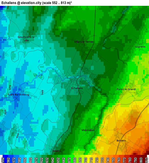
Below is the Elevation map of Echallens, which displays elevation range with different colors. Scale of the first map is from 552 to 813 m (1811 to 2667 ft) with average elevation of 638.8 meters (=2096 ft) [note 1]
These maps also provides idea of topography and contour of this city, they are displayed at different zoom levels. More info about maps, scale and edge coordinates you can find below images.
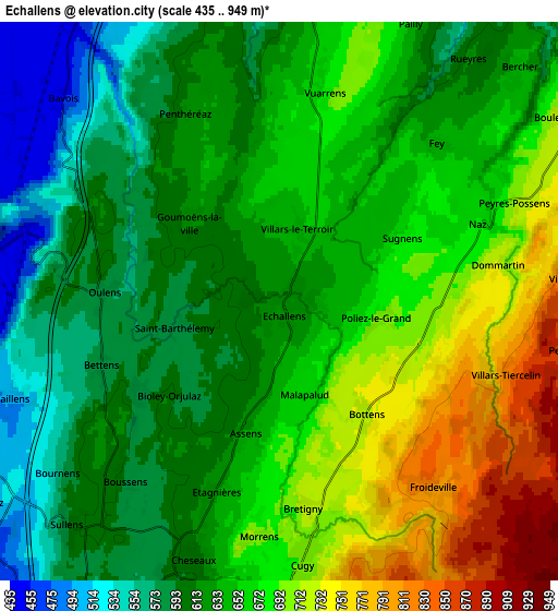
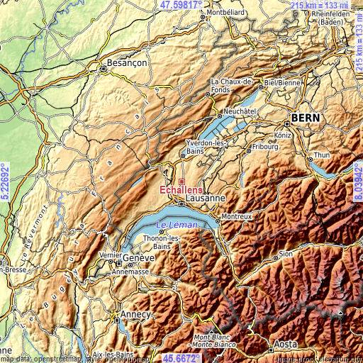
| \ | Map #1 | Map #2 | Topo.Map |
| Scale [m] | 552..813 m | 435..949 m | × |
| Scale [ft] | 1811..2667 ft | 1427..3114 ft | × |
| Average | 638.8 m = 2096 ft | 646.5 m = 2121 ft | × |
| Width | 6.71 km = 4.2 mi | 13.42 km = 8.3 mi | 214.7 km = 133.4 mi |
| Height | 6.71 km = 4.2 mi | 13.42 km = 8.3 mi | 214.7 km = 133.4 mi |
| ↑Max Latitude | 46.671463° | 46.701609° | 47.59817° |
| Latitude at center | 46.6413° | 46.6413° | 46.6413° |
| ↓Min Latitude | 46.61112° | 46.580924° | 45.6672° |
| ← Min Longitude | 6.589225° | 6.545279° | 5.22692° |
| Longitude center | 6.63317° | 6.63317° | 6.63317° |
| →Max Longitude | 6.677115° | 6.721061° | 8.03942° |
Nearby cities:
Cities around Echallens sort by population:
• Cheseaux elevation 607 m
6.5 km,  198°
198°
• Romanel-sur-Lausanne 599 m
8.9 km,  193°
193°
• Chavornay 455 m
8.4 km,  324°
324°
• Froideville 811 m
5.8 km,  140°
140°
• Bottens 730 m
3.6 km, 142°
• Bavois 462 m
6.9 km,  313°
313°
• Pailly 644 m
7.4 km,  25°
25°
• Sottens 754 m
8.4 km,  79°
79°
• Orny 466 m
8.7 km,  289°
289°
• Rueyres 617 m
7.3 km,  37°
37°
• Vuarrens 688 m
5.1 km,  12°
12°
• Penthéréaz 623 m
5 km,  333°
333°
Multilingual:
 En español:
Echallens elevación 622 m.
 En France:
Échallens élévation 622 m.
 Auf Deutsch:
Echallens höhe über dem Meeresspiegel ist 622 m.

Sources and notes:
- [note 1] Map square and city borders are not equal. Map elevation data is calculated only from area inside that square.
- [src 1] Elevation data from geonames database provided with same terms of usage.
- [src 2] The elevation map of Echallens is generated using elevation data from NASA's 3 arcsec (90m) resolution SRTM data.
- [src 3] Base (background) map © OpenStreetMap contributors tiles are generated by Geofabrik and OpenTopoMap.
Copyright & License:
This Echallens Elevation Map is licensed under CC BY-SA. You may reuse any part from this page, if you give a proper credit by linking to this URL:
 More info on terms of use page.