Sutton elevation
Sutton (Quebec, Montérégie), Canada elevation is 176 meters and Sutton elevation in feet is 577 ft above sea level [src 1]. Sutton is a populated place (feature code) with elevation that is 82 meters (269 ft) smaller than average city elevation in Canada.
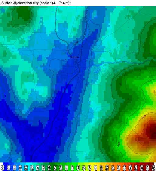
Below is the Elevation map of Sutton, which displays elevation range with different colors. Scale of the first map is from 144 to 714 m (472 to 2343 ft) with average elevation of 261.3 meters (=857 ft) [note 1]
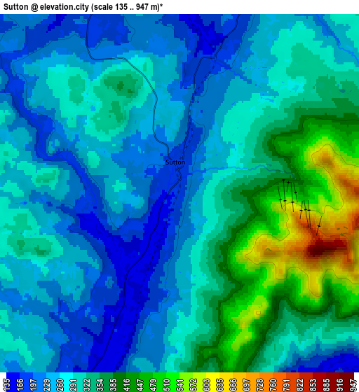
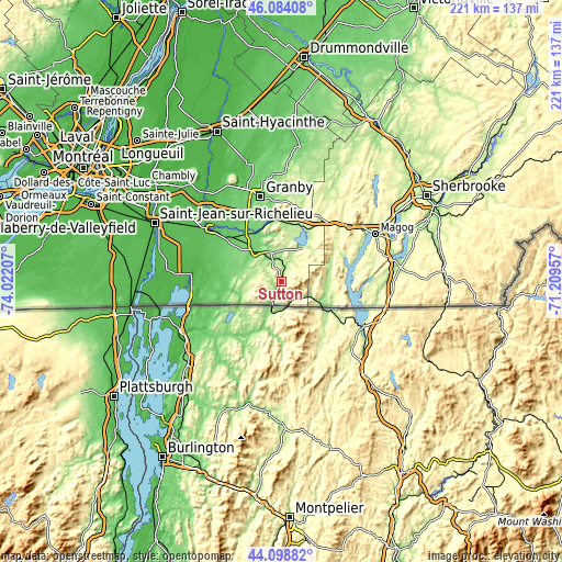
These maps also provides idea of topography and contour of this city, they are displayed at different zoom levels. More info about maps, scale and edge coordinates you can find below images.
| \ | Map #1 | Map #2 | Topo.Map |
| Scale [m] | 144..714 m | 135..947 m | × |
| Scale [ft] | 472..2343 ft | 443..3107 ft | × |
| Average | 261.3 m = 857 ft | 298.8 m = 980 ft | × |
| Width | 6.9 km = 4.3 mi | 13.8 km = 8.6 mi | 220.7 km = 137.1 mi |
| Height | 6.9 km = 4.3 mi | 13.8 km = 8.6 mi | 220.7 km = 137.1 mi |
| ↑Max Latitude | 45.131091° | 45.162086° | 46.08408° |
| Latitude at center | 45.10008° | 45.10008° | 45.10008° |
| ↓Min Latitude | 45.069052° | 45.038007° | 44.09882° |
| ← Min Longitude | -72.659765° | -72.703711° | -74.02207° |
| Longitude center | -72.61582° | -72.61582° | -72.61582° |
| →Max Longitude | -72.571875° | -72.527929° | -71.20957° |
Nearby cities:
Cities around Sutton sort by population:
• Granby elevation 102 m
34.6 km,  344°
344°
• Magog 220 m
41 km,  63°
63°
• Cowansville 117 m
15.3 km,  316°
316°
• Farnham 55 m
35.2 km,  305°
305°
• Lac-Brome 209 m
15.2 km,  31°
31°
• Waterloo 210 m
28.9 km,  15°
15°
• Bromont 126 m
24.2 km,  353°
353°
• Dunham 154 m
14.9 km,  284°
284°
• Bedford 57 m
28.8 km,  273°
273°
• Ange-Gardien 71 m
37.2 km, 318°
• Venise-en-Québec 29 m
40.6 km, 267°
• Sainte-Croix 151 m
15 km, 284°
Multilingual:
 En español:
Sutton elevación 176 m.
 En France:
Sutton élévation 176 m.


Sources and notes:
- [note 1] Map square and city borders are not equal. Map elevation data is calculated only from area inside that square.
- [src 1] Elevation data from geonames database provided with same terms of usage.
- [src 2] The elevation map of Sutton is generated using elevation data from NASA's 3 arcsec (90m) resolution SRTM data.
- [src 3] Base (background) map © OpenStreetMap contributors tiles are generated by Geofabrik and OpenTopoMap.
Copyright & License:
This Sutton Elevation Map is licensed under CC BY-SA. You may reuse any part from this page, if you give a proper credit by linking to this URL:
 More info on terms of use page.