Nanaimo elevation
Nanaimo (British Columbia, Regional District of Nanaimo), Canada elevation is 16 meters and Nanaimo elevation in feet is 52 ft above sea level [src 1]. Nanaimo is a populated place (feature code) with elevation that is 242 meters (794 ft) smaller than average city elevation in Canada.
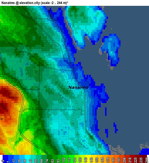
Below is the Elevation map of Nanaimo, which displays elevation range with different colors. Scale of the first map is from -2 to 244 m (-7 to 801 ft) with average elevation of 68.2 meters (=224 ft) [note 1]
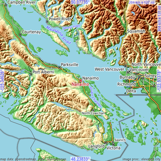
These maps also provides idea of topography and contour of this city, they are displayed at different zoom levels. More info about maps, scale and edge coordinates you can find below images.
| \ | Map #1 | Map #2 | Topo.Map |
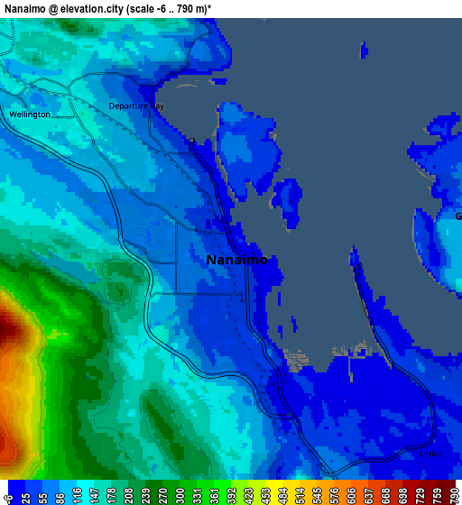
| Scale [m] | -2..244 m | -6..790 m | × |
| Scale [ft] | -7..801 ft | -20..2592 ft | × |
| Average | 68.2 m = 224 ft | 128.1 m = 420 ft | × |
| Width | 6.39 km = 4 mi | 12.78 km = 7.9 mi | 204.5 km = 127.1 mi |
| Height | 6.39 km = 4 mi | 12.78 km = 7.9 mi | 204.5 km = 127.1 mi |
| ↑Max Latitude | 49.195106° | 49.223815° | 50.07735° |
| Latitude at center | 49.16638° | 49.16638° | 49.16638° |
| ↓Min Latitude | 49.137637° | 49.108878° | 48.23833° |
| ← Min Longitude | -123.983975° | -124.027921° | -125.34628° |
| Longitude center | -123.94003° | -123.94003° | -123.94003° |
| →Max Longitude | -123.896085° | -123.852139° | -122.53378° |
Nearby cities:
Cities around Nanaimo sort by population:
• Parksville elevation 26 m
32.1 km,  301°
301°
• Sechelt 10 m
36.7 km,  20°
20°
• Ladysmith 71 m
21.5 km,  155°
155°
• Chemainus 40 m
32.1 km,  149°
149°
• Cedar 32 m
8.4 km,  131°
131°
• Saltair 67 m
27.1 km, 152°
• Coombs 118 m
37.8 km,  293°
293°
• East Wellington 133 m
5.7 km,  278°
278°
• North Oyster/Yellow Point 58 m
15.3 km, 149°
• Fairwinds 22 m
18.3 km,  311°
311°
• Welcome Beach 81 m
35 km,  5°
5°
• French Creek 31 m
35.9 km, 302°
Multilingual:
 En español:
Nanaimo elevación 16 m.
 En France:
Nanaimo élévation 16 m.


Sources and notes:
- [note 1] Map square and city borders are not equal. Map elevation data is calculated only from area inside that square.
- [src 1] Elevation data from geonames database provided with same terms of usage.
- [src 2] The elevation map of Nanaimo is generated using elevation data from NASA's 3 arcsec (90m) resolution SRTM data.
- [src 3] Base (background) map © OpenStreetMap contributors tiles are generated by Geofabrik and OpenTopoMap.
Copyright & License:
This Nanaimo Elevation Map is licensed under CC BY-SA. You may reuse any part from this page, if you give a proper credit by linking to this URL:
 More info on terms of use page.