Kenora elevation
Kenora (Ontario, Kenora District), Canada elevation is 328 meters and Kenora elevation in feet is 1076 ft above sea level [src 1]. Kenora is a populated place (feature code) with elevation that is 70 meters (230 ft) bigger than average city elevation in Canada.
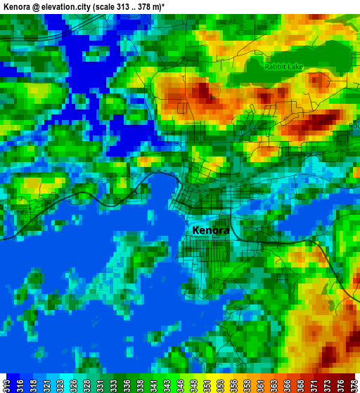
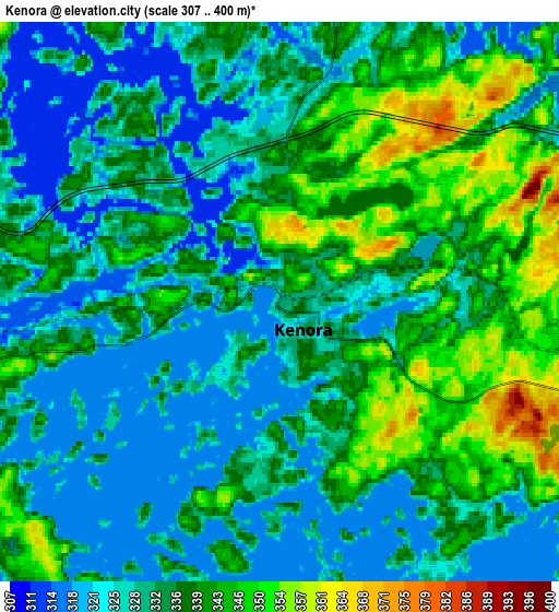
Below is the Elevation map of Kenora, which displays elevation range with different colors. Scale of the first map is from 313 to 378 m (1027 to 1240 ft) with average elevation of 334 meters (=1096 ft) [note 1]
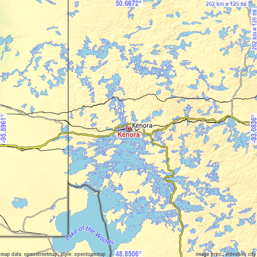
These maps also provides idea of topography and contour of this city, they are displayed at different zoom levels. More info about maps, scale and edge coordinates you can find below images.
| \ | Map #1 | Map #2 | Topo.Map |
| Scale [m] | 313..378 m | 307..400 m | × |
| Scale [ft] | 1027..1240 ft | 1007..1312 ft | × |
| Average | 334 m = 1096 ft | 334.5 m = 1097 ft | × |
| Width | 6.31 km = 3.9 mi | 12.62 km = 7.8 mi | 202 km = 125.5 mi |
| Height | 6.31 km = 3.9 mi | 12.62 km = 7.8 mi | 202 km = 125.5 mi |
| ↑Max Latitude | 49.795786° | 49.824145° | 50.6672° |
| Latitude at center | 49.76741° | 49.76741° | 49.76741° |
| ↓Min Latitude | 49.739018° | 49.710609° | 48.8506° |
| ← Min Longitude | -94.533795° | -94.577741° | -95.8961° |
| Longitude center | -94.48985° | -94.48985° | -94.48985° |
| →Max Longitude | -94.445905° | -94.401959° | -93.0836° |
Nearby cities:
Cities around Kenora sort by population:
• Steinbach elevation 263 m
160.3 km,  260°
260°
• Dryden 387 m
124.9 km,  89°
89°
• Fort Frances 340 m
150.5 km,  148°
148°
• Red Lake 374 m
146.6 km,  18°
18°
• Beausejour 248 m
148.8 km,  282°
282°
• Landmark 242 m
168 km,  266°
266°
• Moose Lake 346 m
85.9 km,  223°
223°
• Red Lake 358 m
154.1 km, 20°
• Golden 380 m
153.2 km, 20°
• Lac du Bonnet 261 m
124.6 km,  295°
295°
• La Broquerie 280 m
147.4 km, 259°
• Ear Falls 376 m
131.8 km,  42°
42°
Multilingual:
 En español:
Kenora elevación 328 m.
 En France:
Kenora élévation 328 m.


Sources and notes:
- [note 1] Map square and city borders are not equal. Map elevation data is calculated only from area inside that square.
- [src 1] Elevation data from geonames database provided with same terms of usage.
- [src 2] The elevation map of Kenora is generated using elevation data from NASA's 3 arcsec (90m) resolution SRTM data.
- [src 3] Base (background) map © OpenStreetMap contributors tiles are generated by Geofabrik and OpenTopoMap.
Copyright & License:
This Kenora Elevation Map is licensed under CC BY-SA. You may reuse any part from this page, if you give a proper credit by linking to this URL:
 More info on terms of use page.