Byahoml’ elevation
Byahoml’ (Vitebsk), Belarus elevation is 181 meters and Byahoml’ elevation in feet is 594 ft above sea level [src 1]. Byahoml’ is a populated place (feature code) with elevation that is 14 meters (46 ft) bigger than average city elevation in Belarus.
Below is the Elevation map of Byahoml’, which displays elevation range with different colors. Scale of the first map is from 165 to 218 m (541 to 715 ft) with average elevation of 191.5 meters (=628 ft) [note 1]
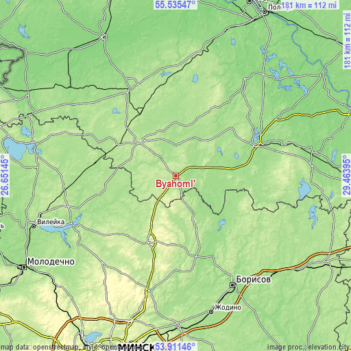
These maps also provides idea of topography and contour of this city, they are displayed at different zoom levels. More info about maps, scale and edge coordinates you can find below images.
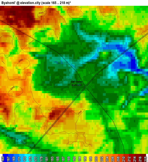
| \ | Map #1 | Topo.Map |
| Scale [m] | 165..218 m | × |
| Scale [ft] | 541..715 ft | × |
| Average | 191.5 m = 628 ft | × |
| Width | 5.64 km = 3.5 mi | 180.6 km = 112.2 mi |
| Height | 5.64 km = 3.5 mi | 180.6 km = 112.2 mi |
| ↑Max Latitude | 54.756966° | 55.53547° |
| Latitude at center | 54.7316° | 54.7316° |
| ↓Min Latitude | 54.706218° | 53.91146° |
| ← Min Longitude | 28.013755° | 26.65145° |
| Longitude center | 28.0577° | 28.0577° |
| →Max Longitude | 28.101645° | 29.46395° |
Nearby cities:
Cities around Byahoml’ sort by population:
• Barysaw elevation 172 m
63 km,  152°
152°
• Hlybokaye 159 m
51 km,  332°
332°
• Lyepyel’ 165 m
44.3 km,  67°
67°
• Lahoysk 192 m
59.9 km,  192°
192°
• Dokshytsy 204 m
25.8 km,  313°
313°
• Plyeshchanitsy 211 m
37.3 km,  203°
203°
• Ushachy 148 m
61.2 km,  35°
35°
• Il’ya 183 m
60.3 km,  234°
234°
• Mosar 143 m
66.6 km, 325°
• Kholopenichi 190 m
62.6 km,  112°
112°
• Kryvichy 173 m
49.4 km,  267°
267°
• Zyembin 181 m
42.9 km,  165°
165°
Multilingual:
 En español:
Byahoml’ elevación 181 m.
 En France:
Byahoml’ élévation 181 m.
 Auf Deutsch:
Byahoml’ höhe über dem Meeresspiegel ist 181 m.

Sources and notes:
- [note 1] Map square and city borders are not equal. Map elevation data is calculated only from area inside that square.
- [src 1] Elevation data from geonames database provided with same terms of usage.
- [src 2] The elevation map of Byahoml’ is generated using elevation data from NASA's 3 arcsec (90m) resolution SRTM data.
- [src 3] Base (background) map © OpenStreetMap contributors tiles are generated by Geofabrik and OpenTopoMap.
Copyright & License:
This Byahoml’ Elevation Map is licensed under CC BY-SA. You may reuse any part from this page, if you give a proper credit by linking to this URL:
 More info on terms of use page.