Lyepyel’ elevation
Lyepyel’ (Vitebsk), Belarus elevation is 165 meters and Lyepyel’ elevation in feet is 541 ft above sea level [src 1]. Lyepyel’ is a populated place (feature code) with elevation that is 2 meters (7 ft) smaller than average city elevation in Belarus.
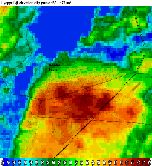
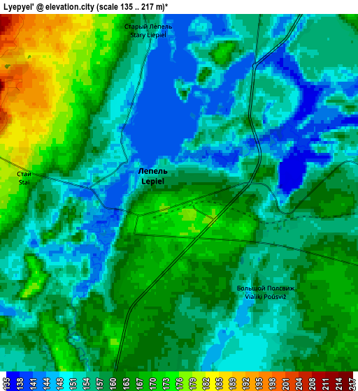
Below is the Elevation map of Lyepyel’, which displays elevation range with different colors. Scale of the first map is from 139 to 179 m (456 to 587 ft) with average elevation of 156.3 meters (=513 ft) [note 1]
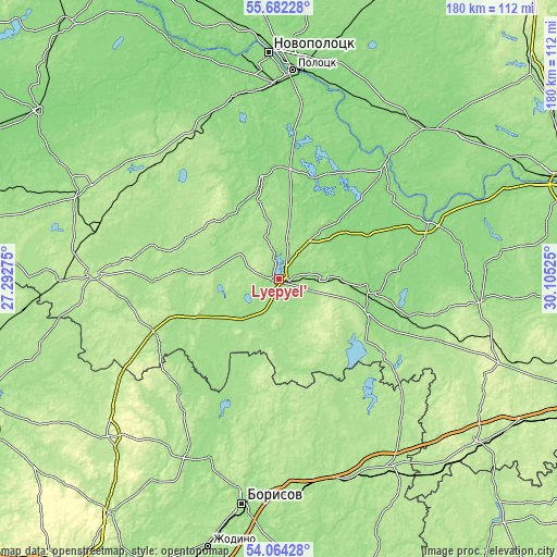
These maps also provides idea of topography and contour of this city, they are displayed at different zoom levels. More info about maps, scale and edge coordinates you can find below images.
| \ | Map #1 | Map #2 | Topo.Map |
| Scale [m] | 139..179 m | 135..217 m | × |
| Scale [ft] | 456..587 ft | 443..712 ft | × |
| Average | 156.3 m = 513 ft | 159 m = 522 ft | × |
| Width | 5.62 km = 3.5 mi | 11.24 km = 7 mi | 179.9 km = 111.8 mi |
| Height | 5.62 km = 3.5 mi | 11.24 km = 7 mi | 179.9 km = 111.8 mi |
| ↑Max Latitude | 54.906673° | 54.931929° | 55.68228° |
| Latitude at center | 54.8814° | 54.8814° | 54.8814° |
| ↓Min Latitude | 54.856112° | 54.830807° | 54.06428° |
| ← Min Longitude | 28.655055° | 28.611109° | 27.29275° |
| Longitude center | 28.699° | 28.699° | 28.699° |
| →Max Longitude | 28.742945° | 28.786891° | 30.10525° |
Nearby cities:
Cities around Lyepyel’ sort by population:
• Polatsk elevation 129 m
67.7 km,  4°
4°
• Novolukoml’ 175 m
37.9 km,  130°
130°
• Chashniki 136 m
29.7 km,  94°
94°
• Syanno 165 m
65.1 km,  96°
96°
• Krupki 174 m
68.7 km,  155°
155°
• Dokshytsy 204 m
59.6 km,  271°
271°
• Loshnitsa 176 m
67 km,  176°
176°
• Ushachy 148 m
33.5 km,  350°
350°
• Konstantinovo 176 m
44.1 km,  124°
124°
• Byahoml’ 181 m
44.3 km,  247°
247°
• Kholopenichi 190 m
43.7 km, 157°
• Zyembin 181 m
65.9 km,  207°
207°
Multilingual:
 En español:
Lyepyel’ elevación 165 m.
 En France:
Lyepyel’ élévation 165 m.
 Auf Deutsch:
Lyepyel’ höhe über dem Meeresspiegel ist 165 m.

Sources and notes:
- [note 1] Map square and city borders are not equal. Map elevation data is calculated only from area inside that square.
- [src 1] Elevation data from geonames database provided with same terms of usage.
- [src 2] The elevation map of Lyepyel’ is generated using elevation data from NASA's 3 arcsec (90m) resolution SRTM data.
- [src 3] Base (background) map © OpenStreetMap contributors tiles are generated by Geofabrik and OpenTopoMap.
Copyright & License:
This Lyepyel’ Elevation Map is licensed under CC BY-SA. You may reuse any part from this page, if you give a proper credit by linking to this URL:
 More info on terms of use page.