Areal elevation
Areal (Rio de Janeiro), Brazil elevation is 496 meters and Areal elevation in feet is 1627 ft above sea level [src 1]. Areal is a populated place (feature code) with elevation that is 114 meters (374 ft) bigger than average city elevation in Brazil.
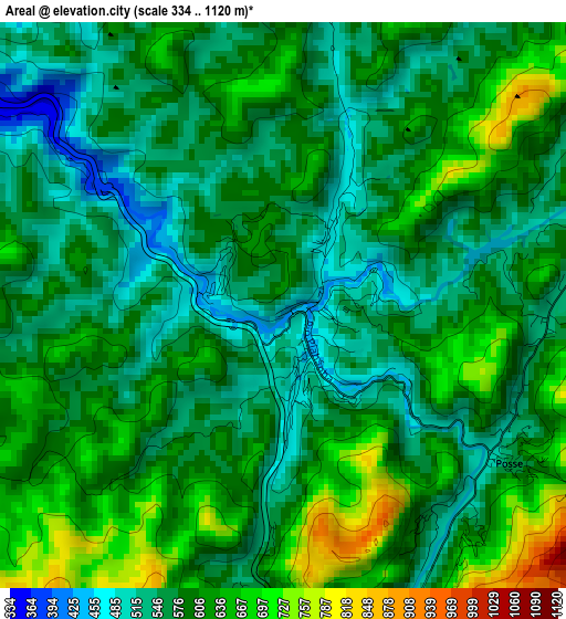
Below is the Elevation map of Areal, which displays elevation range with different colors. Scale of the first map is from 334 to 1120 m (1096 to 3675 ft) with average elevation of 591.6 meters (=1941 ft) [note 1]
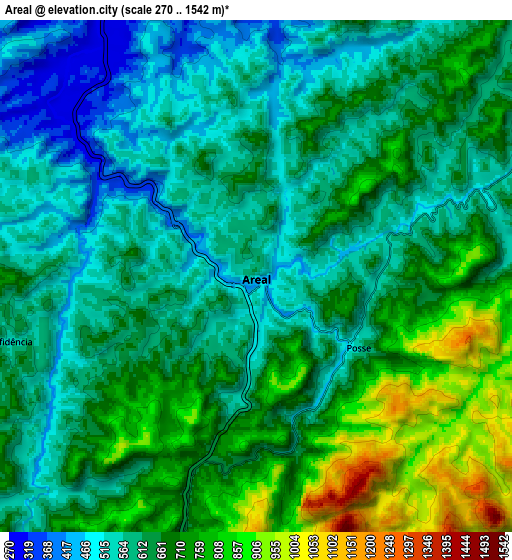
These maps also provides idea of topography and contour of this city, they are displayed at different zoom levels. More info about maps, scale and edge coordinates you can find below images.
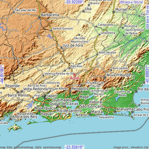
| \ | Map #1 | Map #2 | Topo.Map |
| Scale [m] | 334..1120 m | 270..1542 m | × |
| Scale [ft] | 1096..3675 ft | 886..5059 ft | × |
| Average | 591.6 m = 1941 ft | 646.1 m = 2120 ft | × |
| Width | 9.05 km = 5.6 mi | 18.09 km = 11.2 mi | 289.5 km = 179.9 mi |
| Height | 9.05 km = 5.6 mi | 18.09 km = 11.2 mi | 289.5 km = 179.9 mi |
| ↑Max Latitude | -22.189875° | -22.149179° | -20.92289° |
| Latitude at center | -22.23056° | -22.23056° | -22.23056° |
| ↓Min Latitude | -22.271233° | -22.311894° | -23.52615° |
| ← Min Longitude | -43.149505° | -43.193451° | -44.51181° |
| Longitude center | -43.10556° | -43.10556° | -43.10556° |
| →Max Longitude | -43.061615° | -43.017669° | -41.69931° |
Nearby cities:
Cities around Areal sort by population:
• Petrópolis elevation 819 m
31.4 km,  193°
193°
• Teresópolis 936 m
24.5 km,  147°
147°
• Três Rios 276 m
16.6 km,  319°
319°
• Cachoeiras de Macacu 63 m
53.2 km,  118°
118°
• Paraíba do Sul 323 m
20.9 km,  292°
292°
• Guapimirim 33 m
36.4 km,  159°
159°
• Miguel Pereira 615 m
44.9 km,  236°
236°
• Paty do Alferes 599 m
39 km, 235°
• São Pedro 920 m
25.8 km, 146°
• Sapucaia 224 m
32.8 km,  36°
36°
• Matias Barbosa 481 m
45.8 km,  331°
331°
• Mar de Espanha 484 m
41.6 km,  13°
13°
Multilingual:
 En español:
Areal elevación 496 m.
 En France:
Areal élévation 496 m.


Sources and notes:
- [note 1] Map square and city borders are not equal. Map elevation data is calculated only from area inside that square.
- [src 1] Elevation data from geonames database provided with same terms of usage.
- [src 2] The elevation map of Areal is generated using elevation data from NASA's 3 arcsec (90m) resolution SRTM data.
- [src 3] Base (background) map © OpenStreetMap contributors tiles are generated by Geofabrik and OpenTopoMap.
Copyright & License:
This Areal Elevation Map is licensed under CC BY-SA. You may reuse any part from this page, if you give a proper credit by linking to this URL:
 More info on terms of use page.