Cajuru elevation
Cajuru (São Paulo), Brazil elevation is 786 meters and Cajuru elevation in feet is 2579 ft above sea level [src 1]. Cajuru is a populated place (feature code) with elevation that is 404 meters (1325 ft) bigger than average city elevation in Brazil.
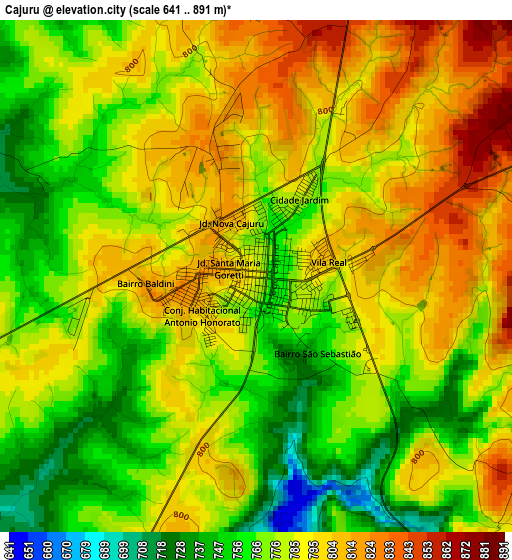
Below is the Elevation map of Cajuru, which displays elevation range with different colors. Scale of the first map is from 641 to 891 m (2103 to 2923 ft) with average elevation of 782.5 meters (=2567 ft) [note 1]
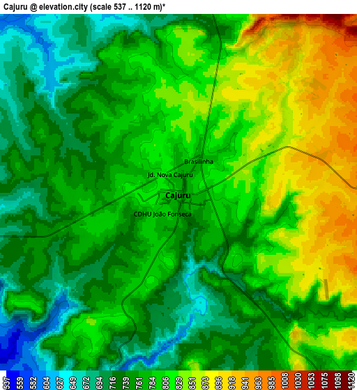
These maps also provides idea of topography and contour of this city, they are displayed at different zoom levels. More info about maps, scale and edge coordinates you can find below images.
| \ | Map #1 | Map #2 | Topo.Map |
| Scale [m] | 641..891 m | 537..1120 m | × |
| Scale [ft] | 2103..2923 ft | 1762..3675 ft | × |
| Average | 782.5 m = 2567 ft | 782.5 m = 2567 ft | × |
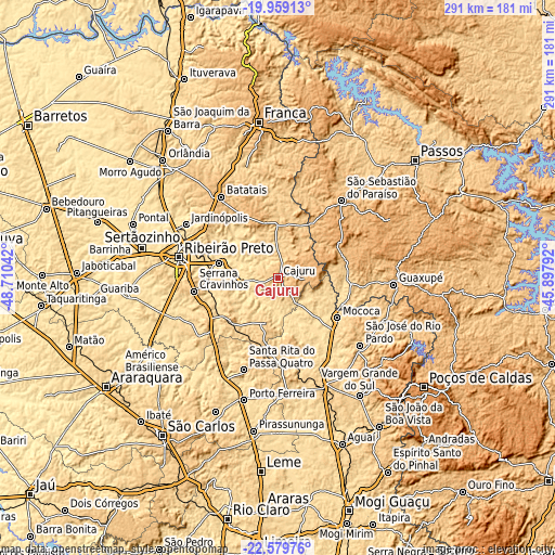
| Width | 9.11 km = 5.7 mi | 18.21 km = 11.3 mi | 291.4 km = 181.1 mi |
| Height | 9.11 km = 5.7 mi | 18.21 km = 11.3 mi | 291.4 km = 181.1 mi |
| ↑Max Latitude | -21.234324° | -21.193357° | -19.95913° |
| Latitude at center | -21.27528° | -21.27528° | -21.27528° |
| ↓Min Latitude | -21.316225° | -21.357158° | -22.57976° |
| ← Min Longitude | -47.348115° | -47.392061° | -48.71042° |
| Longitude center | -47.30417° | -47.30417° | -47.30417° |
| →Max Longitude | -47.260225° | -47.216279° | -45.89792° |
Nearby cities:
Cities around Cajuru sort by population:
• São Sebastião do Paraíso elevation 974 m
51.4 km,  39°
39°
• Mococa 617 m
37.7 km,  124°
124°
• Batatais 877 m
51.7 km,  325°
325°
• Serrana 560 m
31 km,  283°
283°
• Cravinhos 801 m
44.6 km,  260°
260°
• Santa Rita do Passa Quatro 759 m
51.6 km,  200°
200°
• Santa Rosa de Viterbo 677 m
22.8 km, 195°
• Tambaú 703 m
47.9 km,  176°
176°
• Brodósqui 866 m
48.5 km,  310°
310°
• Monte Santo de Minas 893 m
34.9 km,  74°
74°
• Altinópolis 918 m
28.7 km,  345°
345°
• São Simão 659 m
34.1 km,  228°
228°
Multilingual:
 En español:
Cajuru elevación 786 m.
 En France:
Cajuru élévation 786 m.


Sources and notes:
- [note 1] Map square and city borders are not equal. Map elevation data is calculated only from area inside that square.
- [src 1] Elevation data from geonames database provided with same terms of usage.
- [src 2] The elevation map of Cajuru is generated using elevation data from NASA's 3 arcsec (90m) resolution SRTM data.
- [src 3] Base (background) map © OpenStreetMap contributors tiles are generated by Geofabrik and OpenTopoMap.
Copyright & License:
This Cajuru Elevation Map is licensed under CC BY-SA. You may reuse any part from this page, if you give a proper credit by linking to this URL:
 More info on terms of use page.