Crixás elevation
Crixás (Goiás), Brazil elevation is 382 meters and Crixás elevation in feet is 1253 ft above sea level [src 1]. Crixás is a populated place (feature code) with elevation that is 0 meters (0 ft) bigger than average city elevation in Brazil.
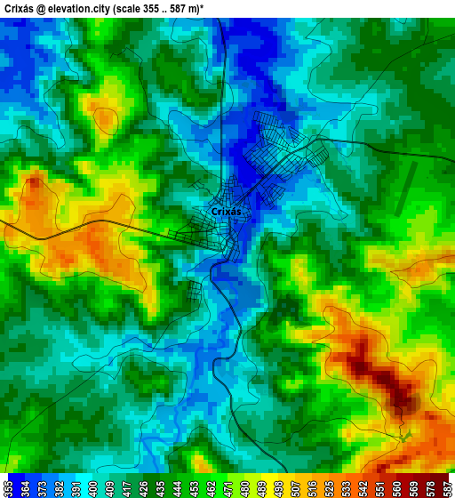
Below is the Elevation map of Crixás, which displays elevation range with different colors. Scale of the first map is from 355 to 587 m (1165 to 1926 ft) with average elevation of 434.2 meters (=1425 ft) [note 1]
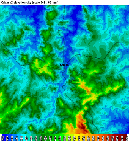
These maps also provides idea of topography and contour of this city, they are displayed at different zoom levels. More info about maps, scale and edge coordinates you can find below images.
| \ | Map #1 | Map #2 | Topo.Map |
| Scale [m] | 355..587 m | 342..681 m | × |
| Scale [ft] | 1165..1926 ft | 1122..2234 ft | × |
| Average | 434.2 m = 1425 ft | 424.5 m = 1393 ft | × |
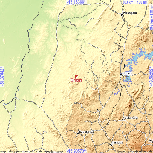
| Width | 9.46 km = 5.9 mi | 18.92 km = 11.8 mi | 302.7 km = 188.1 mi |
| Height | 9.46 km = 5.9 mi | 18.92 km = 11.8 mi | 302.7 km = 188.1 mi |
| ↑Max Latitude | -14.50635° | -14.463801° | -13.18366° |
| Latitude at center | -14.54889° | -14.54889° | -14.54889° |
| ↓Min Latitude | -14.591422° | -14.633946° | -15.90573° |
| ← Min Longitude | -50.013115° | -50.057061° | -51.37542° |
| Longitude center | -49.96917° | -49.96917° | -49.96917° |
| →Max Longitude | -49.925225° | -49.881279° | -48.56292° |
Nearby cities:
Cities around Crixás sort by population:
• Goianésia elevation 649 m
125.2 km,  133°
133°
• Uruaçu 524 m
89.2 km,  88°
88°
• Itapuranga 652 m
112.7 km,  178°
178°
• São Miguel do Araguaia 336 m
143.2 km,  351°
351°
• Ceres 586 m
93.4 km,  154°
154°
• Rubiataba 638 m
70.7 km,  165°
165°
• Itapaci 555 m
63.5 km, 134°
• Mozarlândia 300 m
68.3 km,  251°
251°
• Uruana 595 m
110.5 km,  163°
163°
• Rialma 574 m
94.7 km, 154°
• Barro Alto 605 m
122.6 km,  112°
112°
• Carmo do Rio Verde 611 m
93.8 km, 162°
Multilingual:
 En español:
Crixás elevación 382 m.
 En France:
Crixás élévation 382 m.


Sources and notes:
- [note 1] Map square and city borders are not equal. Map elevation data is calculated only from area inside that square.
- [src 1] Elevation data from geonames database provided with same terms of usage.
- [src 2] The elevation map of Crixás is generated using elevation data from NASA's 3 arcsec (90m) resolution SRTM data.
- [src 3] Base (background) map © OpenStreetMap contributors tiles are generated by Geofabrik and OpenTopoMap.
Copyright & License:
This Crixás Elevation Map is licensed under CC BY-SA. You may reuse any part from this page, if you give a proper credit by linking to this URL:
 More info on terms of use page.