Guarabira elevation
Guarabira (Paraíba), Brazil elevation is 94 meters and Guarabira elevation in feet is 308 ft above sea level [src 1]. Guarabira is a populated place (feature code) with elevation that is 288 meters (945 ft) smaller than average city elevation in Brazil.
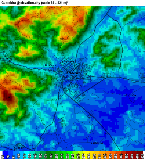
Below is the Elevation map of Guarabira, which displays elevation range with different colors. Scale of the first map is from 64 to 421 m (210 to 1381 ft) with average elevation of 150.7 meters (=494 ft) [note 1]
These maps also provides idea of topography and contour of this city, they are displayed at different zoom levels. More info about maps, scale and edge coordinates you can find below images.
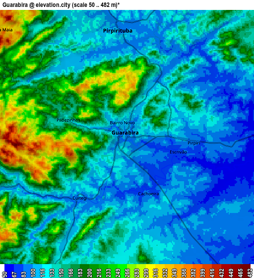
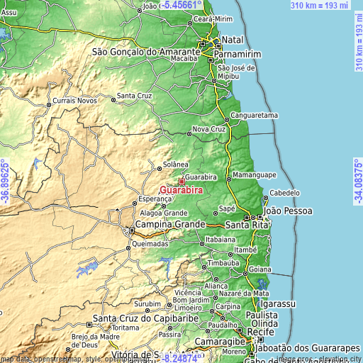
| \ | Map #1 | Map #2 | Topo.Map |
| Scale [m] | 64..421 m | 50..482 m | × |
| Scale [ft] | 210..1381 ft | 164..1581 ft | × |
| Average | 150.7 m = 494 ft | 150.6 m = 494 ft | × |
| Width | 9.7 km = 6 mi | 19.41 km = 12.1 mi | 310.5 km = 192.9 mi |
| Height | 9.7 km = 6 mi | 19.41 km = 12.1 mi | 310.5 km = 192.9 mi |
| ↑Max Latitude | -6.811087° | -6.76745° | -5.45661° |
| Latitude at center | -6.85472° | -6.85472° | -6.85472° |
| ↓Min Latitude | -6.898349° | -6.941974° | -8.24874° |
| ← Min Longitude | -35.533945° | -35.577891° | -36.89625° |
| Longitude center | -35.49° | -35.49° | -35.49° |
| →Max Longitude | -35.446055° | -35.402109° | -34.08375° |
Nearby cities:
Cities around Guarabira sort by population:
• Mari elevation 149 m
29.6 km,  140°
140°
• Solânea 188 m
12.4 km,  333°
333°
• Belém 140 m
18.8 km,  345°
345°
• Areia 546 m
25.3 km,  241°
241°
• Remígio 561 m
33.6 km,  252°
252°
• Pirpirituba 107 m
8.4 km, 353°
• Arara 461 m
29.8 km,  275°
275°
• Alagoinha 136 m
12.2 km,  209°
209°
• Bananeiras 556 m
19.6 km,  306°
306°
• Gurinhém 98 m
30.8 km,  166°
166°
• Mulungu 89 m
19.1 km, 170°
• Dona Inês 462 m
30.8 km, 330°
Multilingual:
 En español:
Guarabira elevación 94 m.
 En France:
Guarabira élévation 94 m.
 Auf Deutsch:
Guarabira höhe über dem Meeresspiegel ist 94 m.

Sources and notes:
- [note 1] Map square and city borders are not equal. Map elevation data is calculated only from area inside that square.
- [src 1] Elevation data from geonames database provided with same terms of usage.
- [src 2] The elevation map of Guarabira is generated using elevation data from NASA's 3 arcsec (90m) resolution SRTM data.
- [src 3] Base (background) map © OpenStreetMap contributors tiles are generated by Geofabrik and OpenTopoMap.
Copyright & License:
This Guarabira Elevation Map is licensed under CC BY-SA. You may reuse any part from this page, if you give a proper credit by linking to this URL:
 More info on terms of use page.