Sousa elevation
Sousa (Paraíba), Brazil elevation is 229 meters and Sousa elevation in feet is 751 ft above sea level [src 1]. Sousa is a populated place (feature code) with elevation that is 153 meters (502 ft) smaller than average city elevation in Brazil.
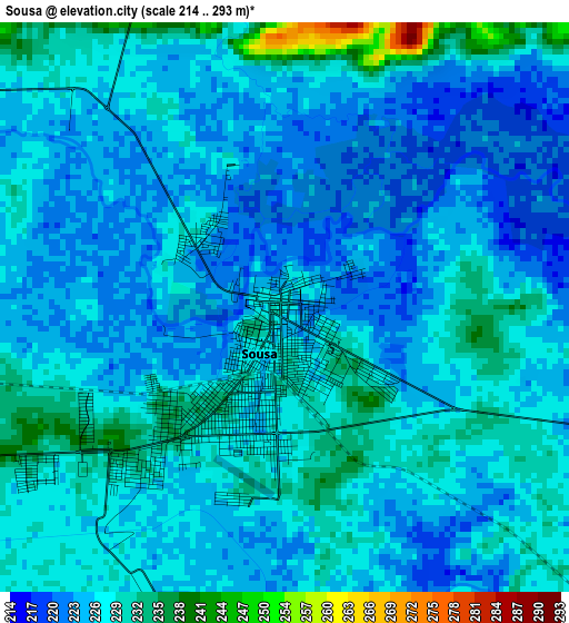
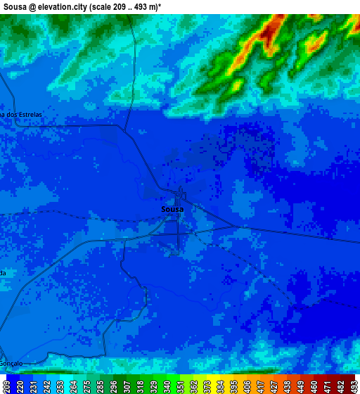
Below is the Elevation map of Sousa, which displays elevation range with different colors. Scale of the first map is from 214 to 293 m (702 to 961 ft) with average elevation of 227.2 meters (=745 ft) [note 1]
These maps also provides idea of topography and contour of this city, they are displayed at different zoom levels. More info about maps, scale and edge coordinates you can find below images.
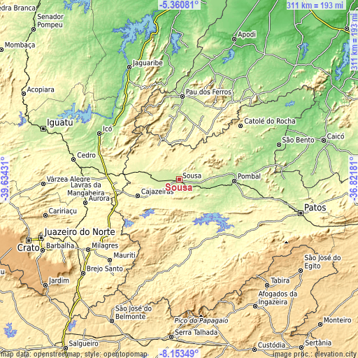
| \ | Map #1 | Map #2 | Topo.Map |
| Scale [m] | 214..293 m | 209..493 m | × |
| Scale [ft] | 702..961 ft | 686..1617 ft | × |
| Average | 227.2 m = 745 ft | 240.7 m = 790 ft | × |
| Width | 9.7 km = 6 mi | 19.41 km = 12.1 mi | 310.5 km = 192.9 mi |
| Height | 9.7 km = 6 mi | 19.41 km = 12.1 mi | 310.5 km = 192.9 mi |
| ↑Max Latitude | -6.715528° | -6.671882° | -5.36081° |
| Latitude at center | -6.75917° | -6.75917° | -6.75917° |
| ↓Min Latitude | -6.802808° | -6.846442° | -8.15349° |
| ← Min Longitude | -38.272005° | -38.315951° | -39.63431° |
| Longitude center | -38.22806° | -38.22806° | -38.22806° |
| →Max Longitude | -38.184115° | -38.140169° | -36.82181° |
Nearby cities:
Cities around Sousa sort by population:
• Cajazeiras elevation 305 m
39 km,  248°
248°
• Pombal 185 m
47.1 km,  91°
91°
• Itaporanga 295 m
61.2 km,  171°
171°
• Coremas 218 m
42.1 km,  132°
132°
• Piancó 268 m
58.9 km,  145°
145°
• Alexandria 314 m
45.1 km,  31°
31°
• Juàzeirinho 222 m
20.7 km,  108°
108°
• Serra Branca 327 m
25.5 km,  350°
350°
• Uiraúna 298 m
33.6 km,  322°
322°
• São José de Piranhas 344 m
50.3 km,  216°
216°
• Triunfo 340 m
46.3 km,  297°
297°
• Paulista 165 m
69.2 km,  74°
74°
Multilingual:
 En español:
Sousa elevación 229 m.
 En France:
Sousa élévation 229 m.


Sources and notes:
- [note 1] Map square and city borders are not equal. Map elevation data is calculated only from area inside that square.
- [src 1] Elevation data from geonames database provided with same terms of usage.
- [src 2] The elevation map of Sousa is generated using elevation data from NASA's 3 arcsec (90m) resolution SRTM data.
- [src 3] Base (background) map © OpenStreetMap contributors tiles are generated by Geofabrik and OpenTopoMap.
Copyright & License:
This Sousa Elevation Map is licensed under CC BY-SA. You may reuse any part from this page, if you give a proper credit by linking to this URL:
 More info on terms of use page.