Tchaourou elevation
Tchaourou (Borgou, Commune of Tchaourou), Benin elevation is 332 meters and Tchaourou elevation in feet is 1089 ft above sea level [src 1]. Tchaourou is a populated place (feature code) with elevation that is 169 meters (554 ft) bigger than average city elevation in Benin.
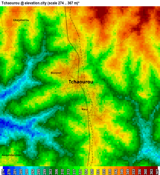
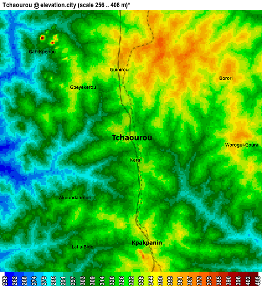
Below is the Elevation map of Tchaourou, which displays elevation range with different colors. Scale of the first map is from 274 to 367 m (899 to 1204 ft) with average elevation of 319.3 meters (=1048 ft) [note 1]
These maps also provides idea of topography and contour of this city, they are displayed at different zoom levels. More info about maps, scale and edge coordinates you can find below images.
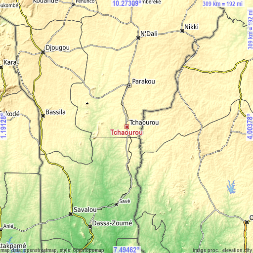
| \ | Map #1 | Map #2 | Topo.Map |
| Scale [m] | 274..367 m | 256..408 m | × |
| Scale [ft] | 899..1204 ft | 840..1339 ft | × |
| Average | 319.3 m = 1048 ft | 317.8 m = 1043 ft | × |
| Width | 9.66 km = 6 mi | 19.31 km = 12 mi | 308.9 km = 191.9 mi |
| Height | 9.66 km = 6 mi | 19.31 km = 12 mi | 309 km = 192 mi |
| ↑Max Latitude | 8.929905° | 8.973315° | 10.27309° |
| Latitude at center | 8.88649° | 8.88649° | 8.88649° |
| ↓Min Latitude | 8.84307° | 8.799644° | 7.49462° |
| ← Min Longitude | 2.553585° | 2.509639° | 1.19128° |
| Longitude center | 2.59753° | 2.59753° | 2.59753° |
| →Max Longitude | 2.641475° | 2.685421° | 4.00378° |
Nearby cities:
Cities around Tchaourou sort by population:
• Djougou elevation 444 m
137.1 km,  311°
311°
• Parakou 369 m
50.2 km,  4°
4°
• Savé 190 m
95.5 km,  187°
187°
• Nikki 403 m
135.1 km,  29°
29°
• Cové 117 m
187.3 km, 188°
• Savalou 181 m
126.6 km,  212°
212°
• Bembèrèkè 445 m
149.4 km, 2°
• Bassila 388 m
103.3 km,  277°
277°
• Kétou 103 m
169.4 km,  179°
179°
• Dassa-Zoumé 156 m
134.3 km,  199°
199°
• Bétérou 259 m
50.9 km, 313°
• Zagnanado 108 m
186.7 km, 187°
Multilingual:
 En español:
Tchaourou elevación 332 m.
 En France:
Tchaourou élévation 332 m.
 Auf Deutsch:
Tchaourou höhe über dem Meeresspiegel ist 332 m.

Sources and notes:
- [note 1] Map square and city borders are not equal. Map elevation data is calculated only from area inside that square.
- [src 1] Elevation data from geonames database provided with same terms of usage.
- [src 2] The elevation map of Tchaourou is generated using elevation data from NASA's 3 arcsec (90m) resolution SRTM data.
- [src 3] Base (background) map © OpenStreetMap contributors tiles are generated by Geofabrik and OpenTopoMap.
Copyright & License:
This Tchaourou Elevation Map is licensed under CC BY-SA. You may reuse any part from this page, if you give a proper credit by linking to this URL:
 More info on terms of use page.