Karlovo elevation
Karlovo (Plovdiv, Obshtina Karlovo), Bulgaria elevation is 406 meters and Karlovo elevation in feet is 1332 ft above sea level [src 1]. Karlovo is a populated place (feature code) with elevation that is 87 meters (285 ft) bigger than average city elevation in Bulgaria.
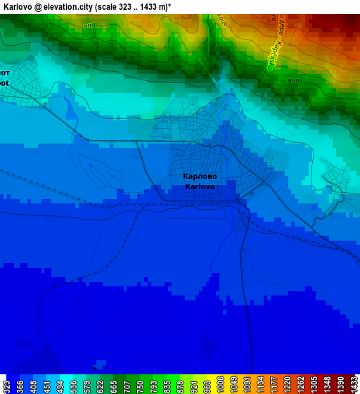
Below is the Elevation map of Karlovo, which displays elevation range with different colors. Scale of the first map is from 323 to 1433 m (1060 to 4701 ft) with average elevation of 501.9 meters (=1647 ft) [note 1]
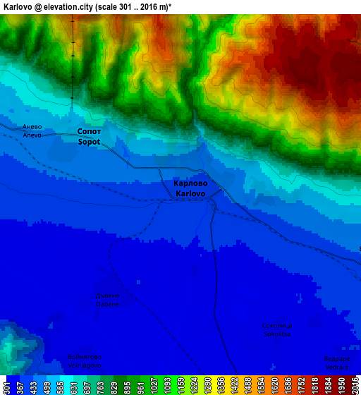
These maps also provides idea of topography and contour of this city, they are displayed at different zoom levels. More info about maps, scale and edge coordinates you can find below images.
| \ | Map #1 | Map #2 | Topo.Map |
| Scale [m] | 323..1433 m | 301..2016 m | × |
| Scale [ft] | 1060..4701 ft | 988..6614 ft | × |
| Average | 501.9 m = 1647 ft | 698.8 m = 2293 ft | × |
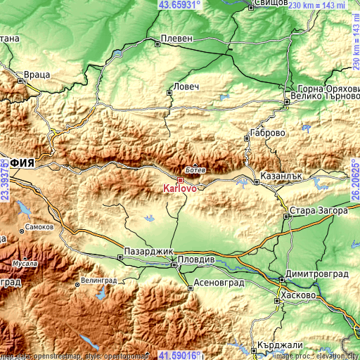
| Width | 7.19 km = 4.5 mi | 14.38 km = 8.9 mi | 230.1 km = 143 mi |
| Height | 7.19 km = 4.5 mi | 14.38 km = 8.9 mi | 230.1 km = 143 mi |
| ↑Max Latitude | 42.665652° | 42.697958° | 43.65931° |
| Latitude at center | 42.63333° | 42.63333° | 42.63333° |
| ↓Min Latitude | 42.600991° | 42.568635° | 41.59016° |
| ← Min Longitude | 24.756055° | 24.712109° | 23.39375° |
| Longitude center | 24.8° | 24.8° | 24.8° |
| →Max Longitude | 24.843945° | 24.887891° | 26.20625° |
Nearby cities:
Cities around Karlovo sort by population:
• Troyan elevation 389 m
29.8 km,  346°
346°
• Rakovski 162 m
41.6 km,  163°
163°
• Hisarya 364 m
16.9 km,  208°
208°
• Apriltsi 511 m
25.1 km,  22°
22°
• Kalofer 731 m
15.1 km,  97°
97°
• Pavel Banya 411 m
32.9 km, 96°
• Koprivshtitsa 1098 m
36.8 km,  270°
270°
• Kaloyanovo 219 m
32 km,  189°
189°
• Brezovo 249 m
39.1 km,  143°
143°
• Klisura 772 m
29.6 km,  284°
284°
• Zelenikovo 305 m
34.8 km, 138°
• Asen 470 m
32.8 km,  86°
86°
Multilingual:
 En español:
Karlovo elevación 406 m.
 En France:
Karlovo élévation 406 m.


Sources and notes:
- [note 1] Map square and city borders are not equal. Map elevation data is calculated only from area inside that square.
- [src 1] Elevation data from geonames database provided with same terms of usage.
- [src 2] The elevation map of Karlovo is generated using elevation data from NASA's 3 arcsec (90m) resolution SRTM data.
- [src 3] Base (background) map © OpenStreetMap contributors tiles are generated by Geofabrik and OpenTopoMap.
Copyright & License:
This Karlovo Elevation Map is licensed under CC BY-SA. You may reuse any part from this page, if you give a proper credit by linking to this URL:
 More info on terms of use page.