Rakovski elevation
Rakovski (Plovdiv, Obshtina Rakovski), Bulgaria elevation is 162 meters and Rakovski elevation in feet is 531 ft above sea level [src 1]. Rakovski is a populated place (feature code) with elevation that is 157 meters (515 ft) smaller than average city elevation in Bulgaria.
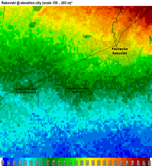
Below is the Elevation map of Rakovski, which displays elevation range with different colors. Scale of the first map is from 159 to 203 m (522 to 666 ft) with average elevation of 174.5 meters (=573 ft) [note 1]
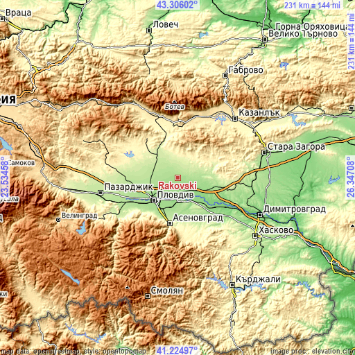
These maps also provides idea of topography and contour of this city, they are displayed at different zoom levels. More info about maps, scale and edge coordinates you can find below images.
| \ | Map #1 | Map #2 | Topo.Map |
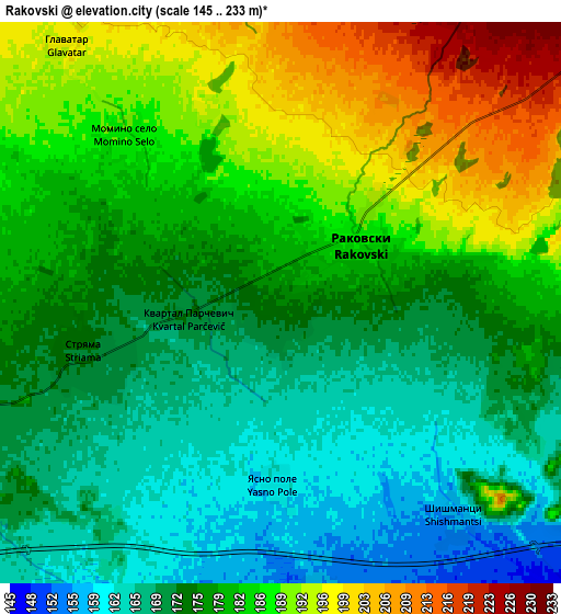
| Scale [m] | 159..203 m | 145..233 m | × |
| Scale [ft] | 522..666 ft | 476..764 ft | × |
| Average | 174.5 m = 573 ft | 179 m = 587 ft | × |
| Width | 7.23 km = 4.5 mi | 14.46 km = 9 mi | 231.4 km = 143.8 mi |
| Height | 7.23 km = 4.5 mi | 14.46 km = 9 mi | 231.4 km = 143.8 mi |
| ↑Max Latitude | 42.306588° | 42.33908° | 43.30602° |
| Latitude at center | 42.27408° | 42.27408° | 42.27408° |
| ↓Min Latitude | 42.241555° | 42.209013° | 41.22497° |
| ← Min Longitude | 24.896885° | 24.852939° | 23.53458° |
| Longitude center | 24.94083° | 24.94083° | 24.94083° |
| →Max Longitude | 24.984775° | 25.028721° | 26.34708° |
Nearby cities:
Cities around Rakovski sort by population:
• Plovdiv elevation 169 m
20.9 km,  228°
228°
• Asenovgrad 226 m
29.3 km,  192°
192°
• Chirpan 195 m
33.3 km,  104°
104°
• Parvomay 134 m
29.9 km,  130°
130°
• Stamboliyski 188 m
37 km,  245°
245°
• Hisarya 364 m
32 km,  321°
321°
• Saedinenie 203 m
32.2 km,  268°
268°
• Kalofer 731 m
38.3 km,  5°
5°
• Kaloyanovo 219 m
19 km,  296°
296°
• Sadovo 153 m
15.8 km,  180°
180°
• Brezovo 249 m
14.4 km,  54°
54°
• Zelenikovo 305 m
18.3 km,  39°
39°
Multilingual:
 En español:
Rakovski elevación 162 m.
 En France:
Rakovski élévation 162 m.
 Auf Deutsch:
Rakovski höhe über dem Meeresspiegel ist 162 m.

Sources and notes:
- [note 1] Map square and city borders are not equal. Map elevation data is calculated only from area inside that square.
- [src 1] Elevation data from geonames database provided with same terms of usage.
- [src 2] The elevation map of Rakovski is generated using elevation data from NASA's 3 arcsec (90m) resolution SRTM data.
- [src 3] Base (background) map © OpenStreetMap contributors tiles are generated by Geofabrik and OpenTopoMap.
Copyright & License:
This Rakovski Elevation Map is licensed under CC BY-SA. You may reuse any part from this page, if you give a proper credit by linking to this URL:
 More info on terms of use page.