Hisarya elevation
Hisarya (Plovdiv, Obshtina Hisarya), Bulgaria elevation is 364 meters and Hisarya elevation in feet is 1194 ft above sea level [src 1]. Hisarya is a populated place (feature code) with elevation that is 45 meters (148 ft) bigger than average city elevation in Bulgaria.
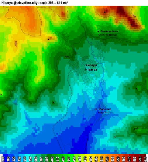
Below is the Elevation map of Hisarya, which displays elevation range with different colors. Scale of the first map is from 296 to 611 m (971 to 2005 ft) with average elevation of 396.5 meters (=1301 ft) [note 1]
These maps also provides idea of topography and contour of this city, they are displayed at different zoom levels. More info about maps, scale and edge coordinates you can find below images.
| \ | Map #1 | Map #2 | Topo.Map |
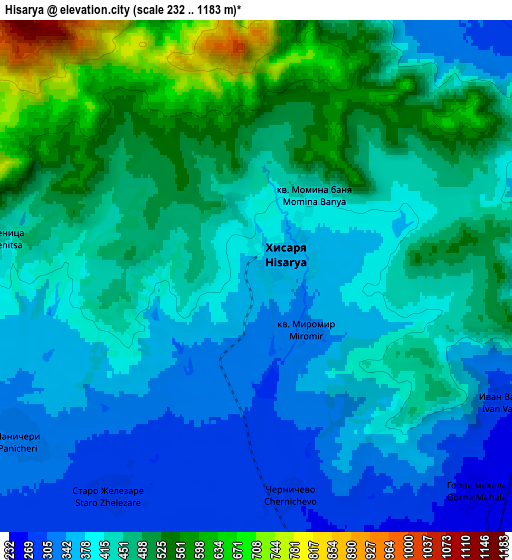
| Scale [m] | 296..611 m | 232..1183 m | × |
| Scale [ft] | 971..2005 ft | 761..3881 ft | × |
| Average | 396.5 m = 1301 ft | 436.3 m = 1431 ft | × |
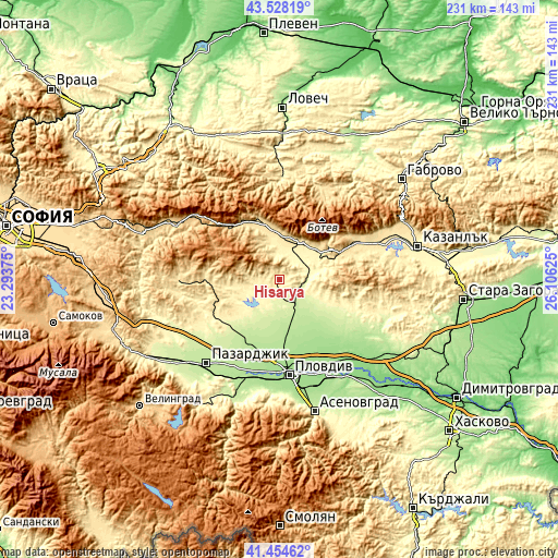
| Width | 7.21 km = 4.5 mi | 14.41 km = 9 mi | 230.6 km = 143.3 mi |
| Height | 7.2 km = 4.5 mi | 14.41 km = 9 mi | 230.6 km = 143.3 mi |
| ↑Max Latitude | 42.532391° | 42.564766° | 43.52819° |
| Latitude at center | 42.5° | 42.5° | 42.5° |
| ↓Min Latitude | 42.467592° | 42.435167° | 41.45462° |
| ← Min Longitude | 24.656055° | 24.612109° | 23.29375° |
| Longitude center | 24.7° | 24.7° | 24.7° |
| →Max Longitude | 24.743945° | 24.787891° | 26.10625° |
Nearby cities:
Cities around Hisarya sort by population:
• Plovdiv elevation 169 m
39.1 km,  173°
173°
• Karlovo 406 m
16.9 km,  28°
28°
• Panagyurishte 518 m
41.8 km,  269°
269°
• Rakovski 162 m
32 km,  141°
141°
• Saedinenie 203 m
28.7 km,  205°
205°
• Strelcha 511 m
31.4 km, 270°
• Kalofer 731 m
26.6 km,  60°
60°
• Koprivshtitsa 1098 m
32.3 km,  297°
297°
• Kaloyanovo 219 m
16.9 km, 170°
• Brezovo 249 m
35.6 km,  117°
117°
• Klisura 772 m
30.2 km,  317°
317°
• Zelenikovo 305 m
33.4 km,  109°
109°
Multilingual:
 En español:
Hisarya elevación 364 m.
 En France:
Hisarya élévation 364 m.


Sources and notes:
- [note 1] Map square and city borders are not equal. Map elevation data is calculated only from area inside that square.
- [src 1] Elevation data from geonames database provided with same terms of usage.
- [src 2] The elevation map of Hisarya is generated using elevation data from NASA's 3 arcsec (90m) resolution SRTM data.
- [src 3] Base (background) map © OpenStreetMap contributors tiles are generated by Geofabrik and OpenTopoMap.
Copyright & License:
This Hisarya Elevation Map is licensed under CC BY-SA. You may reuse any part from this page, if you give a proper credit by linking to this URL:
 More info on terms of use page.