Letnitsa elevation
Letnitsa (Lovech), Bulgaria elevation is 72 meters and Letnitsa elevation in feet is 236 ft above sea level [src 1]. Letnitsa is a populated place (feature code) with elevation that is 247 meters (810 ft) smaller than average city elevation in Bulgaria.
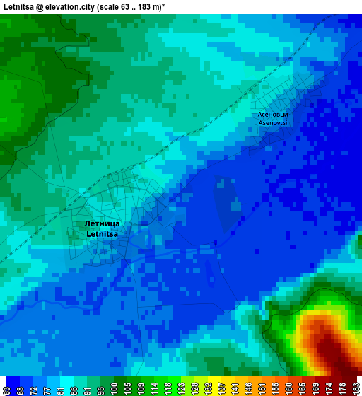
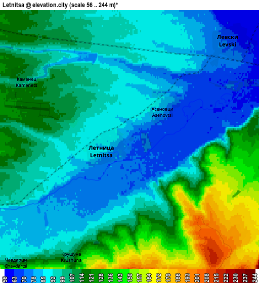
Below is the Elevation map of Letnitsa, which displays elevation range with different colors. Scale of the first map is from 63 to 183 m (207 to 600 ft) with average elevation of 84.5 meters (=277 ft) [note 1]
These maps also provides idea of topography and contour of this city, they are displayed at different zoom levels. More info about maps, scale and edge coordinates you can find below images.
| \ | Map #1 | Map #2 | Topo.Map |
| Scale [m] | 63..183 m | 56..244 m | × |
| Scale [ft] | 207..600 ft | 184..801 ft | × |
| Average | 84.5 m = 277 ft | 103.9 m = 341 ft | × |
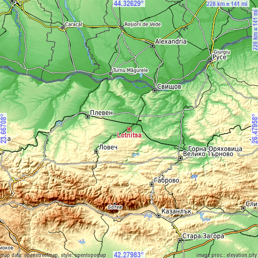
| Width | 7.11 km = 4.4 mi | 14.22 km = 8.8 mi | 227.5 km = 141.4 mi |
| Height | 7.11 km = 4.4 mi | 14.22 km = 8.8 mi | 227.5 km = 141.4 mi |
| ↑Max Latitude | 43.343638° | 43.375588° | 44.32629° |
| Latitude at center | 43.31167° | 43.31167° | 43.31167° |
| ↓Min Latitude | 43.279686° | 43.247684° | 42.27983° |
| ← Min Longitude | 25.029385° | 24.985439° | 23.66708° |
| Longitude center | 25.07333° | 25.07333° | 25.07333° |
| →Max Longitude | 25.117275° | 25.161221° | 26.47958° |
Nearby cities:
Cities around Letnitsa sort by population:
• Pleven elevation 97 m
38.7 km,  287°
287°
• Lovech 179 m
35 km,  235°
235°
• Svishtov 1 m
40.8 km,  33°
33°
• Sevlievo 195 m
31.9 km,  174°
174°
• Pavlikeni 157 m
21.5 km,  110°
110°
• Levski 73 m
7.8 km,  38°
38°
• Belene 29 m
37.4 km,  6°
6°
• Polski Trambesh 30 m
45.9 km,  81°
81°
• Slavyanovo 135 m
24 km,  315°
315°
• Byala Cherkva 105 m
22.2 km,  124°
124°
• Suhindol 269 m
15.9 km,  146°
146°
• Pordim 182 m
19.7 km, 293°
Multilingual:
 En español:
Letnitsa elevación 72 m.
 En France:
Letnitsa élévation 72 m.


Sources and notes:
- [note 1] Map square and city borders are not equal. Map elevation data is calculated only from area inside that square.
- [src 1] Elevation data from geonames database provided with same terms of usage.
- [src 2] The elevation map of Letnitsa is generated using elevation data from NASA's 3 arcsec (90m) resolution SRTM data.
- [src 3] Base (background) map © OpenStreetMap contributors tiles are generated by Geofabrik and OpenTopoMap.
Copyright & License:
This Letnitsa Elevation Map is licensed under CC BY-SA. You may reuse any part from this page, if you give a proper credit by linking to this URL:
 More info on terms of use page.