Nikopol elevation
Nikopol (Pleven, Obshtina Nikopol), Bulgaria elevation is 108 meters and Nikopol elevation in feet is 354 ft above sea level [src 1]. Nikopol is a seat of a second-order administrative division (feature code) with elevation that is 211 meters (692 ft) smaller than average city elevation in Bulgaria.
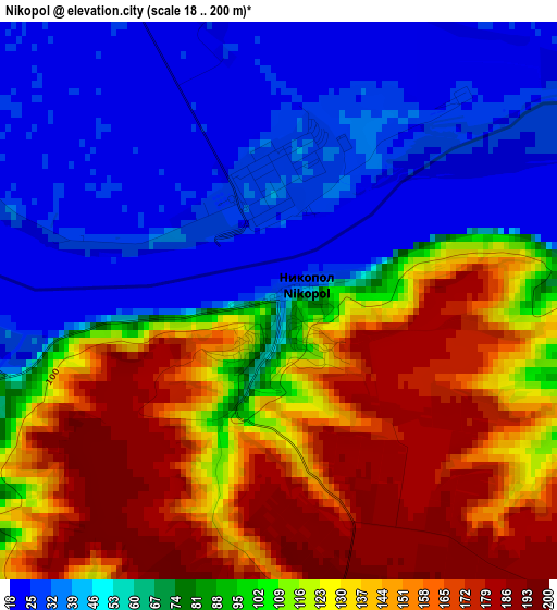
Below is the Elevation map of Nikopol, which displays elevation range with different colors. Scale of the first map is from 18 to 200 m (59 to 656 ft) with average elevation of 93.3 meters (=306 ft) [note 1]
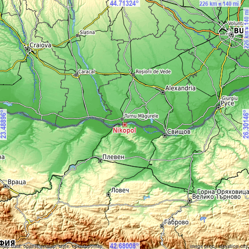
These maps also provides idea of topography and contour of this city, they are displayed at different zoom levels. More info about maps, scale and edge coordinates you can find below images.
| \ | Map #1 | Map #2 | Topo.Map |
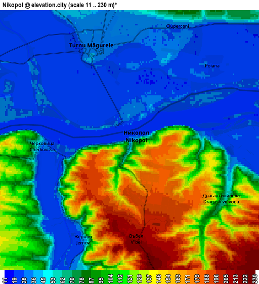
| Scale [m] | 18..200 m | 11..230 m | × |
| Scale [ft] | 59..656 ft | 36..755 ft | × |
| Average | 93.3 m = 306 ft | 80 m = 262 ft | × |
| Width | 7.06 km = 4.4 mi | 14.13 km = 8.8 mi | 226.1 km = 140.5 mi |
| Height | 7.06 km = 4.4 mi | 14.13 km = 8.8 mi | 226.1 km = 140.5 mi |
| ↑Max Latitude | 43.73704° | 43.768783° | 44.71324° |
| Latitude at center | 43.70528° | 43.70528° | 43.70528° |
| ↓Min Latitude | 43.673503° | 43.64171° | 42.68008° |
| ← Min Longitude | 24.851265° | 24.807319° | 23.48896° |
| Longitude center | 24.89521° | 24.89521° | 24.89521° |
| →Max Longitude | 24.939155° | 24.983101° | 26.30146° |
Nearby cities:
Cities around Nikopol sort by population:
• Pleven elevation 97 m
39.2 km,  214°
214°
• Svishtov 1 m
37.9 km,  104°
104°
• Levski 73 m
42.3 km,  152°
152°
• Belene 29 m
19.7 km,  109°
109°
• Dolni Dabnik 109 m
50.4 km,  227°
227°
• Slavyanovo 135 m
26.6 km,  184°
184°
• Iskar 110 m
58 km,  240°
240°
• Gulyantsi 37 m
17.7 km,  246°
246°
• Letnitsa 72 m
46.1 km,  161°
161°
• Dolna Mitropolia 57 m
39.4 km, 227°
• Pordim 182 m
36 km,  185°
185°
• Iskar 50 m
35.8 km,  263°
263°
Multilingual:
 En español:
Nikopol elevación 108 m.
 En France:
Nikopol élévation 108 m.


Sources and notes:
- [note 1] Map square and city borders are not equal. Map elevation data is calculated only from area inside that square.
- [src 1] Elevation data from geonames database provided with same terms of usage.
- [src 2] The elevation map of Nikopol is generated using elevation data from NASA's 3 arcsec (90m) resolution SRTM data.
- [src 3] Base (background) map © OpenStreetMap contributors tiles are generated by Geofabrik and OpenTopoMap.
Copyright & License:
This Nikopol Elevation Map is licensed under CC BY-SA. You may reuse any part from this page, if you give a proper credit by linking to this URL:
 More info on terms of use page.