Aiseau elevation
Aiseau (Wallonia, Province du Hainaut), Belgium elevation is 117 meters and Aiseau elevation in feet is 384 ft above sea level [src 1]. Aiseau is a populated place (feature code) with elevation that is 18 meters (59 ft) bigger than average city elevation in Belgium.
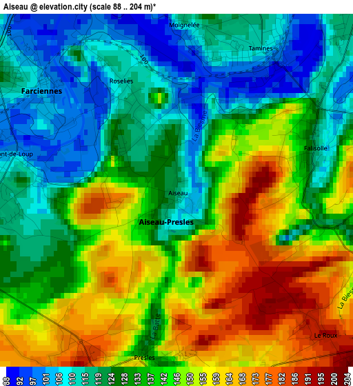
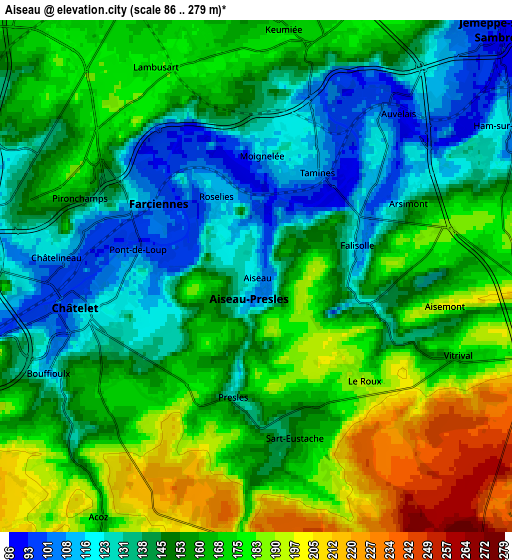
Below is the Elevation map of Aiseau, which displays elevation range with different colors. Scale of the first map is from 88 to 204 m (289 to 669 ft) with average elevation of 136.1 meters (=447 ft) [note 1]
These maps also provides idea of topography and contour of this city, they are displayed at different zoom levels. More info about maps, scale and edge coordinates you can find below images.
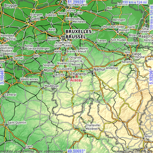
| \ | Map #1 | Map #2 | Topo.Map |
| Scale [m] | 88..204 m | 86..279 m | × |
| Scale [ft] | 289..669 ft | 282..915 ft | × |
| Average | 136.1 m = 447 ft | 157.2 m = 516 ft | × |
| Width | 6.23 km = 3.9 mi | 12.46 km = 7.7 mi | 199.3 km = 123.8 mi |
| Height | 6.23 km = 3.9 mi | 12.46 km = 7.7 mi | 199.3 km = 123.8 mi |
| ↑Max Latitude | 50.439577° | 50.467557° | 51.29928° |
| Latitude at center | 50.41158° | 50.41158° | 50.41158° |
| ↓Min Latitude | 50.383567° | 50.355537° | 49.50693° |
| ← Min Longitude | 4.542765° | 4.498819° | 3.18046° |
| Longitude center | 4.58671° | 4.58671° | 4.58671° |
| →Max Longitude | 4.630655° | 4.674601° | 5.99296° |
Nearby cities:
Cities around Aiseau sort by population:
• Charleroi elevation 136 m
10.1 km,  269°
269°
• Châtelet 118 m
4.2 km,  257°
257°
• Courcelles 160 m
16.1 km,  291°
291°
• Fleurus 158 m
8.4 km,  342°
342°
• Mettet 241 m
11.4 km,  151°
151°
• Gerpinnes 185 m
9.2 km,  207°
207°
• Farciennes 128 m
3.8 km,  302°
302°
• Fosses-la-Ville 176 m
8 km,  103°
103°
• La Bruyère 194 m
2.7 km,  133°
133°
• Brunehault 147 m
15.1 km,  313°
313°
• Floreffe 92 m
12.5 km,  78°
78°
• Sombreffe 146 m
13.1 km,  4°
4°
Multilingual:
 En español:
Aiseau elevación 117 m.
 En France:
Aiseau élévation 117 m.


Sources and notes:
- [note 1] Map square and city borders are not equal. Map elevation data is calculated only from area inside that square.
- [src 1] Elevation data from geonames database provided with same terms of usage.
- [src 2] The elevation map of Aiseau is generated using elevation data from NASA's 3 arcsec (90m) resolution SRTM data.
- [src 3] Base (background) map © OpenStreetMap contributors tiles are generated by Geofabrik and OpenTopoMap.
Copyright & License:
This Aiseau Elevation Map is licensed under CC BY-SA. You may reuse any part from this page, if you give a proper credit by linking to this URL:
 More info on terms of use page.