Floreffe elevation
Floreffe (Wallonia, Province de Namur), Belgium elevation is 92 meters and Floreffe elevation in feet is 302 ft above sea level [src 1]. Floreffe is a populated place (feature code) with elevation that is 7 meters (23 ft) smaller than average city elevation in Belgium.
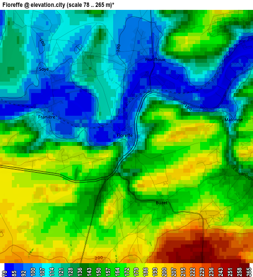
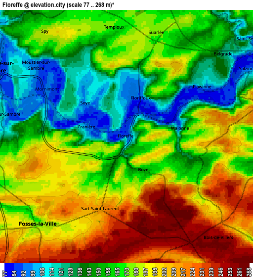
Below is the Elevation map of Floreffe, which displays elevation range with different colors. Scale of the first map is from 78 to 265 m (256 to 869 ft) with average elevation of 146.8 meters (=482 ft) [note 1]
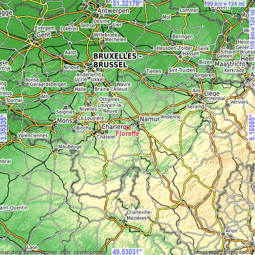
These maps also provides idea of topography and contour of this city, they are displayed at different zoom levels. More info about maps, scale and edge coordinates you can find below images.
| \ | Map #1 | Map #2 | Topo.Map |
| Scale [m] | 78..265 m | 77..268 m | × |
| Scale [ft] | 256..869 ft | 253..879 ft | × |
| Average | 146.8 m = 482 ft | 172.1 m = 565 ft | × |
| Width | 6.22 km = 3.9 mi | 12.45 km = 7.7 mi | 199.2 km = 123.8 mi |
| Height | 6.22 km = 3.9 mi | 12.45 km = 7.7 mi | 199.2 km = 123.8 mi |
| ↑Max Latitude | 50.462503° | 50.49047° | 51.32179° |
| Latitude at center | 50.43452° | 50.43452° | 50.43452° |
| ↓Min Latitude | 50.40652° | 50.378504° | 49.53031° |
| ← Min Longitude | 4.715655° | 4.671709° | 3.35335° |
| Longitude center | 4.7596° | 4.7596° | 4.7596° |
| →Max Longitude | 4.803545° | 4.847491° | 6.16585° |
Nearby cities:
Cities around Floreffe sort by population:
• Namur elevation 88 m
8.4 km,  64°
64°
• Fleurus 158 m
15.8 km,  290°
290°
• Gembloux 158 m
14.8 km,  343°
343°
• Mettet 241 m
14.4 km,  208°
208°
• Farciennes 128 m
15.5 km,  268°
268°
• Profondeville 93 m
9.9 km,  131°
131°
• Aiseau 117 m
12.5 km,  258°
258°
• Fosses-la-Ville 176 m
6.3 km,  225°
225°
• La Bruyère 194 m
11.2 km,  246°
246°
• Yvoir 96 m
14.6 km,  144°
144°
• Sombreffe 146 m
15.4 km,  312°
312°
• Anhée 91 m
16.2 km,  148°
148°
Multilingual:
 En español:
Floreffe elevación 92 m.
 En France:
Floreffe élévation 92 m.


Sources and notes:
- [note 1] Map square and city borders are not equal. Map elevation data is calculated only from area inside that square.
- [src 1] Elevation data from geonames database provided with same terms of usage.
- [src 2] The elevation map of Floreffe is generated using elevation data from NASA's 3 arcsec (90m) resolution SRTM data.
- [src 3] Base (background) map © OpenStreetMap contributors tiles are generated by Geofabrik and OpenTopoMap.
Copyright & License:
This Floreffe Elevation Map is licensed under CC BY-SA. You may reuse any part from this page, if you give a proper credit by linking to this URL:
 More info on terms of use page.