Sombreffe elevation
Sombreffe (Wallonia, Province de Namur), Belgium elevation is 146 meters and Sombreffe elevation in feet is 479 ft above sea level [src 1]. Sombreffe is a populated place (feature code) with elevation that is 47 meters (154 ft) bigger than average city elevation in Belgium.
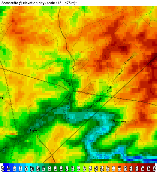
Below is the Elevation map of Sombreffe, which displays elevation range with different colors. Scale of the first map is from 115 to 175 m (377 to 574 ft) with average elevation of 150.5 meters (=494 ft) [note 1]
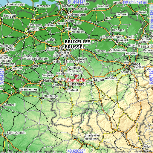
These maps also provides idea of topography and contour of this city, they are displayed at different zoom levels. More info about maps, scale and edge coordinates you can find below images.
| \ | Map #1 | Map #2 | Topo.Map |
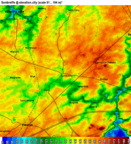
| Scale [m] | 115..175 m | 91..184 m | × |
| Scale [ft] | 377..574 ft | 299..604 ft | × |
| Average | 150.5 m = 494 ft | 148 m = 486 ft | × |
| Width | 6.21 km = 3.9 mi | 12.42 km = 7.7 mi | 198.8 km = 123.5 mi |
| Height | 6.21 km = 3.9 mi | 12.42 km = 7.7 mi | 198.8 km = 123.5 mi |
| ↑Max Latitude | 50.556577° | 50.584488° | 51.41414° |
| Latitude at center | 50.52865° | 50.52865° | 50.52865° |
| ↓Min Latitude | 50.500706° | 50.472746° | 49.62622° |
| ← Min Longitude | 4.556925° | 4.512979° | 3.19462° |
| Longitude center | 4.60087° | 4.60087° | 4.60087° |
| →Max Longitude | 4.644815° | 4.688761° | 6.00712° |
Nearby cities:
Cities around Sombreffe sort by population:
• Châtelet elevation 118 m
14.8 km,  200°
200°
• Fleurus 158 m
6.2 km,  215°
215°
• Gembloux 158 m
7.8 km,  62°
62°
• Genappe 112 m
14 km,  311°
311°
• Farciennes 128 m
11.7 km, 200°
• Aiseau 117 m
13.1 km,  184°
184°
• Villers-la-Ville 137 m
7.3 km, 305°
• Court-Saint-Étienne 85 m
11.9 km,  348°
348°
• Brunehault 147 m
12.2 km,  257°
257°
• Mont-Saint-Guibert 85 m
11.8 km,  3°
3°
• Chastre-Villeroux-Blanmont 133 m
9.3 km,  18°
18°
• Walhain-Saint-Paul 147 m
12.9 km,  32°
32°
Multilingual:
 En español:
Sombreffe elevación 146 m.
 En France:
Sombreffe élévation 146 m.
 Auf Deutsch:
Sombreffe höhe über dem Meeresspiegel ist 146 m.

Sources and notes:
- [note 1] Map square and city borders are not equal. Map elevation data is calculated only from area inside that square.
- [src 1] Elevation data from geonames database provided with same terms of usage.
- [src 2] The elevation map of Sombreffe is generated using elevation data from NASA's 3 arcsec (90m) resolution SRTM data.
- [src 3] Base (background) map © OpenStreetMap contributors tiles are generated by Geofabrik and OpenTopoMap.
Copyright & License:
This Sombreffe Elevation Map is licensed under CC BY-SA. You may reuse any part from this page, if you give a proper credit by linking to this URL:
 More info on terms of use page.