Potoci elevation
Potoci (Federation of B&H), Bosnia and Herzegovina elevation is 91 meters and Potoci elevation in feet is 299 ft above sea level [src 1]. Potoci is a populated locality (feature code) with elevation that is 272 meters (892 ft) smaller than average city elevation in Bosnia and Herzegovina.
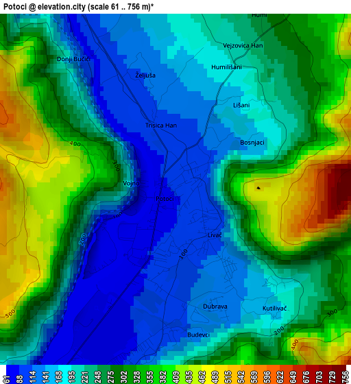
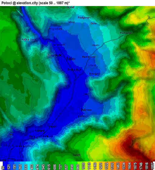
Below is the Elevation map of Potoci, which displays elevation range with different colors. Scale of the first map is from 61 to 756 m (200 to 2480 ft) with average elevation of 250.4 meters (=822 ft) [note 1]
These maps also provides idea of topography and contour of this city, they are displayed at different zoom levels. More info about maps, scale and edge coordinates you can find below images.
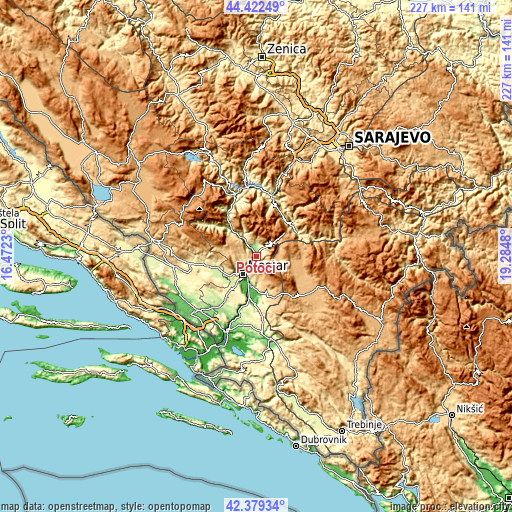
| \ | Map #1 | Map #2 | Topo.Map |
| Scale [m] | 61..756 m | 50..1887 m | × |
| Scale [ft] | 200..2480 ft | 164..6191 ft | × |
| Average | 250.4 m = 822 ft | 571.8 m = 1876 ft | × |
| Width | 7.1 km = 4.4 mi | 14.2 km = 8.8 mi | 227.2 km = 141.2 mi |
| Height | 7.1 km = 4.4 mi | 14.2 km = 8.8 mi | 227.2 km = 141.2 mi |
| ↑Max Latitude | 43.441446° | 43.473345° | 44.42249° |
| Latitude at center | 43.40953° | 43.40953° | 43.40953° |
| ↓Min Latitude | 43.377597° | 43.345647° | 42.37934° |
| ← Min Longitude | 17.834605° | 17.790659° | 16.4723° |
| Longitude center | 17.87855° | 17.87855° | 17.87855° |
| →Max Longitude | 17.922495° | 17.966441° | 19.2848° |
Nearby cities:
Cities around Potoci sort by population:
• Mostar elevation 66 m
9.3 km,  217°
217°
• Konjic 286 m
27.7 km,  13°
13°
• Široki Brijeg 281 m
23.2 km,  262°
262°
• Nevesinje 891 m
25.3 km,  131°
131°
• Jablanica 199 m
29.4 km,  341°
341°
• Čitluk 225 m
24.7 km, 215°
• Rodoč 57 m
12.2 km,  210°
210°
• Blagaj 62 m
16.8 km,  177°
177°
• Cim 142 m
10 km,  232°
232°
• Ilići 98 m
11.2 km, 232°
• Bijela 446 m
22.9 km, 14°
• Polje-Bijela 339 m
26 km,  16°
16°
Multilingual:
 En español:
Potoci elevación 91 m.
 En France:
Potoci élévation 91 m.


Sources and notes:
- [note 1] Map square and city borders are not equal. Map elevation data is calculated only from area inside that square.
- [src 1] Elevation data from geonames database provided with same terms of usage.
- [src 2] The elevation map of Potoci is generated using elevation data from NASA's 3 arcsec (90m) resolution SRTM data.
- [src 3] Base (background) map © OpenStreetMap contributors tiles are generated by Geofabrik and OpenTopoMap.
Copyright & License:
This Potoci Elevation Map is licensed under CC BY-SA. You may reuse any part from this page, if you give a proper credit by linking to this URL:
 More info on terms of use page.