Tešanj elevation
Tešanj (Federation of B&H), Bosnia and Herzegovina elevation is 232 meters and Tešanj elevation in feet is 761 ft above sea level [src 1]. Tešanj is a seat of a third-order administrative division (feature code) with elevation that is 131 meters (430 ft) smaller than average city elevation in Bosnia and Herzegovina.
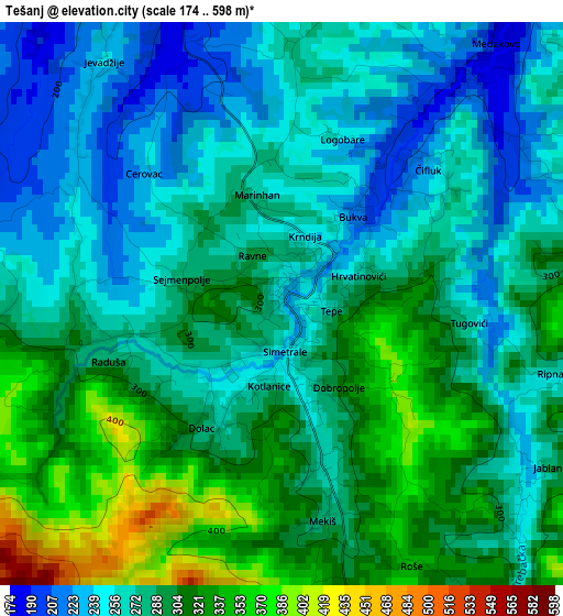
Below is the Elevation map of Tešanj, which displays elevation range with different colors. Scale of the first map is from 174 to 598 m (571 to 1962 ft) with average elevation of 283.4 meters (=930 ft) [note 1]
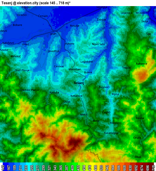
These maps also provides idea of topography and contour of this city, they are displayed at different zoom levels. More info about maps, scale and edge coordinates you can find below images.
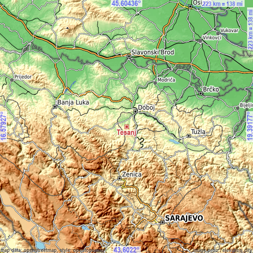
| \ | Map #1 | Map #2 | Topo.Map |
| Scale [m] | 174..598 m | 145..718 m | × |
| Scale [ft] | 571..1962 ft | 476..2356 ft | × |
| Average | 283.4 m = 930 ft | 323.8 m = 1062 ft | × |
| Width | 6.96 km = 4.3 mi | 13.91 km = 8.6 mi | 222.6 km = 138.3 mi |
| Height | 6.96 km = 4.3 mi | 13.91 km = 8.6 mi | 222.6 km = 138.3 mi |
| ↑Max Latitude | 44.643185° | 44.674444° | 45.60436° |
| Latitude at center | 44.61191° | 44.61191° | 44.61191° |
| ↓Min Latitude | 44.580618° | 44.549309° | 43.6022° |
| ← Min Longitude | 17.941575° | 17.897629° | 16.57927° |
| Longitude center | 17.98552° | 17.98552° | 17.98552° |
| →Max Longitude | 18.029465° | 18.073411° | 19.39177° |
Nearby cities:
Cities around Tešanj sort by population:
• Doboj elevation 144 m
15.6 km,  31°
31°
• Maglaj 177 m
11.5 km,  128°
128°
• Teslić 202 m
10 km,  266°
266°
• Blatnica 324 m
19 km,  222°
222°
• Tešanjka 157 m
7 km,  16°
16°
• Jelah 184 m
5.1 km,  335°
335°
• Novi Šeher 237 m
11.7 km,  164°
164°
• Karadaglije 276 m
5.2 km,  150°
150°
• Stanari 230 m
19.4 km,  319°
319°
• Liješnica 281 m
14.9 km, 151°
• Omanjska 223 m
9.9 km,  347°
347°
• Matuzići 248 m
9.8 km, 30°
Multilingual:
 En español:
Tešanj elevación 232 m.
 En France:
Tešanj élévation 232 m.


Sources and notes:
- [note 1] Map square and city borders are not equal. Map elevation data is calculated only from area inside that square.
- [src 1] Elevation data from geonames database provided with same terms of usage.
- [src 2] The elevation map of Tešanj is generated using elevation data from NASA's 3 arcsec (90m) resolution SRTM data.
- [src 3] Base (background) map © OpenStreetMap contributors tiles are generated by Geofabrik and OpenTopoMap.
Copyright & License:
This Tešanj Elevation Map is licensed under CC BY-SA. You may reuse any part from this page, if you give a proper credit by linking to this URL:
 More info on terms of use page.