Hectorville elevation
Hectorville (South Australia, Campbelltown), Australia elevation is 71 meters and Hectorville elevation in feet is 233 ft above sea level [src 1]. Hectorville is a section of populated place (feature code) with elevation that is 42 meters (138 ft) smaller than average city elevation in Australia.
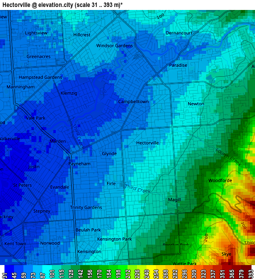
Below is the Elevation map of Hectorville, which displays elevation range with different colors. Scale of the first map is from 31 to 393 m (102 to 1289 ft) with average elevation of 96.6 meters (=317 ft) [note 1]
These maps also provides idea of topography and contour of this city, they are displayed at different zoom levels. More info about maps, scale and edge coordinates you can find below images.
| \ | Map #1 | Map #2 | Topo.Map |
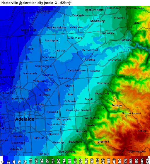
| Scale [m] | 31..393 m | -3..629 m | × |
| Scale [ft] | 102..1289 ft | -10..2064 ft | × |
| Average | 96.6 m = 317 ft | 157.8 m = 518 ft | × |
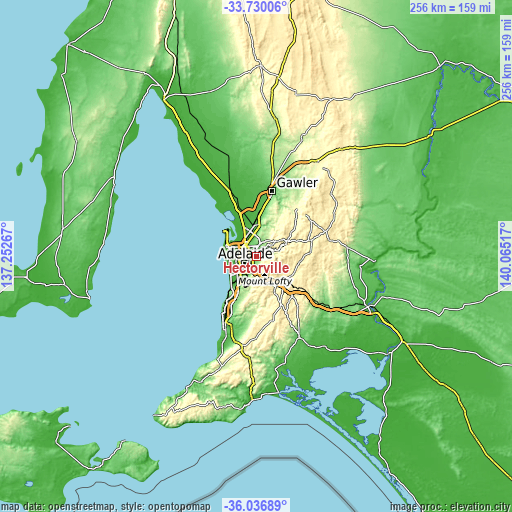
| Width | 8.02 km = 5 mi | 16.03 km = 10 mi | 256.5 km = 159.4 mi |
| Height | 8.02 km = 5 mi | 16.03 km = 10 mi | 256.5 km = 159.4 mi |
| ↑Max Latitude | -34.855517° | -34.819447° | -33.73006° |
| Latitude at center | -34.89157° | -34.89157° | -34.89157° |
| ↓Min Latitude | -34.927608° | -34.963629° | -36.03689° |
| ← Min Longitude | 138.614975° | 138.571029° | 137.25267° |
| Longitude center | 138.65892° | 138.65892° | 138.65892° |
| →Max Longitude | 138.702865° | 138.746811° | 140.06517° |
Nearby cities:
Cities around Hectorville sort by population:
• Magill elevation 120 m
2.4 km,  143°
143°
• Campbelltown 75 m
1.2 km,  37°
37°
• Paradise 72 m
2.2 km,  24°
24°
• Newton 96 m
2.4 km,  63°
63°
• Tranmere 97 m
1.6 km,  169°
169°
• Marden 57 m
2 km,  256°
256°
• Felixstow 52 m
1.1 km,  284°
284°
• Payneham 60 m
1.8 km,  249°
249°
• Glynde 70 m
0.8 km,  229°
229°
• Payneham South 65 m
2 km,  221°
221°
• St Morris 81 m
2.2 km,  192°
192°
• Firle 77 m
1.5 km,  199°
199°
Multilingual:
 En español:
Hectorville elevación 71 m.
 En France:
Hectorville élévation 71 m.
 Auf Deutsch:
Hectorville höhe über dem Meeresspiegel ist 71 m.

Sources and notes:
- [note 1] Map square and city borders are not equal. Map elevation data is calculated only from area inside that square.
- [src 1] Elevation data from geonames database provided with same terms of usage.
- [src 2] The elevation map of Hectorville is generated using elevation data from NASA's 3 arcsec (90m) resolution SRTM data.
- [src 3] Base (background) map © OpenStreetMap contributors tiles are generated by Geofabrik and OpenTopoMap.
Copyright & License:
This Hectorville Elevation Map is licensed under CC BY-SA. You may reuse any part from this page, if you give a proper credit by linking to this URL:
 More info on terms of use page.