Spence elevation
Spence (ACT), Australia elevation is 640 meters and Spence elevation in feet is 2100 ft above sea level [src 1]. Spence is a section of populated place (feature code) with elevation that is 527 meters (1729 ft) bigger than average city elevation in Australia.
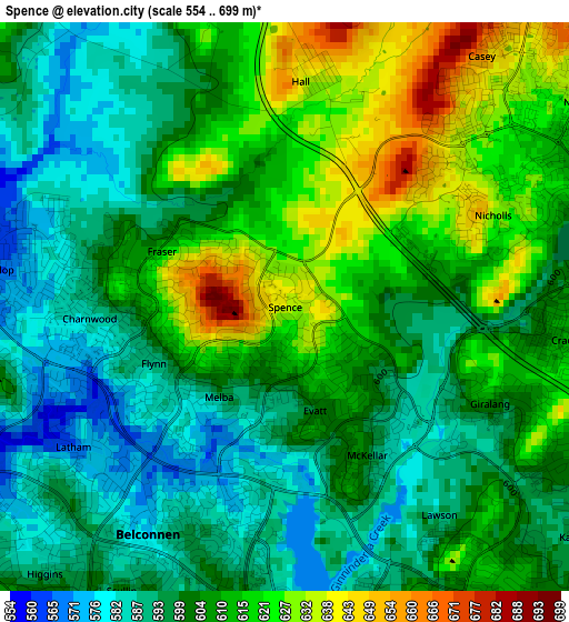
Below is the Elevation map of Spence, which displays elevation range with different colors. Scale of the first map is from 554 to 699 m (1818 to 2293 ft) with average elevation of 605.5 meters (=1987 ft) [note 1]
These maps also provides idea of topography and contour of this city, they are displayed at different zoom levels. More info about maps, scale and edge coordinates you can find below images.
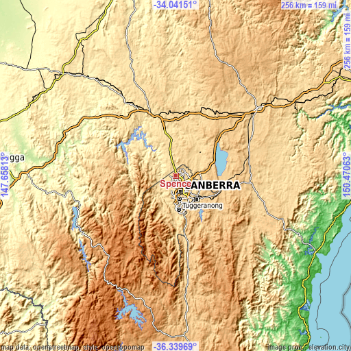
| \ | Map #1 | Topo.Map |
| Scale [m] | 554..699 m | × |
| Scale [ft] | 1818..2293 ft | × |
| Average | 605.5 m = 1987 ft | × |
| Width | 7.99 km = 5 mi | 255.5 km = 158.8 mi |
| Height | 7.99 km = 5 mi | 255.5 km = 158.8 mi |
| ↑Max Latitude | -35.162812° | -34.04151° |
| Latitude at center | -35.19873° | -35.19873° |
| ↓Min Latitude | -35.234632° | -36.33969° |
| ← Min Longitude | 149.020435° | 147.65813° |
| Longitude center | 149.06438° | 149.06438° |
| →Max Longitude | 149.108325° | 150.47063° |
Nearby cities:
Cities around Spence sort by population:
• Dunlop elevation 567 m
4.1 km,  277°
277°
• Nicholls 626 m
3.2 km,  66°
66°
• Evatt 600 m
1.5 km,  164°
164°
• Florey 592 m
3.3 km,  203°
203°
• Crace 610 m
3.9 km,  96°
96°
• Latham 567 m
3.6 km,  236°
236°
• Flynn 588 m
2 km,  246°
246°
• Giralang 604 m
3.2 km,  115°
115°
• Melba 594 m
1.6 km,  216°
216°
• Charnwood 584 m
2.8 km,  266°
266°
• McKellar 599 m
2.4 km,  151°
151°
• Fraser 612 m
1.9 km,  294°
294°
Multilingual:
 En español:
Spence elevación 640 m.
 En France:
Spence élévation 640 m.


Sources and notes:
- [note 1] Map square and city borders are not equal. Map elevation data is calculated only from area inside that square.
- [src 1] Elevation data from geonames database provided with same terms of usage.
- [src 2] The elevation map of Spence is generated using elevation data from NASA's 3 arcsec (90m) resolution SRTM data.
- [src 3] Base (background) map © OpenStreetMap contributors tiles are generated by Geofabrik and OpenTopoMap.
Copyright & License:
This Spence Elevation Map is licensed under CC BY-SA. You may reuse any part from this page, if you give a proper credit by linking to this URL:
 More info on terms of use page.