Nicholls elevation
Nicholls (ACT), Australia elevation is 626 meters and Nicholls elevation in feet is 2054 ft above sea level [src 1]. Nicholls is a section of populated place (feature code) with elevation that is 513 meters (1683 ft) bigger than average city elevation in Australia.
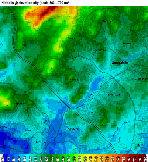
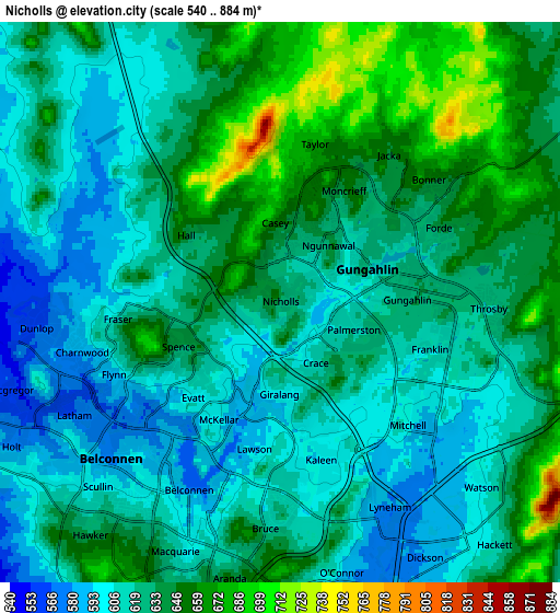
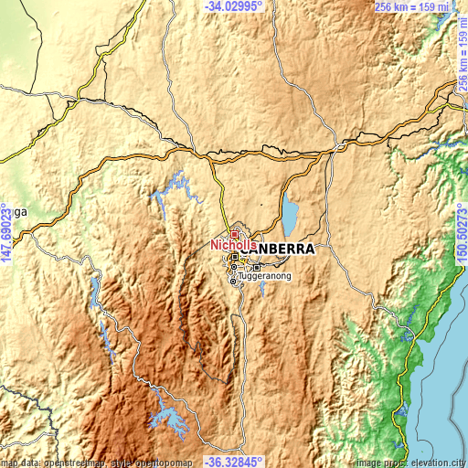
Below is the Elevation map of Nicholls, which displays elevation range with different colors. Scale of the first map is from 563 to 792 m (1847 to 2598 ft) with average elevation of 626 meters (=2054 ft) [note 1]
These maps also provides idea of topography and contour of this city, they are displayed at different zoom levels. More info about maps, scale and edge coordinates you can find below images.
| \ | Map #1 | Map #2 | Topo.Map |
| Scale [m] | 563..792 m | 540..884 m | × |
| Scale [ft] | 1847..2598 ft | 1772..2900 ft | × |
| Average | 626 m = 2054 ft | 628 m = 2060 ft | × |
| Width | 7.99 km = 5 mi | 15.97 km = 9.9 mi | 255.6 km = 158.8 mi |
| Height | 7.99 km = 5 mi | 15.97 km = 9.9 mi | 255.6 km = 158.8 mi |
| ↑Max Latitude | -35.151407° | -35.115468° | -34.02995° |
| Latitude at center | -35.18733° | -35.18733° | -35.18733° |
| ↓Min Latitude | -35.223237° | -35.259129° | -36.32845° |
| ← Min Longitude | 149.052535° | 149.008589° | 147.69023° |
| Longitude center | 149.09648° | 149.09648° | 149.09648° |
| →Max Longitude | 149.140425° | 149.184371° | 150.50273° |
Nearby cities:
Cities around Nicholls sort by population:
• Ngunnawal elevation 637 m
2.1 km,  40°
40°
• Kaleen 599 m
3.5 km,  167°
167°
• Franklin 611 m
4.5 km,  107°
107°
• Gungahlin 627 m
3.6 km,  88°
88°
• Casey 656 m
2.3 km,  355°
355°
• Amaroo 625 m
3.5 km,  55°
55°
• Palmerston 617 m
2.2 km, 110°
• Evatt 600 m
3.7 km,  222°
222°
• Crace 610 m
2 km,  150°
150°
• Giralang 604 m
2.6 km,  180°
180°
• McKellar 599 m
3.8 km,  207°
207°
• Spence 640 m
3.2 km,  246°
246°
Multilingual:
 En español:
Nicholls elevación 626 m.
 En France:
Nicholls élévation 626 m.
 Auf Deutsch:
Nicholls höhe über dem Meeresspiegel ist 626 m.

Sources and notes:
- [note 1] Map square and city borders are not equal. Map elevation data is calculated only from area inside that square.
- [src 1] Elevation data from geonames database provided with same terms of usage.
- [src 2] The elevation map of Nicholls is generated using elevation data from NASA's 3 arcsec (90m) resolution SRTM data.
- [src 3] Base (background) map © OpenStreetMap contributors tiles are generated by Geofabrik and OpenTopoMap.
Copyright & License:
This Nicholls Elevation Map is licensed under CC BY-SA. You may reuse any part from this page, if you give a proper credit by linking to this URL:
 More info on terms of use page.