Dunlop elevation
Dunlop (ACT), Australia elevation is 567 meters and Dunlop elevation in feet is 1860 ft above sea level [src 1]. Dunlop is a section of populated place (feature code) with elevation that is 454 meters (1490 ft) bigger than average city elevation in Australia.
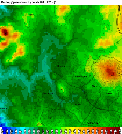
Below is the Elevation map of Dunlop, which displays elevation range with different colors. Scale of the first map is from 484 to 725 m (1588 to 2379 ft) with average elevation of 583.6 meters (=1915 ft) [note 1]
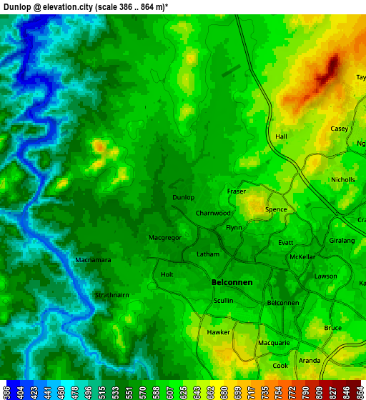
These maps also provides idea of topography and contour of this city, they are displayed at different zoom levels. More info about maps, scale and edge coordinates you can find below images.
| \ | Map #1 | Map #2 | Topo.Map |
| Scale [m] | 484..725 m | 386..864 m | × |
| Scale [ft] | 1588..2379 ft | 1266..2835 ft | × |
| Average | 583.6 m = 1915 ft | 579 m = 1900 ft | × |
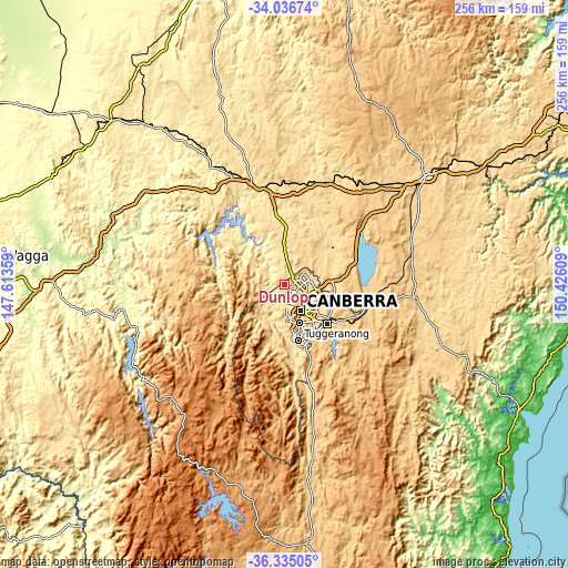
| Width | 7.99 km = 5 mi | 15.97 km = 9.9 mi | 255.5 km = 158.8 mi |
| Height | 7.99 km = 5 mi | 15.97 km = 9.9 mi | 255.5 km = 158.8 mi |
| ↑Max Latitude | -35.1581° | -35.122164° | -34.03674° |
| Latitude at center | -35.19402° | -35.19402° | -35.19402° |
| ↓Min Latitude | -35.229924° | -35.265813° | -36.33505° |
| ← Min Longitude | 148.975895° | 148.931949° | 147.61359° |
| Longitude center | 149.01984° | 149.01984° | 149.01984° |
| →Max Longitude | 149.063785° | 149.107731° | 150.42609° |
Nearby cities:
Cities around Dunlop sort by population:
• Macgregor elevation 558 m
1.9 km,  204°
204°
• Evatt 600 m
4.9 km,  114°
114°
• Florey 592 m
4.5 km,  142°
142°
• Holt 576 m
3.5 km,  192°
192°
• Latham 567 m
2.7 km,  157°
157°
• Flynn 588 m
2.6 km,  121°
121°
• Melba 594 m
3.6 km, 120°
• Higgins 593 m
4.3 km,  171°
171°
• Charnwood 584 m
1.5 km, 117°
• Scullin 608 m
4.8 km, 158°
• Spence 640 m
4.1 km,  97°
97°
• Fraser 612 m
2.3 km,  83°
83°
Multilingual:
 En español:
Dunlop elevación 567 m.
 En France:
Dunlop élévation 567 m.


Sources and notes:
- [note 1] Map square and city borders are not equal. Map elevation data is calculated only from area inside that square.
- [src 1] Elevation data from geonames database provided with same terms of usage.
- [src 2] The elevation map of Dunlop is generated using elevation data from NASA's 3 arcsec (90m) resolution SRTM data.
- [src 3] Base (background) map © OpenStreetMap contributors tiles are generated by Geofabrik and OpenTopoMap.
Copyright & License:
This Dunlop Elevation Map is licensed under CC BY-SA. You may reuse any part from this page, if you give a proper credit by linking to this URL:
 More info on terms of use page.