Boorowa elevation
Boorowa (New South Wales, Hilltops), Australia elevation is 487 meters and Boorowa elevation in feet is 1598 ft above sea level [src 1]. Boorowa is a populated place (feature code) with elevation that is 374 meters (1227 ft) bigger than average city elevation in Australia.
Below is the Elevation map of Boorowa, which displays elevation range with different colors. Scale of the first map is from 458 to 653 m (1503 to 2142 ft) with average elevation of 509.4 meters (=1671 ft) [note 1]
These maps also provides idea of topography and contour of this city, they are displayed at different zoom levels. More info about maps, scale and edge coordinates you can find below images.
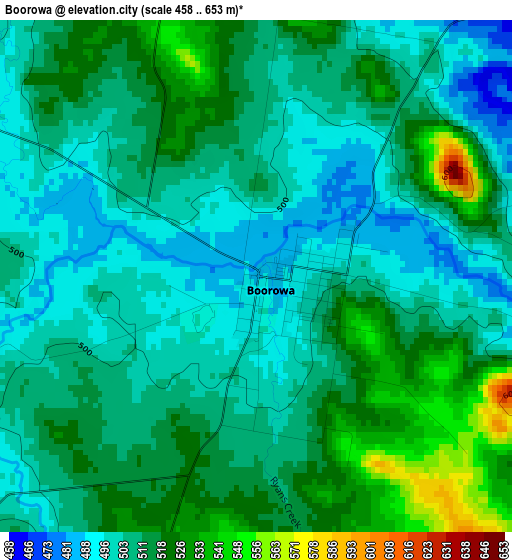
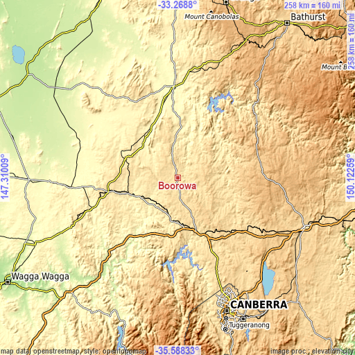
| \ | Map #1 | Topo.Map |
| Scale [m] | 458..653 m | × |
| Scale [ft] | 1503..2142 ft | × |
| Average | 509.4 m = 1671 ft | × |
| Width | 8.06 km = 5 mi | 257.9 km = 160.3 mi |
| Height | 8.06 km = 5 mi | 257.9 km = 160.3 mi |
| ↑Max Latitude | -34.400358° | -33.2688° |
| Latitude at center | -34.43661° | -34.43661° |
| ↓Min Latitude | -34.472846° | -35.58833° |
| ← Min Longitude | 148.672395° | 147.31009° |
| Longitude center | 148.71634° | 148.71634° |
| →Max Longitude | 148.760285° | 150.12259° |
Nearby cities:
Cities around Boorowa sort by population:
• Young elevation 438 m
40.5 km,  289°
289°
• Cowra 302 m
66.9 km,  358°
358°
• Dunlop 567 m
88.7 km,  161°
161°
• Bonner 630 m
89.4 km,  154°
154°
• Cootamundra 332 m
67 km,  250°
250°
• Yass 486 m
48.3 km, 158°
• Casey 656 m
88.3 km, 156°
• Murrumbateman 573 m
66.1 km, 154°
• Crookwell 896 m
69.3 km,  92°
92°
• Grenfell 389 m
78.7 km,  319°
319°
• Fraser 612 m
89.2 km, 160°
• Gundaroo 578 m
82.3 km,  143°
143°
Multilingual:
 En español:
Boorowa elevación 487 m.
 En France:
Boorowa élévation 487 m.


Sources and notes:
- [note 1] Map square and city borders are not equal. Map elevation data is calculated only from area inside that square.
- [src 1] Elevation data from geonames database provided with same terms of usage.
- [src 2] The elevation map of Boorowa is generated using elevation data from NASA's 3 arcsec (90m) resolution SRTM data.
- [src 3] Base (background) map © OpenStreetMap contributors tiles are generated by Geofabrik and OpenTopoMap.
Copyright & License:
This Boorowa Elevation Map is licensed under CC BY-SA. You may reuse any part from this page, if you give a proper credit by linking to this URL:
 More info on terms of use page.