Eberau elevation
Eberau (Burgenland, Politischer Bezirk Güssing), Austria elevation is 215 meters and Eberau elevation in feet is 705 ft above sea level [src 1]. Eberau is a seat of a third-order administrative division (feature code) with elevation that is 294 meters (965 ft) smaller than average city elevation in Austria.
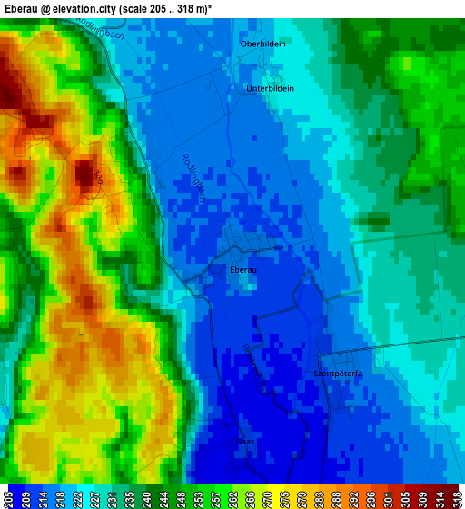
Below is the Elevation map of Eberau, which displays elevation range with different colors. Scale of the first map is from 205 to 318 m (673 to 1043 ft) with average elevation of 237.5 meters (=779 ft) [note 1]
These maps also provides idea of topography and contour of this city, they are displayed at different zoom levels. More info about maps, scale and edge coordinates you can find below images.
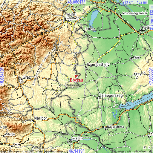
| \ | Map #1 | Topo.Map |
| Scale [m] | 205..318 m | × |
| Scale [ft] | 673..1043 ft | × |
| Average | 237.5 m = 779 ft | × |
| Width | 6.65 km = 4.1 mi | 212.8 km = 132.2 mi |
| Height | 6.65 km = 4.1 mi | 212.8 km = 132.2 mi |
| ↑Max Latitude | 47.137542° | 48.05617° |
| Latitude at center | 47.10764° | 47.10764° |
| ↓Min Latitude | 47.077721° | 46.1419° |
| ← Min Longitude | 16.416495° | 15.05419° |
| Longitude center | 16.46044° | 16.46044° |
| →Max Longitude | 16.504385° | 17.86669° |
Nearby cities:
Cities around Eberau sort by population:
• Güssing elevation 232 m
11.6 km,  242°
242°
• Kohfidisch 256 m
10.8 km,  313°
313°
• Güttenbach 284 m
13.9 km,  293°
293°
• Sankt Michael im Burgenland 252 m
14.5 km,  279°
279°
• Strem 209 m
7.8 km,  206°
206°
• Mischendorf 271 m
14.5 km, 310°
• Hannersdorf 255 m
14.7 km,  336°
336°
• Moschendorf 206 m
5.6 km,  166°
166°
• Badersdorf 261 m
12.5 km,  325°
325°
• Tobaj 233 m
12.4 km,  257°
257°
• Heiligenbrunn 211 m
9.5 km,  200°
200°
• Kleinmürbisch 249 m
13.2 km,  231°
231°
Multilingual:
 En español:
Eberau elevación 215 m.
 En France:
Eberau élévation 215 m.


Sources and notes:
- [note 1] Map square and city borders are not equal. Map elevation data is calculated only from area inside that square.
- [src 1] Elevation data from geonames database provided with same terms of usage.
- [src 2] The elevation map of Eberau is generated using elevation data from NASA's 3 arcsec (90m) resolution SRTM data.
- [src 3] Base (background) map © OpenStreetMap contributors tiles are generated by Geofabrik and OpenTopoMap.
Copyright & License:
This Eberau Elevation Map is licensed under CC BY-SA. You may reuse any part from this page, if you give a proper credit by linking to this URL:
 More info on terms of use page.