Floing elevation
Floing (Styria, Politischer Bezirk Weiz), Austria elevation is 698 meters and Floing elevation in feet is 2290 ft above sea level [src 1]. Floing is a seat of a third-order administrative division (feature code) with elevation that is 189 meters (620 ft) bigger than average city elevation in Austria.
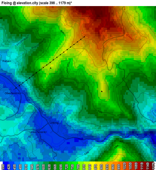
Below is the Elevation map of Floing, which displays elevation range with different colors. Scale of the first map is from 398 to 1179 m (1306 to 3868 ft) with average elevation of 679.9 meters (=2231 ft) [note 1]
These maps also provides idea of topography and contour of this city, they are displayed at different zoom levels. More info about maps, scale and edge coordinates you can find below images.
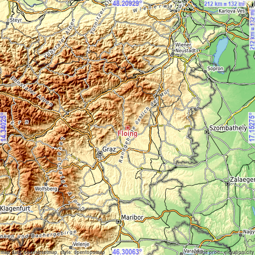
| \ | Map #1 | Topo.Map |
| Scale [m] | 398..1179 m | × |
| Scale [ft] | 1306..3868 ft | × |
| Average | 679.9 m = 2231 ft | × |
| Width | 6.63 km = 4.1 mi | 212.2 km = 131.9 mi |
| Height | 6.63 km = 4.1 mi | 212.2 km = 131.9 mi |
| ↑Max Latitude | 47.293374° | 48.20929° |
| Latitude at center | 47.26356° | 47.26356° |
| ↓Min Latitude | 47.233729° | 46.30063° |
| ← Min Longitude | 15.702555° | 14.34025° |
| Longitude center | 15.7465° | 15.7465° |
| →Max Longitude | 15.790445° | 17.15275° |
Nearby cities:
Cities around Floing sort by population:
• Pöllau elevation 422 m
7.7 km,  58°
58°
• Birkfeld 676 m
10.7 km,  333°
333°
• Baierdorf-Umgebung 675 m
3.6 km,  311°
311°
• Anger 473 m
4.3 km,  285°
285°
• Stubenberg 444 m
4.6 km,  117°
117°
• Hirnsdorf 362 m
10.1 km,  142°
142°
• Reichendorf 458 m
8.3 km,  172°
172°
• Puch bei Weiz 406 m
5.7 km,  203°
203°
• Sankt Johann bei Herberstein 425 m
8.1 km,  150°
150°
• Kaibing 351 m
9.6 km, 137°
• Siegersdorf bei Herberstein 412 m
7.6 km,  158°
158°
• Pöllauberg 625 m
9.8 km,  52°
52°
Multilingual:
 En español:
Floing elevación 698 m.
 En France:
Floing élévation 698 m.


Sources and notes:
- [note 1] Map square and city borders are not equal. Map elevation data is calculated only from area inside that square.
- [src 1] Elevation data from geonames database provided with same terms of usage.
- [src 2] The elevation map of Floing is generated using elevation data from NASA's 3 arcsec (90m) resolution SRTM data.
- [src 3] Base (background) map © OpenStreetMap contributors tiles are generated by Geofabrik and OpenTopoMap.
Copyright & License:
This Floing Elevation Map is licensed under CC BY-SA. You may reuse any part from this page, if you give a proper credit by linking to this URL:
 More info on terms of use page.