Gablitz elevation
Gablitz (Lower Austria, Politischer Bezirk Sankt Pölten), Austria elevation is 272 meters and Gablitz elevation in feet is 892 ft above sea level [src 1]. Gablitz is a seat of a third-order administrative division (feature code) with elevation that is 237 meters (778 ft) smaller than average city elevation in Austria.
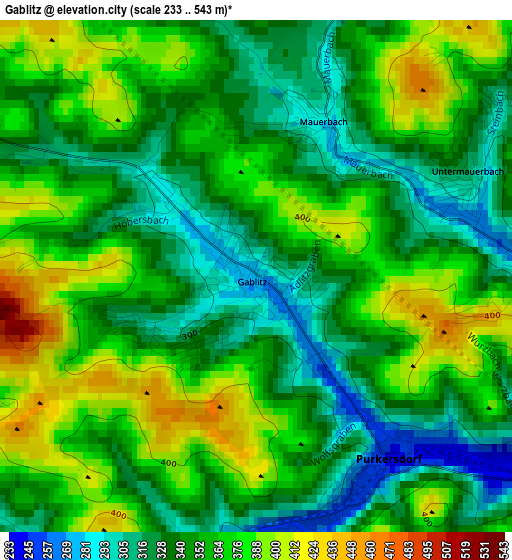
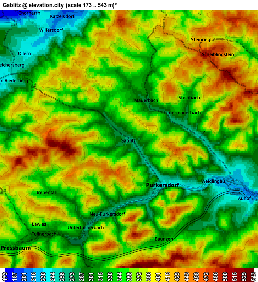
Below is the Elevation map of Gablitz, which displays elevation range with different colors. Scale of the first map is from 233 to 543 m (764 to 1781 ft) with average elevation of 353.3 meters (=1159 ft) [note 1]
These maps also provides idea of topography and contour of this city, they are displayed at different zoom levels. More info about maps, scale and edge coordinates you can find below images.
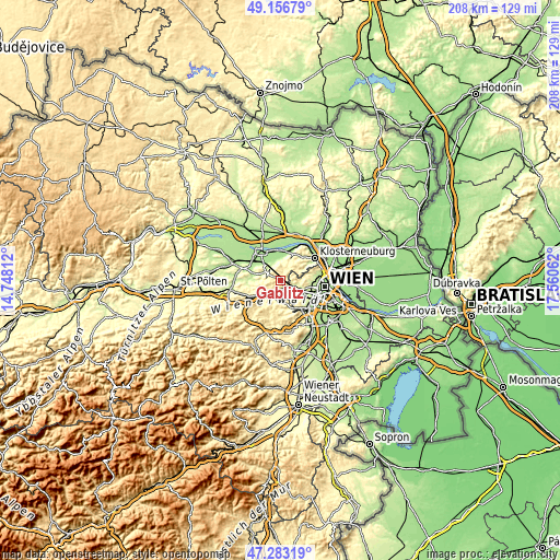
| \ | Map #1 | Map #2 | Topo.Map |
| Scale [m] | 233..543 m | 173..543 m | × |
| Scale [ft] | 764..1781 ft | 568..1781 ft | × |
| Average | 353.3 m = 1159 ft | 359.3 m = 1179 ft | × |
| Width | 6.51 km = 4 mi | 13.02 km = 8.1 mi | 208.3 km = 129.4 mi |
| Height | 6.51 km = 4 mi | 13.02 km = 8.1 mi | 208.3 km = 129.4 mi |
| ↑Max Latitude | 48.257826° | 48.287076° | 49.15679° |
| Latitude at center | 48.22856° | 48.22856° | 48.22856° |
| ↓Min Latitude | 48.199277° | 48.169977° | 47.28319° |
| ← Min Longitude | 16.110425° | 16.066479° | 14.74812° |
| Longitude center | 16.15437° | 16.15437° | 16.15437° |
| →Max Longitude | 16.198315° | 16.242261° | 17.56062° |
Nearby cities:
Cities around Gablitz sort by population:
• Ottakring elevation 247 m
10.9 km,  96°
96°
• Hernals 339 m
8.3 km,  86°
86°
• Purkersdorf 250 m
2.8 km,  146°
146°
• Pressbaum 317 m
7.3 km,  226°
226°
• Breitenfurt bei Wien 339 m
10.6 km,  181°
181°
• Mauerbach 281 m
2.1 km,  28°
28°
• Königstetten 176 m
8.2 km,  355°
355°
• Wolfsgraben 323 m
8.2 km,  197°
197°
• Tullnerbach-Lawies 371 m
6.4 km, 226°
• Laab im Walde 314 m
8.3 km,  170°
170°
• Katzelsdorf 204 m
7.1 km,  331°
331°
• Tulbing 183 m
7.6 km,  341°
341°
Multilingual:
 En español:
Gablitz elevación 272 m.
 En France:
Gablitz élévation 272 m.


Sources and notes:
- [note 1] Map square and city borders are not equal. Map elevation data is calculated only from area inside that square.
- [src 1] Elevation data from geonames database provided with same terms of usage.
- [src 2] The elevation map of Gablitz is generated using elevation data from NASA's 3 arcsec (90m) resolution SRTM data.
- [src 3] Base (background) map © OpenStreetMap contributors tiles are generated by Geofabrik and OpenTopoMap.
Copyright & License:
This Gablitz Elevation Map is licensed under CC BY-SA. You may reuse any part from this page, if you give a proper credit by linking to this URL:
 More info on terms of use page.