Ottakring elevation
Ottakring (Vienna, Wien Stadt), Austria elevation is 247 meters and Ottakring elevation in feet is 810 ft above sea level [src 1]. Ottakring is a section of populated place (feature code) with elevation that is 262 meters (860 ft) smaller than average city elevation in Austria.
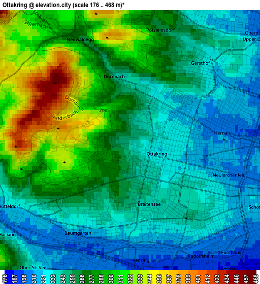
Below is the Elevation map of Ottakring, which displays elevation range with different colors. Scale of the first map is from 176 to 468 m (577 to 1535 ft) with average elevation of 262.3 meters (=861 ft) [note 1]
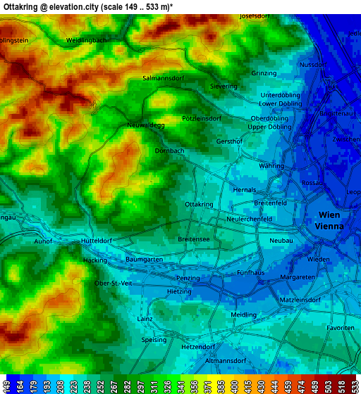
These maps also provides idea of topography and contour of this city, they are displayed at different zoom levels. More info about maps, scale and edge coordinates you can find below images.
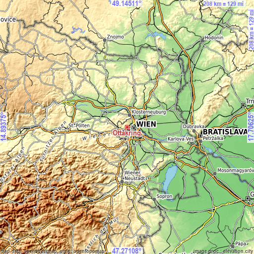
| \ | Map #1 | Map #2 | Topo.Map |
| Scale [m] | 176..468 m | 149..533 m | × |
| Scale [ft] | 577..1535 ft | 489..1749 ft | × |
| Average | 262.3 m = 861 ft | 273 m = 896 ft | × |
| Width | 6.51 km = 4 mi | 13.02 km = 8.1 mi | 208.4 km = 129.5 mi |
| Height | 6.51 km = 4 mi | 13.02 km = 8.1 mi | 208.4 km = 129.5 mi |
| ↑Max Latitude | 48.245943° | 48.275199° | 49.14511° |
| Latitude at center | 48.21667° | 48.21667° | 48.21667° |
| ↓Min Latitude | 48.18738° | 48.158074° | 47.27108° |
| ← Min Longitude | 16.256055° | 16.212109° | 14.89375° |
| Longitude center | 16.3° | 16.3° | 16.3° |
| →Max Longitude | 16.343945° | 16.387891° | 17.70625° |
Nearby cities:
Cities around Ottakring sort by population:
• Vienna elevation 193 m
5.4 km,  99°
99°
• Favoriten 236 m
8.7 km,  135°
135°
• Floridsdorf 159 m
8.3 km,  63°
63°
• Meidling 212 m
6.1 km,  156°
156°
• Hernals 339 m
3.1 km,  306°
306°
• Hietzing 201 m
3.4 km,  184°
184°
• Innere Stadt 190 m
5.4 km, 99°
• Klosterneuburg 192 m
10 km,  10°
10°
• Purkersdorf 250 m
9.3 km,  263°
263°
• Mauerbach 281 m
10.3 km,  287°
287°
• Kierling 212 m
10.5 km,  350°
350°
• Weidling 198 m
8.3 km,  4°
4°
Multilingual:
 En español:
Ottakring elevación 247 m.
 En France:
Ottakring élévation 247 m.
 Auf Deutsch:
Ottakring höhe über dem Meeresspiegel ist 247 m.

Sources and notes:
- [note 1] Map square and city borders are not equal. Map elevation data is calculated only from area inside that square.
- [src 1] Elevation data from geonames database provided with same terms of usage.
- [src 2] The elevation map of Ottakring is generated using elevation data from NASA's 3 arcsec (90m) resolution SRTM data.
- [src 3] Base (background) map © OpenStreetMap contributors tiles are generated by Geofabrik and OpenTopoMap.
Copyright & License:
This Ottakring Elevation Map is licensed under CC BY-SA. You may reuse any part from this page, if you give a proper credit by linking to this URL:
 More info on terms of use page.