Las Lomitas elevation
Las Lomitas (Formosa, Departamento de Patiño), Argentina elevation is 134 meters and Las Lomitas elevation in feet is 440 ft above sea level [src 1]. Las Lomitas is a populated place (feature code) with elevation that is 216 meters (709 ft) smaller than average city elevation in Argentina.
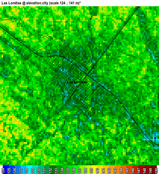
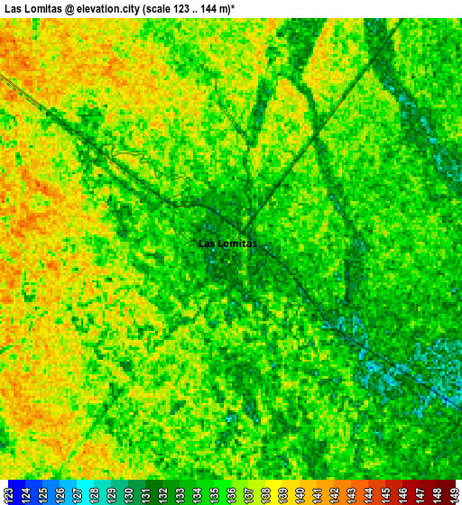
Below is the Elevation map of Las Lomitas, which displays elevation range with different colors. Scale of the first map is from 124 to 141 m (407 to 463 ft) with average elevation of 134.4 meters (=441 ft) [note 1]
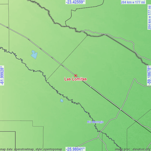
These maps also provides idea of topography and contour of this city, they are displayed at different zoom levels. More info about maps, scale and edge coordinates you can find below images.
| \ | Map #1 | Map #2 | Topo.Map |
| Scale [m] | 124..141 m | 123..144 m | × |
| Scale [ft] | 407..463 ft | 404..472 ft | × |
| Average | 134.4 m = 441 ft | 135.3 m = 444 ft | × |
| Width | 8.88 km = 5.5 mi | 17.76 km = 11 mi | 284.1 km = 176.5 mi |
| Height | 8.88 km = 5.5 mi | 17.76 km = 11 mi | 284.1 km = 176.5 mi |
| ↑Max Latitude | -24.669622° | -24.629681° | -23.42559° |
| Latitude at center | -24.70955° | -24.70955° | -24.70955° |
| ↓Min Latitude | -24.749465° | -24.789368° | -25.98041° |
| ← Min Longitude | -60.636975° | -60.680921° | -61.99928° |
| Longitude center | -60.59303° | -60.59303° | -60.59303° |
| →Max Longitude | -60.549085° | -60.505139° | -59.18678° |
Nearby cities:
Cities around Las Lomitas sort by population:
• Castelli elevation 113 m
137.6 km,  181°
181°
• Tres Isletas 102 m
182.1 km,  174°
174°
• Pirané 86 m
187.7 km,  127°
127°
• Pampa del Indio 96 m
162.9 km,  156°
156°
• Ingeniero Guillermo N. Juárez 185 m
156 km,  305°
305°
• Ibarreta 107 m
92.9 km, 127°
• Comandante Fontana 103 m
115.1 km, 127°
• Palo Santo 90 m
158 km, 126°
• Estanislao del Campo 115 m
63.5 km, 127°
• Villa General Guemes 109 m
111.6 km,  92°
92°
• Pozo del Tigre 127 m
34.3 km, 127°
• Laguna Yema 162 m
83.2 km, 307°
Multilingual:
 En español:
Las Lomitas elevación 134 m.
 En France:
Las Lomitas élévation 134 m.
 Auf Deutsch:
Las Lomitas höhe über dem Meeresspiegel ist 134 m.

Sources and notes:
- [note 1] Map square and city borders are not equal. Map elevation data is calculated only from area inside that square.
- [src 1] Elevation data from geonames database provided with same terms of usage.
- [src 2] The elevation map of Las Lomitas is generated using elevation data from NASA's 3 arcsec (90m) resolution SRTM data.
- [src 3] Base (background) map © OpenStreetMap contributors tiles are generated by Geofabrik and OpenTopoMap.
Copyright & License:
This Las Lomitas Elevation Map is licensed under CC BY-SA. You may reuse any part from this page, if you give a proper credit by linking to this URL:
 More info on terms of use page.