Santa Magdalena elevation
Santa Magdalena (Cordoba, Departamento de General Roca), Argentina elevation is 158 meters and Santa Magdalena elevation in feet is 518 ft above sea level [src 1]. Santa Magdalena is a populated place (feature code) with elevation that is 192 meters (630 ft) smaller than average city elevation in Argentina.
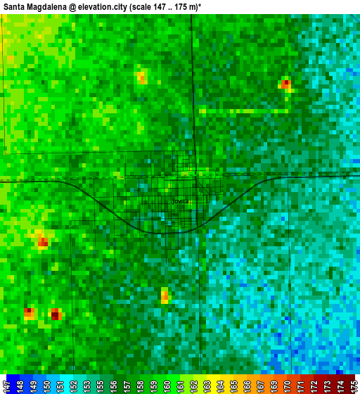
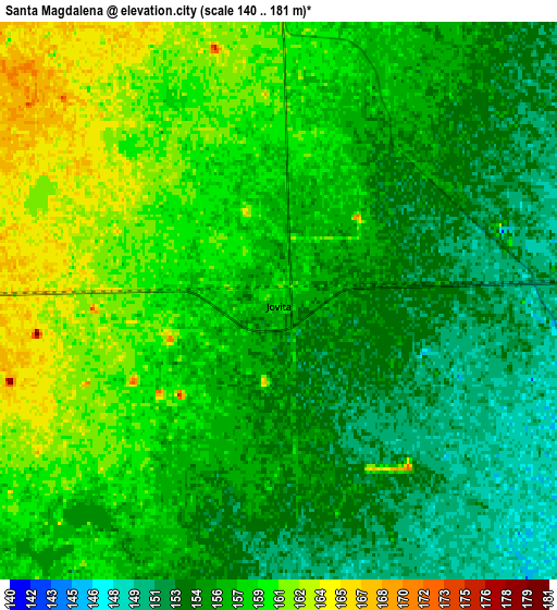
Below is the Elevation map of Santa Magdalena, which displays elevation range with different colors. Scale of the first map is from 147 to 175 m (482 to 574 ft) with average elevation of 156.5 meters (=513 ft) [note 1]
These maps also provides idea of topography and contour of this city, they are displayed at different zoom levels. More info about maps, scale and edge coordinates you can find below images.
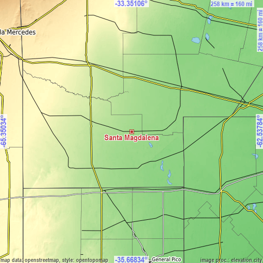
| \ | Map #1 | Map #2 | Topo.Map |
| Scale [m] | 147..175 m | 140..181 m | × |
| Scale [ft] | 482..574 ft | 459..594 ft | × |
| Average | 156.5 m = 513 ft | 156.7 m = 514 ft | × |
| Width | 8.05 km = 5 mi | 16.1 km = 10 mi | 257.7 km = 160.1 mi |
| Height | 8.05 km = 5 mi | 16.1 km = 10 mi | 257.7 km = 160.1 mi |
| ↑Max Latitude | -34.481543° | -34.445311° | -33.35106° |
| Latitude at center | -34.51776° | -34.51776° | -34.51776° |
| ↓Min Latitude | -34.553961° | -34.590146° | -35.66834° |
| ← Min Longitude | -63.988035° | -64.031981° | -65.35034° |
| Longitude center | -63.94409° | -63.94409° | -63.94409° |
| →Max Longitude | -63.900145° | -63.856199° | -62.53784° |
Nearby cities:
Cities around Santa Magdalena sort by population:
• Laboulaye elevation 143 m
66.9 km,  49°
49°
• Vicuña Mackenna 243 m
78.2 km,  328°
328°
• Huinca Renancó 186 m
53.3 km,  227°
227°
• Realicó 167 m
63.9 km,  205°
205°
• General Levalle 180 m
56 km,  1°
1°
• Villa Huidobro 219 m
68.7 km,  238°
238°
• Del Campillo 228 m
52.9 km,  287°
287°
• Serrano 147 m
37.6 km,  81°
81°
• Buchardo 133 m
45.9 km,  119°
119°
• Mattaldi 181 m
21.3 km,  280°
280°
• Bernardo Larroudé 127 m
65.3 km,  149°
149°
• Italó 144 m
33.9 km, 154°
Multilingual:
 En español:
Santa Magdalena elevación 158 m.
 En France:
Santa Magdalena élévation 158 m.
 Auf Deutsch:
Santa Magdalena höhe über dem Meeresspiegel ist 158 m.

Sources and notes:
- [note 1] Map square and city borders are not equal. Map elevation data is calculated only from area inside that square.
- [src 1] Elevation data from geonames database provided with same terms of usage.
- [src 2] The elevation map of Santa Magdalena is generated using elevation data from NASA's 3 arcsec (90m) resolution SRTM data.
- [src 3] Base (background) map © OpenStreetMap contributors tiles are generated by Geofabrik and OpenTopoMap.
Copyright & License:
This Santa Magdalena Elevation Map is licensed under CC BY-SA. You may reuse any part from this page, if you give a proper credit by linking to this URL:
 More info on terms of use page.