La Escondida elevation
La Escondida (Chaco, Departamento de General Donovan), Argentina elevation is 67 meters and La Escondida elevation in feet is 220 ft above sea level [src 1]. La Escondida is a populated place (feature code) with elevation that is 283 meters (928 ft) smaller than average city elevation in Argentina.
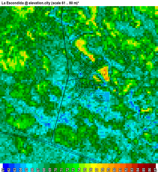
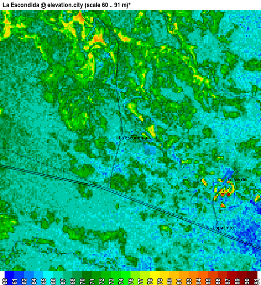
Below is the Elevation map of La Escondida, which displays elevation range with different colors. Scale of the first map is from 61 to 80 m (200 to 262 ft) with average elevation of 68.6 meters (=225 ft) [note 1]
These maps also provides idea of topography and contour of this city, they are displayed at different zoom levels. More info about maps, scale and edge coordinates you can find below images.
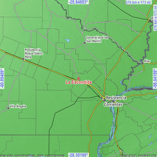
| \ | Map #1 | Map #2 | Topo.Map |
| Scale [m] | 61..80 m | 60..91 m | × |
| Scale [ft] | 200..262 ft | 197..299 ft | × |
| Average | 68.6 m = 225 ft | 68.4 m = 224 ft | × |
| Width | 8.7 km = 5.4 mi | 17.4 km = 10.8 mi | 278.4 km = 173 mi |
| Height | 8.7 km = 5.4 mi | 17.4 km = 10.8 mi | 278.4 km = 173 mi |
| ↑Max Latitude | -27.068115° | -27.028976° | -25.84853° |
| Latitude at center | -27.10724° | -27.10724° | -27.10724° |
| ↓Min Latitude | -27.146351° | -27.185449° | -28.35195° |
| ← Min Longitude | -59.491785° | -59.535731° | -60.85409° |
| Longitude center | -59.44784° | -59.44784° | -59.44784° |
| →Max Longitude | -59.403895° | -59.359949° | -58.04159° |
Nearby cities:
Cities around La Escondida sort by population:
• Fontana elevation 54 m
54.3 km,  129°
129°
• Presidencia de la Plaza 76 m
40.8 km,  286°
286°
• Puerto Tirol 54 m
46.6 km, 129°
• Margarita Belén 58 m
50.1 km,  110°
110°
• Makallé 67 m
19.4 km,  124°
124°
• Colonia Elisa 72 m
20.9 km,  340°
340°
• Colonias Unidas 83 m
49 km, 338°
• La Eduvigis 70 m
48.7 km,  51°
51°
• La Verde 67 m
7.7 km, 106°
• Capitán Solari 80 m
35.7 km, 341°
• Coté-Lai 65 m
46.2 km,  198°
198°
• Lapachito 66 m
8.5 km, 133°
Multilingual:
 En español:
La Escondida elevación 67 m.
 En France:
La Escondida élévation 67 m.
 Auf Deutsch:
La Escondida höhe über dem Meeresspiegel ist 67 m.

Sources and notes:
- [note 1] Map square and city borders are not equal. Map elevation data is calculated only from area inside that square.
- [src 1] Elevation data from geonames database provided with same terms of usage.
- [src 2] The elevation map of La Escondida is generated using elevation data from NASA's 3 arcsec (90m) resolution SRTM data.
- [src 3] Base (background) map © OpenStreetMap contributors tiles are generated by Geofabrik and OpenTopoMap.
Copyright & License:
This La Escondida Elevation Map is licensed under CC BY-SA. You may reuse any part from this page, if you give a proper credit by linking to this URL:
 More info on terms of use page.