La Eduvigis elevation
La Eduvigis (Chaco, Departamento de Libertador General San Martín), Argentina elevation is 70 meters and La Eduvigis elevation in feet is 230 ft above sea level [src 1]. La Eduvigis is a populated place (feature code) with elevation that is 280 meters (919 ft) smaller than average city elevation in Argentina.
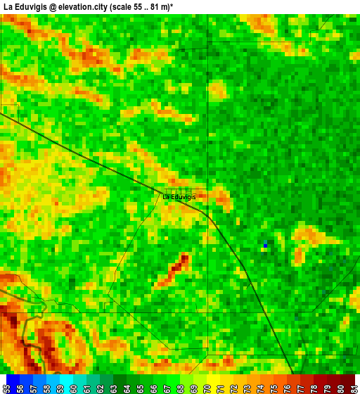
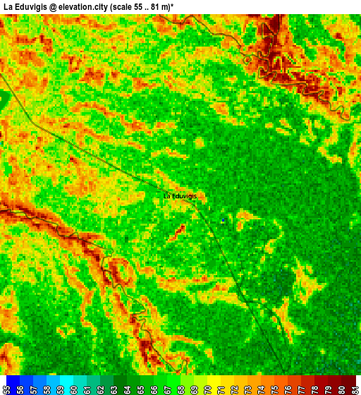
Below is the Elevation map of La Eduvigis, which displays elevation range with different colors. Scale of the first map is from 55 to 81 m (180 to 266 ft) with average elevation of 67.3 meters (=221 ft) [note 1]
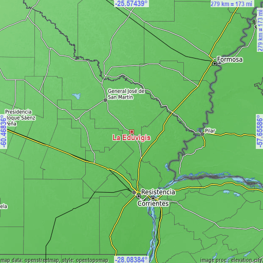
These maps also provides idea of topography and contour of this city, they are displayed at different zoom levels. More info about maps, scale and edge coordinates you can find below images.
| \ | Map #1 | Map #2 | Topo.Map |
| Scale [m] | 55..81 m | 55..81 m | × |
| Scale [ft] | 180..266 ft | 180..266 ft | × |
| Average | 67.3 m = 221 ft | 67.9 m = 223 ft | × |
| Width | 8.72 km = 5.4 mi | 17.44 km = 10.8 mi | 279 km = 173.4 mi |
| Height | 8.72 km = 5.4 mi | 17.44 km = 10.8 mi | 279 km = 173.4 mi |
| ↑Max Latitude | -26.796851° | -26.757618° | -25.57439° |
| Latitude at center | -26.83607° | -26.83607° | -26.83607° |
| ↓Min Latitude | -26.875276° | -26.914468° | -28.08384° |
| ← Min Longitude | -59.106055° | -59.150001° | -60.46836° |
| Longitude center | -59.06211° | -59.06211° | -59.06211° |
| →Max Longitude | -59.018165° | -58.974219° | -57.65586° |
Nearby cities:
Cities around La Eduvigis sort by population:
• General José de San Martín elevation 81 m
43.3 km,  320°
320°
• La Leonesa 60 m
42 km,  122°
122°
• Margarita Belén 58 m
48.1 km,  169°
169°
• Makallé 67 m
46.9 km,  208°
208°
• Colonia Elisa 72 m
46.5 km,  256°
256°
• La Escondida 67 m
48.7 km,  231°
231°
• General Vedia 58 m
41.3 km,  105°
105°
• La Verde 67 m
44.7 km,  223°
223°
• Capitán Solari 80 m
49.6 km,  274°
274°
• Pampa Almirón 68 m
16.3 km,  338°
338°
• Lapachito 66 m
48.2 km, 221°
• Villa Escolar 69 m
45.5 km,  58°
58°
Multilingual:
 En español:
La Eduvigis elevación 70 m.
 En France:
La Eduvigis élévation 70 m.
 Auf Deutsch:
La Eduvigis höhe über dem Meeresspiegel ist 70 m.

Sources and notes:
- [note 1] Map square and city borders are not equal. Map elevation data is calculated only from area inside that square.
- [src 1] Elevation data from geonames database provided with same terms of usage.
- [src 2] The elevation map of La Eduvigis is generated using elevation data from NASA's 3 arcsec (90m) resolution SRTM data.
- [src 3] Base (background) map © OpenStreetMap contributors tiles are generated by Geofabrik and OpenTopoMap.
Copyright & License:
This La Eduvigis Elevation Map is licensed under CC BY-SA. You may reuse any part from this page, if you give a proper credit by linking to this URL:
 More info on terms of use page.