Makallé elevation
Makallé (Chaco, Departamento de General Donovan), Argentina elevation is 67 meters and Makallé elevation in feet is 220 ft above sea level [src 1]. Makallé is a seat of a second-order administrative division (feature code) with elevation that is 283 meters (928 ft) smaller than average city elevation in Argentina.
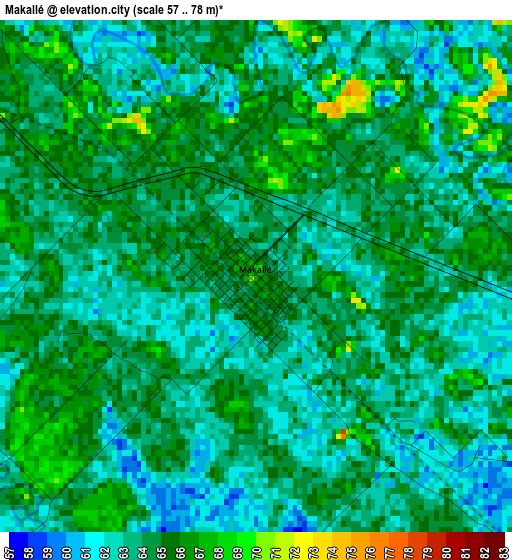
Below is the Elevation map of Makallé, which displays elevation range with different colors. Scale of the first map is from 57 to 78 m (187 to 256 ft) with average elevation of 63.7 meters (=209 ft) [note 1]
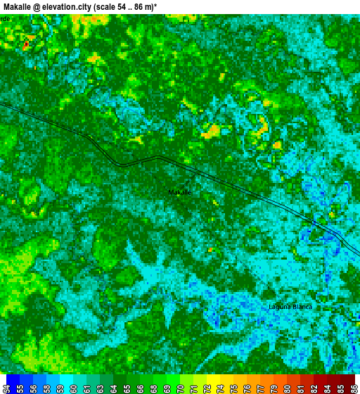
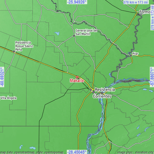
These maps also provides idea of topography and contour of this city, they are displayed at different zoom levels. More info about maps, scale and edge coordinates you can find below images.
| \ | Map #1 | Map #2 | Topo.Map |
| Scale [m] | 57..78 m | 54..86 m | × |
| Scale [ft] | 187..256 ft | 177..282 ft | × |
| Average | 63.7 m = 209 ft | 63.8 m = 209 ft | × |
| Width | 8.69 km = 5.4 mi | 17.38 km = 10.8 mi | 278.1 km = 172.8 mi |
| Height | 8.69 km = 5.4 mi | 17.38 km = 10.8 mi | 278.1 km = 172.8 mi |
| ↑Max Latitude | -27.16778° | -27.128676° | -25.94926° |
| Latitude at center | -27.20687° | -27.20687° | -27.20687° |
| ↓Min Latitude | -27.245946° | -27.285009° | -28.45045° |
| ← Min Longitude | -59.330905° | -59.374851° | -60.69321° |
| Longitude center | -59.28696° | -59.28696° | -59.28696° |
| →Max Longitude | -59.243015° | -59.199069° | -57.88071° |
Nearby cities:
Cities around Makallé sort by population:
• Resistencia elevation 56 m
41.1 km,  133°
133°
• Barranqueras 52 m
45.9 km, 131°
• Fontana 54 m
35 km, 132°
• Puerto Tirol 54 m
27.3 km, 132°
• Margarita Belén 58 m
31.7 km,  101°
101°
• Colonia Elisa 72 m
38.4 km,  323°
323°
• La Escondida 67 m
19.4 km,  304°
304°
• La Eduvigis 70 m
46.9 km,  28°
28°
• Colonia Benítez 54 m
36.4 km,  112°
112°
• La Verde 67 m
12.4 km, 316°
• Coté-Lai 65 m
44.9 km,  223°
223°
• Lapachito 66 m
11.1 km, 298°
Multilingual:
 En español:
Makallé elevación 67 m.
 En France:
Makallé élévation 67 m.


Sources and notes:
- [note 1] Map square and city borders are not equal. Map elevation data is calculated only from area inside that square.
- [src 1] Elevation data from geonames database provided with same terms of usage.
- [src 2] The elevation map of Makallé is generated using elevation data from NASA's 3 arcsec (90m) resolution SRTM data.
- [src 3] Base (background) map © OpenStreetMap contributors tiles are generated by Geofabrik and OpenTopoMap.
Copyright & License:
This Makallé Elevation Map is licensed under CC BY-SA. You may reuse any part from this page, if you give a proper credit by linking to this URL:
 More info on terms of use page.