Colonias Unidas elevation
Colonias Unidas (Chaco, Departamento de Sargento Cabral), Argentina elevation is 83 meters and Colonias Unidas elevation in feet is 272 ft above sea level [src 1]. Colonias Unidas is a populated place (feature code) with elevation that is 267 meters (876 ft) smaller than average city elevation in Argentina.
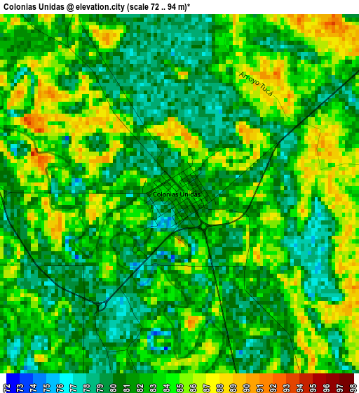
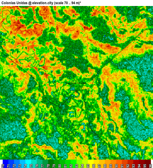
Below is the Elevation map of Colonias Unidas, which displays elevation range with different colors. Scale of the first map is from 72 to 94 m (236 to 308 ft) with average elevation of 82.1 meters (=269 ft) [note 1]
These maps also provides idea of topography and contour of this city, they are displayed at different zoom levels. More info about maps, scale and edge coordinates you can find below images.
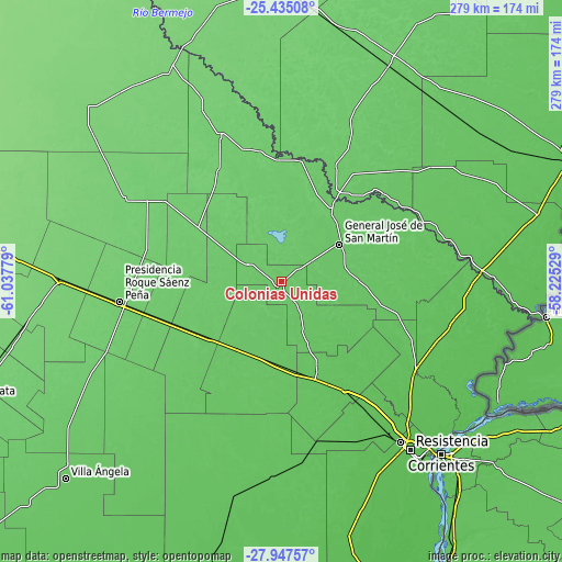
| \ | Map #1 | Map #2 | Topo.Map |
| Scale [m] | 72..94 m | 70..94 m | × |
| Scale [ft] | 236..308 ft | 230..308 ft | × |
| Average | 82.1 m = 269 ft | 81.7 m = 268 ft | × |
| Width | 8.73 km = 5.4 mi | 17.46 km = 10.8 mi | 279.4 km = 173.6 mi |
| Height | 8.73 km = 5.4 mi | 17.46 km = 10.8 mi | 279.4 km = 173.6 mi |
| ↑Max Latitude | -26.658983° | -26.619703° | -25.43508° |
| Latitude at center | -26.69825° | -26.69825° | -26.69825° |
| ↓Min Latitude | -26.737503° | -26.776743° | -27.94757° |
| ← Min Longitude | -59.675485° | -59.719431° | -61.03779° |
| Longitude center | -59.63154° | -59.63154° | -59.63154° |
| →Max Longitude | -59.587595° | -59.543649° | -58.22529° |
Nearby cities:
Cities around Colonias Unidas sort by population:
• General José de San Martín elevation 81 m
33.9 km,  58°
58°
• Machagai 90 m
48.6 km,  238°
238°
• El Colorado 86 m
50.4 km,  30°
30°
• Presidencia de la Plaza 76 m
39.7 km,  211°
211°
• Colonia Elisa 72 m
28.1 km,  156°
156°
• Las Garcitas 86 m
19.1 km,  297°
297°
• La Escondida 67 m
49 km, 158°
• La Verde 67 m
54 km,  151°
151°
• Capitán Solari 80 m
13.5 km, 148°
• Pampa Almirón 68 m
50.5 km,  90°
90°
• Laguna Limpia 86 m
23.1 km,  347°
347°
• Ciervo Petiso 88 m
13.1 km,  0°
0°
Multilingual:
 En español:
Colonias Unidas elevación 83 m.
 En France:
Colonias Unidas élévation 83 m.
 Auf Deutsch:
Colonias Unidas höhe über dem Meeresspiegel ist 83 m.

Sources and notes:
- [note 1] Map square and city borders are not equal. Map elevation data is calculated only from area inside that square.
- [src 1] Elevation data from geonames database provided with same terms of usage.
- [src 2] The elevation map of Colonias Unidas is generated using elevation data from NASA's 3 arcsec (90m) resolution SRTM data.
- [src 3] Base (background) map © OpenStreetMap contributors tiles are generated by Geofabrik and OpenTopoMap.
Copyright & License:
This Colonias Unidas Elevation Map is licensed under CC BY-SA. You may reuse any part from this page, if you give a proper credit by linking to this URL:
 More info on terms of use page.