Machagai elevation
Machagai (Chaco, Veinticinco de Mayo), Argentina elevation is 90 meters and Machagai elevation in feet is 295 ft above sea level [src 1]. Machagai is a seat of a second-order administrative division (feature code) with elevation that is 260 meters (853 ft) smaller than average city elevation in Argentina.
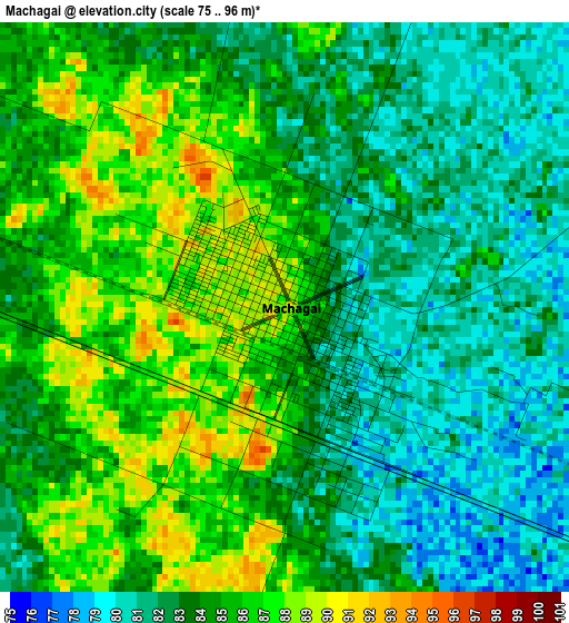
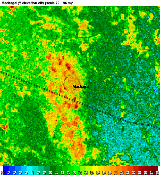
Below is the Elevation map of Machagai, which displays elevation range with different colors. Scale of the first map is from 75 to 96 m (246 to 315 ft) with average elevation of 83.7 meters (=275 ft) [note 1]
These maps also provides idea of topography and contour of this city, they are displayed at different zoom levels. More info about maps, scale and edge coordinates you can find below images.
| \ | Map #1 | Map #2 | Topo.Map |
| Scale [m] | 75..96 m | 72..96 m | × |
| Scale [ft] | 246..315 ft | 236..315 ft | × |
| Average | 83.7 m = 275 ft | 82.4 m = 270 ft | × |
| Width | 8.71 km = 5.4 mi | 17.43 km = 10.8 mi | 278.8 km = 173.2 mi |
| Height | 8.71 km = 5.4 mi | 17.43 km = 10.8 mi | 278.8 km = 173.2 mi |
| ↑Max Latitude | -26.886952° | -26.84775° | -25.66545° |
| Latitude at center | -26.92614° | -26.92614° | -26.92614° |
| ↓Min Latitude | -26.965314° | -27.004475° | -28.1729° |
| ← Min Longitude | -60.093495° | -60.137441° | -61.4558° |
| Longitude center | -60.04955° | -60.04955° | -60.04955° |
| →Max Longitude | -60.005605° | -59.961659° | -58.6433° |
Nearby cities:
Cities around Machagai sort by population:
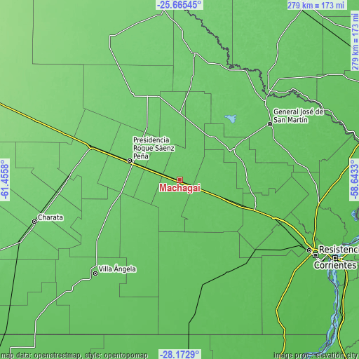
• Presidencia Roque Sáenz Peña elevation 97 m
41.7 km,  292°
292°
• Quitilipi 88 m
17.8 km, 290°
• Presidencia de la Plaza 76 m
22.2 km,  112°
112°
• Villa Berthet 83 m
54.3 km,  221°
221°
• Colonia Elisa 72 m
52.6 km,  90°
90°
• La Tigra 93 m
57 km,  249°
249°
• Las Garcitas 86 m
42.2 km,  35°
35°
• Colonias Unidas 83 m
48.6 km,  58°
58°
• Napenay 97 m
60.2 km, 290°
• Capitán Solari 80 m
50.4 km,  74°
74°
• Laguna Limpia 86 m
60.3 km, 37°
• Ciervo Petiso 88 m
56.6 km,  47°
47°
Multilingual:
 En español:
Machagai elevación 90 m.
 En France:
Machagai élévation 90 m.


Sources and notes:
- [note 1] Map square and city borders are not equal. Map elevation data is calculated only from area inside that square.
- [src 1] Elevation data from geonames database provided with same terms of usage.
- [src 2] The elevation map of Machagai is generated using elevation data from NASA's 3 arcsec (90m) resolution SRTM data.
- [src 3] Base (background) map © OpenStreetMap contributors tiles are generated by Geofabrik and OpenTopoMap.
Copyright & License:
This Machagai Elevation Map is licensed under CC BY-SA. You may reuse any part from this page, if you give a proper credit by linking to this URL:
 More info on terms of use page.