La Tigra elevation
La Tigra (Chaco, Departamento de O’Higgins), Argentina elevation is 93 meters and La Tigra elevation in feet is 305 ft above sea level [src 1]. La Tigra is a populated place (feature code) with elevation that is 257 meters (843 ft) smaller than average city elevation in Argentina.
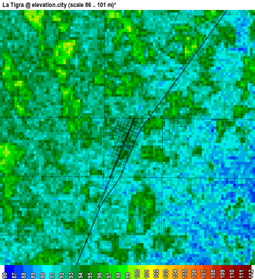
Below is the Elevation map of La Tigra, which displays elevation range with different colors. Scale of the first map is from 86 to 101 m (282 to 331 ft) with average elevation of 92.1 meters (=302 ft) [note 1]
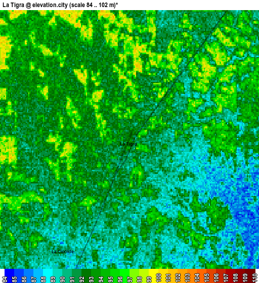
These maps also provides idea of topography and contour of this city, they are displayed at different zoom levels. More info about maps, scale and edge coordinates you can find below images.
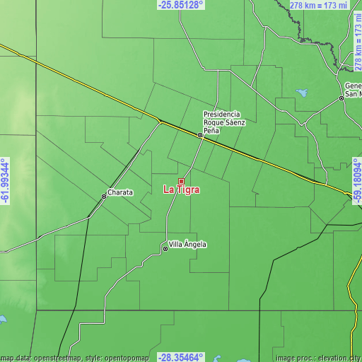
| \ | Map #1 | Map #2 | Topo.Map |
| Scale [m] | 86..101 m | 84..102 m | × |
| Scale [ft] | 282..331 ft | 276..335 ft | × |
| Average | 92.1 m = 302 ft | 92 m = 302 ft | × |
| Width | 8.7 km = 5.4 mi | 17.4 km = 10.8 mi | 278.3 km = 172.9 mi |
| Height | 8.7 km = 5.4 mi | 17.4 km = 10.8 mi | 278.4 km = 173 mi |
| ↑Max Latitude | -27.070836° | -27.031698° | -25.85128° |
| Latitude at center | -27.10996° | -27.10996° | -27.10996° |
| ↓Min Latitude | -27.14907° | -27.188167° | -28.35464° |
| ← Min Longitude | -60.631135° | -60.675081° | -61.99344° |
| Longitude center | -60.58719° | -60.58719° | -60.58719° |
| →Max Longitude | -60.543245° | -60.499299° | -59.18094° |
Nearby cities:
Cities around La Tigra sort by population:
• Presidencia Roque Sáenz Peña elevation 97 m
39 km,  22°
22°
• Villa Ángela 79 m
53.1 km,  193°
193°
• Quitilipi 88 m
45.4 km,  53°
53°
• Las Breñas 104 m
49 km,  272°
272°
• Villa Berthet 83 m
26.6 km,  139°
139°
• San Bernardo 88 m
23.3 km,  212°
212°
• Campo Largo 106 m
42.7 km,  323°
323°
• Corzuela 106 m
41.6 km,  294°
294°
• Aviá Terai 103 m
49.3 km,  343°
343°
• La Clotilde 94 m
8.3 km,  251°
251°
• Napenay 97 m
42 km,  356°
356°
• Samuhú 75 m
49.6 km,  157°
157°
Multilingual:
 En español:
La Tigra elevación 93 m.
 En France:
La Tigra élévation 93 m.


Sources and notes:
- [note 1] Map square and city borders are not equal. Map elevation data is calculated only from area inside that square.
- [src 1] Elevation data from geonames database provided with same terms of usage.
- [src 2] The elevation map of La Tigra is generated using elevation data from NASA's 3 arcsec (90m) resolution SRTM data.
- [src 3] Base (background) map © OpenStreetMap contributors tiles are generated by Geofabrik and OpenTopoMap.
Copyright & License:
This La Tigra Elevation Map is licensed under CC BY-SA. You may reuse any part from this page, if you give a proper credit by linking to this URL:
 More info on terms of use page.