Shenavan elevation
Shenavan (Aragatsotn), Armenia elevation is 1881 meters and Shenavan elevation in feet is 6171 ft above sea level [src 1]. Shenavan is a populated place (feature code) with elevation that is 583 meters (1913 ft) bigger than average city elevation in Armenia.
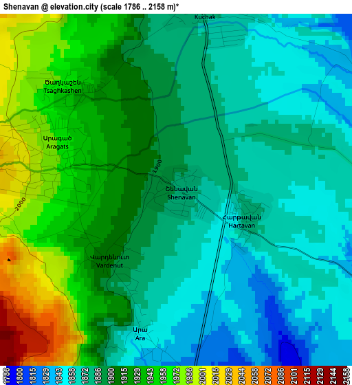
Below is the Elevation map of Shenavan, which displays elevation range with different colors. Scale of the first map is from 1786 to 2158 m (5860 to 7080 ft) with average elevation of 1901.7 meters (=6239 ft) [note 1]
These maps also provides idea of topography and contour of this city, they are displayed at different zoom levels. More info about maps, scale and edge coordinates you can find below images.
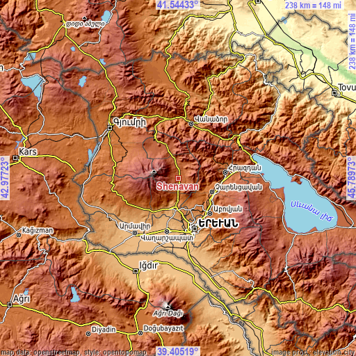
| \ | Map #1 | Topo.Map |
| Scale [m] | 1786..2158 m | × |
| Scale [ft] | 5860..7080 ft | × |
| Average | 1901.7 m = 6239 ft | × |
| Width | 7.43 km = 4.6 mi | 237.9 km = 147.8 mi |
| Height | 7.43 km = 4.6 mi | 237.8 km = 147.8 mi |
| ↑Max Latitude | 40.516696° | 41.54433° |
| Latitude at center | 40.48328° | 40.48328° |
| ↓Min Latitude | 40.449847° | 39.40519° |
| ← Min Longitude | 44.339535° | 42.97723° |
| Longitude center | 44.38348° | 44.38348° |
| →Max Longitude | 44.427425° | 45.78973° |
Nearby cities:
Cities around Shenavan sort by population:
• Yeghvard elevation 1343 m
19.6 km,  153°
153°
• Aparan 1892 m
12.4 km,  350°
350°
• Zovuni 1856 m
5.6 km,  56°
56°
• Kasakh 1857 m
6.4 km,  20°
20°
• Byurakan 1489 m
18.6 km,  210°
210°
• Karbi 1305 m
17 km,  181°
181°
• Aragats 1976 m
2.7 km,  283°
283°
• Arzakan 1483 m
19.4 km,  100°
100°
• Buzhakan 1845 m
11.9 km, 104°
• Nor Yerznka 1193 m
20.4 km, 178°
• Ushi 1394 m
15.1 km, 182°
• Zoravan 1469 m
18.4 km,  140°
140°
Multilingual:
 En español:
Shenavan elevación 1881 m.
 En France:
Shenavan élévation 1881 m.
 Auf Deutsch:
Shenavan höhe über dem Meeresspiegel ist 1881 m.

Sources and notes:
- [note 1] Map square and city borders are not equal. Map elevation data is calculated only from area inside that square.
- [src 1] Elevation data from geonames database provided with same terms of usage.
- [src 2] The elevation map of Shenavan is generated using elevation data from NASA's 3 arcsec (90m) resolution SRTM data.
- [src 3] Base (background) map © OpenStreetMap contributors tiles are generated by Geofabrik and OpenTopoMap.
Copyright & License:
This Shenavan Elevation Map is licensed under CC BY-SA. You may reuse any part from this page, if you give a proper credit by linking to this URL:
 More info on terms of use page.