Velçan elevation
Velçan (Korçë, Rrethi i Pogradecit), Albania elevation is 1023 meters and Velçan elevation in feet is 3356 ft above sea level [src 1]. Velçan is a seat of a third-order administrative division (feature code) with elevation that is 649 meters (2129 ft) bigger than average city elevation in Albania.
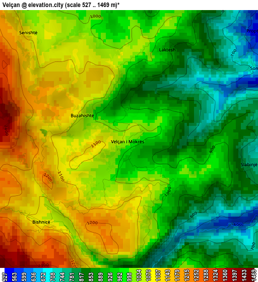
Below is the Elevation map of Velçan, which displays elevation range with different colors. Scale of the first map is from 527 to 1469 m (1729 to 4820 ft) with average elevation of 985.1 meters (=3232 ft) [note 1]
These maps also provides idea of topography and contour of this city, they are displayed at different zoom levels. More info about maps, scale and edge coordinates you can find below images.
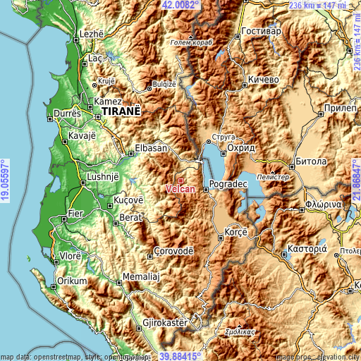
| \ | Map #1 | Topo.Map |
| Scale [m] | 527..1469 m | × |
| Scale [ft] | 1729..4820 ft | × |
| Average | 985.1 m = 3232 ft | × |
| Width | 7.38 km = 4.6 mi | 236.2 km = 146.8 mi |
| Height | 7.38 km = 4.6 mi | 236.2 km = 146.8 mi |
| ↑Max Latitude | 40.9879° | 42.0082° |
| Latitude at center | 40.95472° | 40.95472° |
| ↓Min Latitude | 40.921523° | 39.88415° |
| ← Min Longitude | 20.418275° | 19.05597° |
| Longitude center | 20.46222° | 20.46222° |
| →Max Longitude | 20.506165° | 21.86847° |
Nearby cities:
Cities around Velçan sort by population:
• Pogradec elevation 702 m
17 km,  109°
109°
• Përrenjas-Fshat 586 m
13.9 km,  26°
26°
• Rajcë 694 m
17.9 km, 32°
• Zavalinë 844 m
15.5 km,  280°
280°
• Përrenjas 591 m
15 km, 28°
• Udënisht 743 m
14.9 km,  86°
86°
• Qukës-Skënderbe 556 m
14.5 km,  351°
351°
• Poroçan 770 m
13.8 km,  264°
264°
• Kukur 797 m
12.7 km,  220°
220°
• Trebinjë 898 m
8.9 km,  121°
121°
• Stravaj 729 m
6.5 km,  329°
329°
• Proptisht 600 m
4.9 km,  44°
44°
Multilingual:
 En español:
Velçan elevación 1023 m.
 En France:
Velçan élévation 1023 m.


Sources and notes:
- [note 1] Map square and city borders are not equal. Map elevation data is calculated only from area inside that square.
- [src 1] Elevation data from geonames database provided with same terms of usage.
- [src 2] The elevation map of Velçan is generated using elevation data from NASA's 3 arcsec (90m) resolution SRTM data.
- [src 3] Base (background) map © OpenStreetMap contributors tiles are generated by Geofabrik and OpenTopoMap.
Copyright & License:
This Velçan Elevation Map is licensed under CC BY-SA. You may reuse any part from this page, if you give a proper credit by linking to this URL:
 More info on terms of use page.