Patos Fshat elevation
Patos Fshat (Fier), Albania elevation is 157 meters and Patos Fshat elevation in feet is 515 ft above sea level [src 1]. Patos Fshat is a populated place (feature code) with elevation that is 217 meters (712 ft) smaller than average city elevation in Albania.
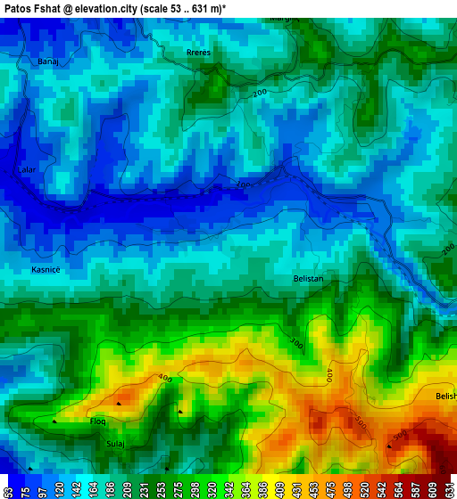
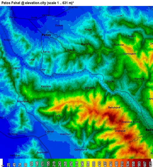
Below is the Elevation map of Patos Fshat, which displays elevation range with different colors. Scale of the first map is from 53 to 631 m (174 to 2070 ft) with average elevation of 216.7 meters (=711 ft) [note 1]
These maps also provides idea of topography and contour of this city, they are displayed at different zoom levels. More info about maps, scale and edge coordinates you can find below images.
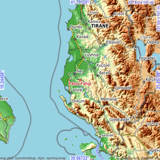
| \ | Map #1 | Map #2 | Topo.Map |
| Scale [m] | 53..631 m | 1..631 m | × |
| Scale [ft] | 174..2070 ft | 3..2070 ft | × |
| Average | 216.7 m = 711 ft | 173.3 m = 569 ft | × |
| Width | 7.42 km = 4.6 mi | 14.83 km = 9.2 mi | 237.3 km = 147.5 mi |
| Height | 7.42 km = 4.6 mi | 14.83 km = 9.2 mi | 237.3 km = 147.5 mi |
| ↑Max Latitude | 40.676117° | 40.709437° | 41.70128° |
| Latitude at center | 40.64278° | 40.64278° | 40.64278° |
| ↓Min Latitude | 40.609427° | 40.576057° | 39.56723° |
| ← Min Longitude | 19.606885° | 19.562939° | 18.24458° |
| Longitude center | 19.65083° | 19.65083° | 19.65083° |
| →Max Longitude | 19.694775° | 19.738721° | 21.05708° |
Nearby cities:
Cities around Patos Fshat sort by population:
• Fier-Çifçi elevation 17 m
10.9 km,  319°
319°
• Patos 61 m
5.2 km,  329°
329°
• Ballsh 206 m
8.6 km,  124°
124°
• Roskovec 18 m
11.4 km,  22°
22°
• Hekal 336 m
11.5 km,  141°
141°
• Kurjan 116 m
11.5 km,  43°
43°
• Kuman 20 m
9.8 km, 17°
• Portëz 58 m
9 km,  314°
314°
• Zharrëz 34 m
7.4 km,  359°
359°
• Drenovë 514 m
6.3 km, 138°
• Ruzhdie 268 m
5.1 km,  52°
52°
• Cakran 86 m
4.9 km,  205°
205°
Multilingual:
 En español:
Patos Fshat elevación 157 m.
 En France:
Patos Fshat élévation 157 m.
 Auf Deutsch:
Patos Fshat höhe über dem Meeresspiegel ist 157 m.

Sources and notes:
- [note 1] Map square and city borders are not equal. Map elevation data is calculated only from area inside that square.
- [src 1] Elevation data from geonames database provided with same terms of usage.
- [src 2] The elevation map of Patos Fshat is generated using elevation data from NASA's 3 arcsec (90m) resolution SRTM data.
- [src 3] Base (background) map © OpenStreetMap contributors tiles are generated by Geofabrik and OpenTopoMap.
Copyright & License:
This Patos Fshat Elevation Map is licensed under CC BY-SA. You may reuse any part from this page, if you give a proper credit by linking to this URL:
 More info on terms of use page.