Patos elevation
Patos (Fier), Albania elevation is 61 meters and Patos elevation in feet is 200 ft above sea level [src 1]. Patos is a seat of a third-order administrative division (feature code) with elevation that is 313 meters (1027 ft) smaller than average city elevation in Albania.
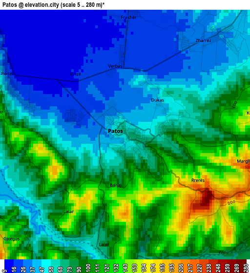
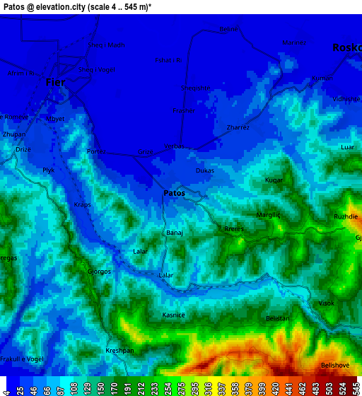
Below is the Elevation map of Patos, which displays elevation range with different colors. Scale of the first map is from 5 to 280 m (16 to 919 ft) with average elevation of 75.1 meters (=246 ft) [note 1]
These maps also provides idea of topography and contour of this city, they are displayed at different zoom levels. More info about maps, scale and edge coordinates you can find below images.
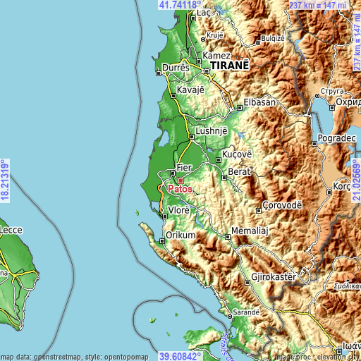
| \ | Map #1 | Map #2 | Topo.Map |
| Scale [m] | 5..280 m | 4..545 m | × |
| Scale [ft] | 16..919 ft | 13..1788 ft | × |
| Average | 75.1 m = 246 ft | 98.3 m = 323 ft | × |
| Width | 7.41 km = 4.6 mi | 14.82 km = 9.2 mi | 237.1 km = 147.3 mi |
| Height | 7.41 km = 4.6 mi | 14.82 km = 9.2 mi | 237.1 km = 147.3 mi |
| ↑Max Latitude | 40.716646° | 40.749946° | 41.74118° |
| Latitude at center | 40.68333° | 40.68333° | 40.68333° |
| ↓Min Latitude | 40.649997° | 40.616647° | 39.60842° |
| ← Min Longitude | 19.575495° | 19.531549° | 18.21319° |
| Longitude center | 19.61944° | 19.61944° | 19.61944° |
| →Max Longitude | 19.663385° | 19.707331° | 21.02569° |
Nearby cities:
Cities around Patos sort by population:
• Fier-Çifçi elevation 17 m
5.8 km,  309°
309°
• Fier 20 m
7 km, 310°
• Patos Fshat 157 m
5.2 km,  149°
149°
• Roskovec 18 m
9.2 km,  49°
49°
• Levan 12 m
11 km,  265°
265°
• Frakulla e Madhe 19 m
10.3 km,  252°
252°
• Cakran 86 m
8.9 km,  176°
176°
• Mbrostar-Urë 33 m
8.5 km,  336°
336°
• Kuman 20 m
7.4 km, 49°
• Ruzhdie 268 m
6.8 km,  101°
101°
• Portëz 58 m
4.2 km,  294°
294°
• Zharrëz 34 m
3.8 km,  41°
41°
Multilingual:
 En español:
Patos elevación 61 m.
 En France:
Patos élévation 61 m.


Sources and notes:
- [note 1] Map square and city borders are not equal. Map elevation data is calculated only from area inside that square.
- [src 1] Elevation data from geonames database provided with same terms of usage.
- [src 2] The elevation map of Patos is generated using elevation data from NASA's 3 arcsec (90m) resolution SRTM data.
- [src 3] Base (background) map © OpenStreetMap contributors tiles are generated by Geofabrik and OpenTopoMap.
Copyright & License:
This Patos Elevation Map is licensed under CC BY-SA. You may reuse any part from this page, if you give a proper credit by linking to this URL:
 More info on terms of use page.