Ballsh elevation
Ballsh (Fier, Rrethi i Mallakastrës), Albania elevation is 206 meters and Ballsh elevation in feet is 676 ft above sea level [src 1]. Ballsh is a seat of a second-order administrative division (feature code) with elevation that is 168 meters (551 ft) smaller than average city elevation in Albania.
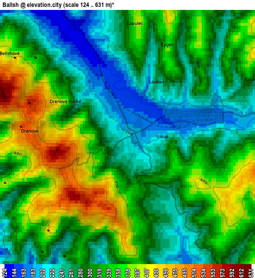
Below is the Elevation map of Ballsh, which displays elevation range with different colors. Scale of the first map is from 124 to 631 m (407 to 2070 ft) with average elevation of 310.9 meters (=1020 ft) [note 1]
These maps also provides idea of topography and contour of this city, they are displayed at different zoom levels. More info about maps, scale and edge coordinates you can find below images.
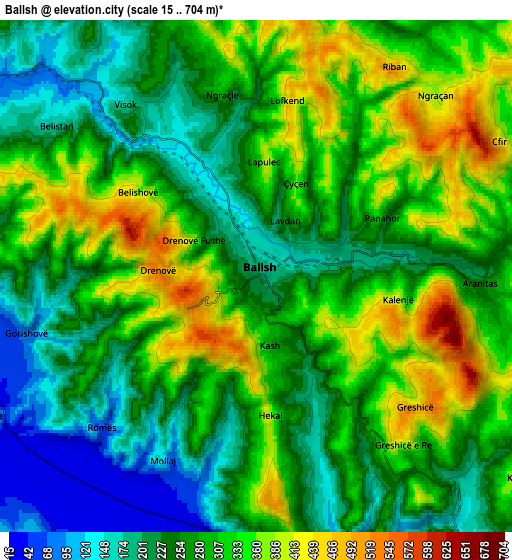
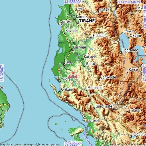
| \ | Map #1 | Map #2 | Topo.Map |
| Scale [m] | 124..631 m | 15..704 m | × |
| Scale [ft] | 407..2070 ft | 49..2310 ft | × |
| Average | 310.9 m = 1020 ft | 281.6 m = 924 ft | × |
| Width | 7.42 km = 4.6 mi | 14.84 km = 9.2 mi | 237.4 km = 147.5 mi |
| Height | 7.42 km = 4.6 mi | 14.84 km = 9.2 mi | 237.4 km = 147.5 mi |
| ↑Max Latitude | 40.632249° | 40.665591° | 41.65809° |
| Latitude at center | 40.59889° | 40.59889° | 40.59889° |
| ↓Min Latitude | 40.565515° | 40.532123° | 39.52264° |
| ← Min Longitude | 19.690775° | 19.646829° | 18.32847° |
| Longitude center | 19.73472° | 19.73472° | 19.73472° |
| →Max Longitude | 19.778665° | 19.822611° | 21.14097° |
Nearby cities:
Cities around Ballsh sort by population:
• Patos Fshat elevation 157 m
8.6 km,  304°
304°
• Selenicë 73 m
11.3 km,  227°
227°
• Sinjë 757 m
12.5 km,  64°
64°
• Selitë 533 m
11.1 km,  120°
120°
• Cakran 86 m
9.2 km,  273°
273°
• Ruzhdie 268 m
8.6 km,  338°
338°
• Ngraçan 428 m
7 km,  43°
43°
• Greshicë 326 m
6.4 km,  144°
144°
• Aranitas 297 m
6.1 km,  94°
94°
• Hekal 336 m
4.1 km,  178°
178°
• Kalenjë 508 m
3.8 km,  105°
105°
• Drenovë 514 m
2.9 km, 273°
Multilingual:
 En español:
Ballsh elevación 206 m.
 En France:
Ballsh élévation 206 m.


Sources and notes:
- [note 1] Map square and city borders are not equal. Map elevation data is calculated only from area inside that square.
- [src 1] Elevation data from geonames database provided with same terms of usage.
- [src 2] The elevation map of Ballsh is generated using elevation data from NASA's 3 arcsec (90m) resolution SRTM data.
- [src 3] Base (background) map © OpenStreetMap contributors tiles are generated by Geofabrik and OpenTopoMap.
Copyright & License:
This Ballsh Elevation Map is licensed under CC BY-SA. You may reuse any part from this page, if you give a proper credit by linking to this URL:
 More info on terms of use page.