Uruzgān elevation
Uruzgān (Oruzgan, Khāş Uruzgān), Afghanistan elevation is 2026 meters and Uruzgān elevation in feet is 6647 ft above sea level [src 1]. Uruzgān is a populated place (feature code) with elevation that is 607 meters (1991 ft) bigger than average city elevation in Afghanistan.
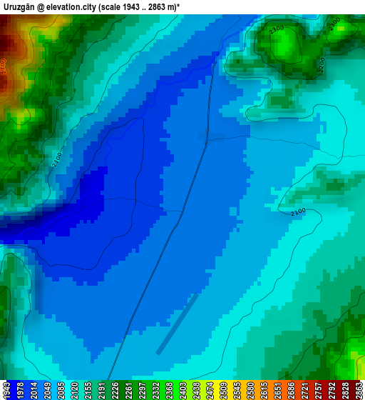
Below is the Elevation map of Uruzgān, which displays elevation range with different colors. Scale of the first map is from 1943 to 2863 m (6375 to 9393 ft) with average elevation of 2111.4 meters (=6927 ft) [note 1]
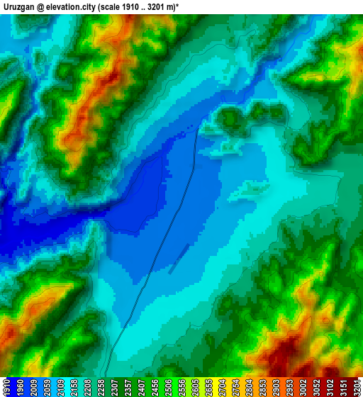
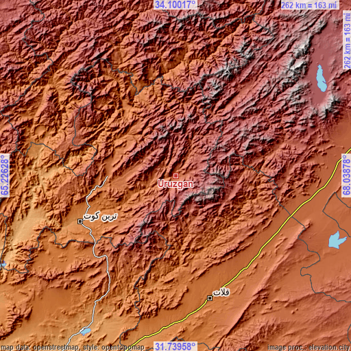
These maps also provides idea of topography and contour of this city, they are displayed at different zoom levels. More info about maps, scale and edge coordinates you can find below images.
| \ | Map #1 | Map #2 | Topo.Map |
| Scale [m] | 1943..2863 m | 1910..3201 m | × |
| Scale [ft] | 6375..9393 ft | 6266..10502 ft | × |
| Average | 2111.4 m = 6927 ft | 2283.2 m = 7491 ft | × |
| Width | 8.2 km = 5.1 mi | 16.41 km = 10.2 mi | 262.5 km = 163.1 mi |
| Height | 8.2 km = 5.1 mi | 16.41 km = 10.2 mi | 262.5 km = 163.1 mi |
| ↑Max Latitude | 32.964628° | 33.001491° | 34.10017° |
| Latitude at center | 32.92775° | 32.92775° | 32.92775° |
| ↓Min Latitude | 32.890857° | 32.853948° | 31.73958° |
| ← Min Longitude | 66.588585° | 66.544639° | 65.22628° |
| Longitude center | 66.63253° | 66.63253° | 66.63253° |
| →Max Longitude | 66.676475° | 66.720421° | 68.03878° |
Nearby cities:
Cities around Uruzgān sort by population:
• Qalāt elevation 1568 m
95 km,  164°
164°
• Tarinkot 1325 m
77.9 km,  244°
244°
• Nīlī 2069 m
99.9 km,  332°
332°
• ‘Alāqahdārī Gēlān 1987 m
96.5 km,  103°
103°
• ‘Alāqahdārī Shāh Jōy 1865 m
85.9 km,  121°
121°
• Mīzān ‘Alāqahdārī 1409 m
84.3 km,  187°
187°
• Sang-e Māshah 2484 m
78.9 km,  72°
72°
• Zamtō Kêlay 1925 m
75 km,  214°
214°
• Chowṉêy 1347 m
60.7 km, 326°
• Sāyagaz 1673 m
55 km,  137°
137°
• Khākirān 2673 m
42.4 km, 103°
• Nāyak 2116 m
41.7 km, 161°
Multilingual:
 En español:
Uruzgān elevación 2026 m.
 En France:
Uruzgān élévation 2026 m.
 Auf Deutsch:
Uruzgān höhe über dem Meeresspiegel ist 2026 m.

Sources and notes:
- [note 1] Map square and city borders are not equal. Map elevation data is calculated only from area inside that square.
- [src 1] Elevation data from geonames database provided with same terms of usage.
- [src 2] The elevation map of Uruzgān is generated using elevation data from NASA's 3 arcsec (90m) resolution SRTM data.
- [src 3] Base (background) map © OpenStreetMap contributors tiles are generated by Geofabrik and OpenTopoMap.
Copyright & License:
This Uruzgān Elevation Map is licensed under CC BY-SA. You may reuse any part from this page, if you give a proper credit by linking to this URL:
 More info on terms of use page.