Tarinkot elevation
Tarinkot (Oruzgan, Tarīn Kōṯ), Afghanistan elevation is 1325 meters and Tarinkot elevation in feet is 4347 ft above sea level [src 1]. Tarinkot is a seat of a first-order administrative division (feature code) with elevation that is 94 meters (308 ft) smaller than average city elevation in Afghanistan.
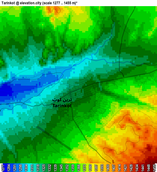
Below is the Elevation map of Tarinkot, which displays elevation range with different colors. Scale of the first map is from 1277 to 1455 m (4190 to 4774 ft) with average elevation of 1346.6 meters (=4418 ft) [note 1]
These maps also provides idea of topography and contour of this city, they are displayed at different zoom levels. More info about maps, scale and edge coordinates you can find below images.
| \ | Map #1 | Map #2 | Topo.Map |
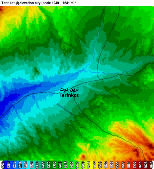
| Scale [m] | 1277..1455 m | 1249..1641 m | × |
| Scale [ft] | 4190..4774 ft | 4098..5384 ft | × |
| Average | 1346.6 m = 4418 ft | 1386 m = 4547 ft | × |
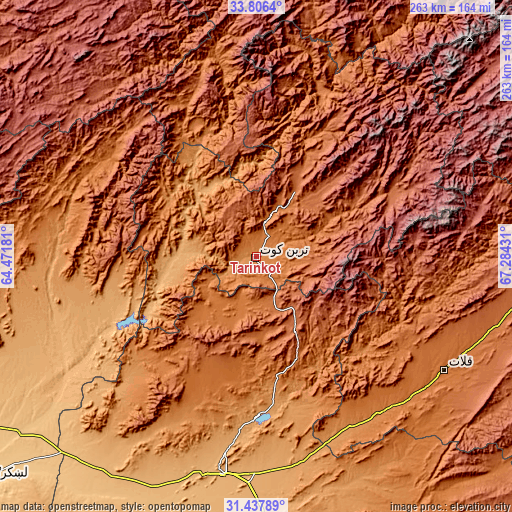
| Width | 8.23 km = 5.1 mi | 16.46 km = 10.2 mi | 263.4 km = 163.7 mi |
| Height | 8.23 km = 5.1 mi | 16.46 km = 10.2 mi | 263.4 km = 163.7 mi |
| ↑Max Latitude | 32.666982° | 32.703968° | 33.8064° |
| Latitude at center | 32.62998° | 32.62998° | 32.62998° |
| ↓Min Latitude | 32.592963° | 32.555931° | 31.43789° |
| ← Min Longitude | 65.834115° | 65.790169° | 64.47181° |
| Longitude center | 65.87806° | 65.87806° | 65.87806° |
| →Max Longitude | 65.922005° | 65.965951° | 67.28431° |
Nearby cities:
Cities around Tarinkot sort by population:
• Uruzgān elevation 2026 m
77.9 km,  64°
64°
• Mūsá Qal‘ah 1053 m
108.2 km,  259°
259°
• Shahr-e Şafā 1257 m
101 km,  155°
155°
• Sar-e Tayghān 1423 m
99.6 km,  349°
349°
• Chinār 1132 m
99.5 km,  226°
226°
• Chowṉêy 1347 m
91.4 km,  23°
23°
• Nāyak 2116 m
84.2 km,  94°
94°
• Zīārat-e Shāh Maqşūd 1577 m
81.2 km,  207°
207°
• Mīzān ‘Alāqahdārī 1409 m
78.1 km,  130°
130°
• Kajrān 1364 m
74.1 km,  329°
329°
• Zamtō Kêlay 1925 m
40.1 km,  135°
135°
• Dê Nārkhēl Kêlay 1478 m
31.7 km, 226°
Multilingual:
 En español:
Tarinkot elevación 1325 m.
 En France:
Tarinkot élévation 1325 m.
 Auf Deutsch:
Tarinkot höhe über dem Meeresspiegel ist 1325 m.

Sources and notes:
- [note 1] Map square and city borders are not equal. Map elevation data is calculated only from area inside that square.
- [src 1] Elevation data from geonames database provided with same terms of usage.
- [src 2] The elevation map of Tarinkot is generated using elevation data from NASA's 3 arcsec (90m) resolution SRTM data.
- [src 3] Base (background) map © OpenStreetMap contributors tiles are generated by Geofabrik and OpenTopoMap.
Copyright & License:
This Tarinkot Elevation Map is licensed under CC BY-SA. You may reuse any part from this page, if you give a proper credit by linking to this URL:
 More info on terms of use page.