Klina elevation
Klina (Pec, Komuna e Klines), Kosovo elevation is 404 meters and Klina elevation in feet is 1325 ft above sea level [src 1]. Klina is a seat of a second-order administrative division (feature code) with elevation that is 142 meters (466 ft) smaller than average city elevation in Kosovo.
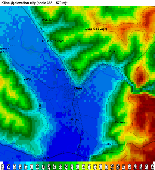
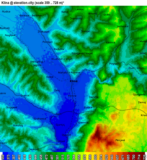
Below is the Elevation map of Klina, which displays elevation range with different colors. Scale of the first map is from 366 to 570 m (1201 to 1870 ft) with average elevation of 430.3 meters (=1412 ft) [note 1]
These maps also provides idea of topography and contour of this city, they are displayed at different zoom levels. More info about maps, scale and edge coordinates you can find below images.
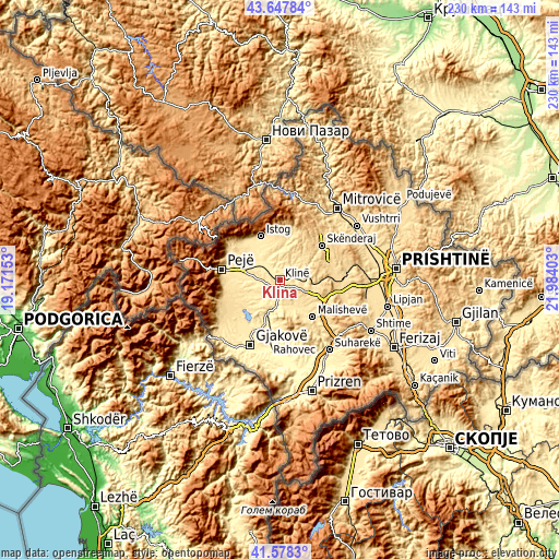
| \ | Map #1 | Map #2 | Topo.Map |
| Scale [m] | 366..570 m | 359..728 m | × |
| Scale [ft] | 1201..1870 ft | 1178..2388 ft | × |
| Average | 430.3 m = 1412 ft | 463.6 m = 1521 ft | × |
| Width | 7.19 km = 4.5 mi | 14.38 km = 8.9 mi | 230.1 km = 143 mi |
| Height | 7.19 km = 4.5 mi | 14.38 km = 8.9 mi | 230.1 km = 143 mi |
| ↑Max Latitude | 42.653998° | 42.68631° | 43.64784° |
| Latitude at center | 42.62167° | 42.62167° | 42.62167° |
| ↓Min Latitude | 42.589325° | 42.556963° | 41.5783° |
| ← Min Longitude | 20.533835° | 20.489889° | 19.17153° |
| Longitude center | 20.57778° | 20.57778° | 20.57778° |
| →Max Longitude | 20.621725° | 20.665671° | 21.98403° |
Nearby cities:
Cities around Klina sort by population:
• Istok elevation 465 m
19.2 km,  337°
337°
• Llazicë 635 m
16.9 km,  115°
115°
• Isniq 587 m
23.6 km,  252°
252°
• Srbica 612 m
22.1 km,  51°
51°
• Strellc i Ulët 558 m
21.9 km,  257°
257°
• Mališevo 529 m
20.7 km,  138°
138°
• Irzniq 525 m
22 km,  239°
239°
• Gllogjan 502 m
21.7 km,  234°
234°
• Lumbardhi 536 m
20.7 km, 246°
• Papraqan 552 m
21.6 km, 249°
• Kosuriq 419 m
10.9 km, 238°
• Dubova (Driloni) 465 m
19.8 km,  300°
300°
Multilingual:
 En español:
Klina elevación 404 m.
 En France:
Klina élévation 404 m.


Sources and notes:
- [note 1] Map square and city borders are not equal. Map elevation data is calculated only from area inside that square.
- [src 1] Elevation data from geonames database provided with same terms of usage.
- [src 2] The elevation map of Klina is generated using elevation data from NASA's 3 arcsec (90m) resolution SRTM data.
- [src 3] Base (background) map © OpenStreetMap contributors tiles are generated by Geofabrik and OpenTopoMap.
Copyright & License:
This Klina Elevation Map is licensed under CC BY-SA. You may reuse any part from this page, if you give a proper credit by linking to this URL:
 More info on terms of use page.