Isniq elevation
Isniq (Gjakova, Komuna e Deçanit), Kosovo elevation is 587 meters and Isniq elevation in feet is 1926 ft above sea level [src 1]. Isniq is a populated place (feature code) with elevation that is 41 meters (135 ft) bigger than average city elevation in Kosovo.
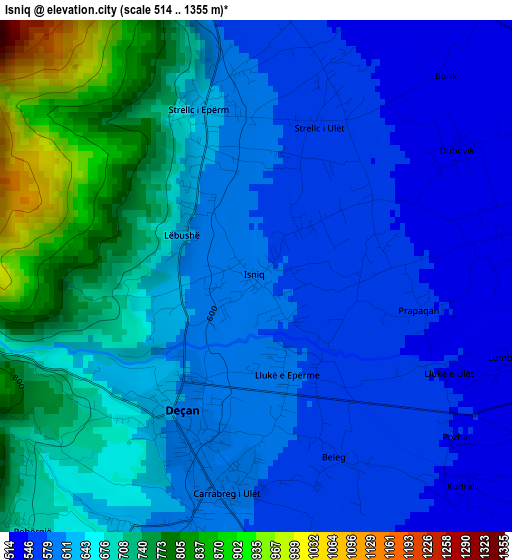
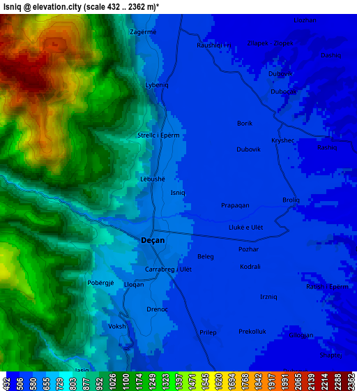
Below is the Elevation map of Isniq, which displays elevation range with different colors. Scale of the first map is from 514 to 1355 m (1686 to 4446 ft) with average elevation of 644.4 meters (=2114 ft) [note 1]
These maps also provides idea of topography and contour of this city, they are displayed at different zoom levels. More info about maps, scale and edge coordinates you can find below images.
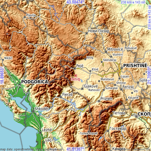
| \ | Map #1 | Map #2 | Topo.Map |
| Scale [m] | 514..1355 m | 432..2362 m | × |
| Scale [ft] | 1686..4446 ft | 1417..7749 ft | × |
| Average | 644.4 m = 2114 ft | 783.6 m = 2571 ft | × |
| Width | 7.2 km = 4.5 mi | 14.4 km = 8.9 mi | 230.3 km = 143.1 mi |
| Height | 7.2 km = 4.5 mi | 14.4 km = 8.9 mi | 230.3 km = 143.1 mi |
| ↑Max Latitude | 42.589862° | 42.622207° | 43.58474° |
| Latitude at center | 42.5575° | 42.5575° | 42.5575° |
| ↓Min Latitude | 42.525122° | 42.492726° | 41.51307° |
| ← Min Longitude | 20.258835° | 20.214889° | 18.89653° |
| Longitude center | 20.30278° | 20.30278° | 20.30278° |
| →Max Longitude | 20.346725° | 20.390671° | 21.70903° |
Nearby cities:
Cities around Isniq sort by population:
• Deçan elevation 611 m
2.3 km,  212°
212°
• Strellc i Epërm 627 m
2.4 km,  342°
342°
• Strellc i Ulët 558 m
2.8 km,  23°
23°
• Prilep 538 m
5.7 km,  167°
167°
• Irzniq 525 m
5.5 km,  138°
138°
• Gllogjan 502 m
7.4 km, 138°
• Dranoc 591 m
4.7 km,  190°
190°
• Lumbardhi 536 m
3.8 km,  108°
108°
• Lluka e Eperme 583 m
1.4 km,  163°
163°
• Papraqan 552 m
2.4 km,  102°
102°
• Lëbushë 618 m
1.2 km,  302°
302°
• Lloqan 622 m
4.1 km, 206°
Multilingual:
 En español:
Isniq elevación 587 m.
 En France:
Isniq élévation 587 m.


Sources and notes:
- [note 1] Map square and city borders are not equal. Map elevation data is calculated only from area inside that square.
- [src 1] Elevation data from geonames database provided with same terms of usage.
- [src 2] The elevation map of Isniq is generated using elevation data from NASA's 3 arcsec (90m) resolution SRTM data.
- [src 3] Base (background) map © OpenStreetMap contributors tiles are generated by Geofabrik and OpenTopoMap.
Copyright & License:
This Isniq Elevation Map is licensed under CC BY-SA. You may reuse any part from this page, if you give a proper credit by linking to this URL:
 More info on terms of use page.