Phan Rang-Tháp Chàm elevation
Phan Rang-Tháp Chàm (Ninh Thuận), Vietnam elevation is 8 meters and Phan Rang-Tháp Chàm elevation in feet is 26 ft above sea level [src 1]. Phan Rang-Tháp Chàm is a seat of a first-order administrative division (feature code) with elevation that is 120 meters (394 ft) smaller than average city elevation in Vietnam.
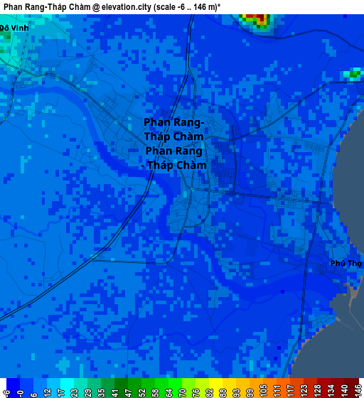
Below is the Elevation map of Phan Rang-Tháp Chàm, which displays elevation range with different colors. Scale of the first map is from -6 to 146 m (-20 to 479 ft) with average elevation of 6.4 meters (=21 ft) [note 1]
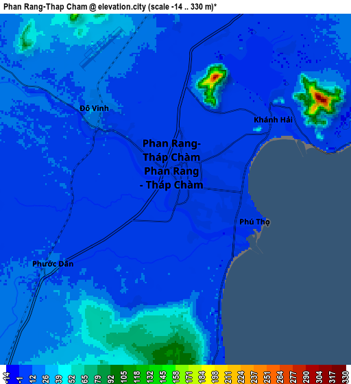
These maps also provides idea of topography and contour of this city, they are displayed at different zoom levels. More info about maps, scale and edge coordinates you can find below images.
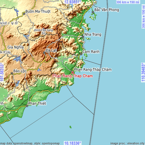
| \ | Map #1 | Map #2 | Topo.Map |
| Scale [m] | -6..146 m | -14..330 m | × |
| Scale [ft] | -20..479 ft | -46..1083 ft | × |
| Average | 6.4 m = 21 ft | 16.6 m = 54 ft | × |
| Width | 9.57 km = 5.9 mi | 19.15 km = 11.9 mi | 306.3 km = 190.3 mi |
| Height | 9.57 km = 5.9 mi | 19.15 km = 11.9 mi | 306.4 km = 190.4 mi |
| ↑Max Latitude | 11.60737° | 11.650413° | 12.93851° |
| Latitude at center | 11.56432° | 11.56432° | 11.56432° |
| ↓Min Latitude | 11.521263° | 11.4782° | 10.18336° |
| ← Min Longitude | 108.944635° | 108.900689° | 107.58233° |
| Longitude center | 108.98858° | 108.98858° | 108.98858° |
| →Max Longitude | 109.032525° | 109.076471° | 110.39483° |
Nearby cities:
Cities around Phan Rang-Tháp Chàm sort by population:
• Ðà Lạt elevation 1483 m
73.1 km,  305°
305°
• Đưc Trọng 939 m
69.7 km,  285°
285°
• Cam Ranh 15 m
43.8 km,  25°
25°
• Chợ Lầu 11 m
64.9 km,  234°
234°
• Thạnh Mỹ 1014 m
58.1 km, 292°
• Cam Lâm 24 m
57.6 km,  18°
18°
• Tô Hạp 382 m
49.3 km,  354°
354°
• Liên Hương 16 m
47.3 km,  217°
217°
• Tân Sơn 122 m
32.3 km,  316°
316°
• Bác Ái 136 m
32.1 km,  343°
343°
• Phước Dân 12 m
7.6 km,  236°
236°
• Khánh Hải 7 m
6.4 km,  62°
62°
Multilingual:
 En español:
Phan Rang-Tháp Chàm elevación 8 m.
 En France:
Phan Rang-Tháp Chàm élévation 8 m.
 Auf Deutsch:
Phan Rang-Tháp Chàm höhe über dem Meeresspiegel ist 8 m.

Sources and notes:
- [note 1] Map square and city borders are not equal. Map elevation data is calculated only from area inside that square.
- [src 1] Elevation data from geonames database provided with same terms of usage.
- [src 2] The elevation map of Phan Rang-Tháp Chàm is generated using elevation data from NASA's 3 arcsec (90m) resolution SRTM data.
- [src 3] Base (background) map © OpenStreetMap contributors tiles are generated by Geofabrik and OpenTopoMap.
Copyright & License:
This Phan Rang-Tháp Chàm Elevation Map is licensed under CC BY-SA. You may reuse any part from this page, if you give a proper credit by linking to this URL:
 More info on terms of use page.